Download
1 / 18
190 likes | 272 Vues
Learn the principles of designing protected areas based on the island biogeography model to effectively preserve species and habitats, including considerations for size, population, and connectivity. Explore how to create conservation networks to enhance biodiversity conservation efforts.

E N D
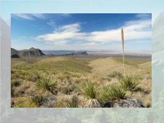
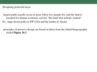
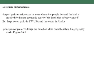
Designing protected areas -largest parks usually occur in areas where few people live and the land is unsuited for human economic activity "the lands that nobody wanted" Ex. huge desert parks in SW USA and the tundra in Alaska -principles of preserve design are based on ideas from the island biogeography model Figure 16.1
16.1 Principles of reserve design proposed based in part on theories of island biogeography
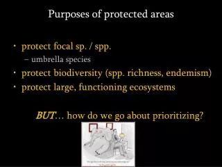
For protected areas to effectively preserve species, the following six characteristics should be considered: 1) Three R's of Protected Area design Representation of all conservation units in preserve. Resiliency so that all conservation units are in a large well protected area so that they remain healthy for the foreseeable future. Redundancy so that reserves protect enough examples of conservation units to ensure their long-term existence. 2) Principles based on island biogeography and experience of protected area managers Figure 16.1 3) Area should be sufficient in area to preserve large populations because population size is the best predictor of extinction probability -one of the biggest debates is the SLOSS debate- single large or several small protected areas Figures 16.2 and 16.3
16.2 Large parks and protected areas in Africa contain larger populations of each species
16.3 Each dot represents the extinction rate of animal populations for a particular park
3) Size cont. -generally bigger is better, but the value of several smaller preserves is that they may be able to include a variety of habitat types and more populations Ex. Possibly true in some cases for the 10,000 small protected areas in Britain Figure 16.4 Ex. the number of large mammal species in three national parks in contrasting habitats (Big Bend, North Cascades in Washington, and Redwoods in California) is > than Yellowstone, which is larger than the combined areas of the three parks -ideally a reserve should be large enough to include a viable population of the most wide-ranging species in it and this umbrella species may provide protection for other species as well Figure 16.5 Red cockaded woodpecker of SE USA needs extensive stands of longleaf pine and this protects rare plant species as well -conservation networks can be used to aggregate small nature reserves and this has been accomplished by organizations such as The Nature Conservancy Box 16.1 and the Chicago Wilderness Project Figure 16.6
16.4 10,000 small (< 3 square km on average) protected areas in Britain managed for biodiversity conservation
16.5 Longleaf pine habitat in the southeastern U.S. is being managed to protect the red-cockaded woodpecker
16.6 The Chicago Wilderness Project-240 organizations form a conservation network
4) parks should be designed to minimize the harmful effects of edge -edge has greater temperature variations, more wind, less humidity, more fire and disease, as well as different species compositions -in the past, edge was advocated as it increased the number of certain species. However, most often, those of greater conservation concern occupy large blocks of undisturbed habitat -circular plots have less edge than rectangular -usually boundaries are irregular because land acquisition is often due to opportunity rather than design 5) Internal fragmentation such as roads, fences, etc. should be avoided to prevent divisions of large populations and lessen chances for introduction of exotics 6) protected areas should be linked with habitat corridors. Corridors facilitate migration and gene flow and allow animals that migrate seasonally to move along protected areas. Figure 16.7
16.7 (A) An overpass allows animals to migrate between two forested areas. (B) Individuals disperse between two large protected areas using smaller protected areas as stepping-stones
Landscape Ecology- discipline that investigates interactions between habitat types and their influences on species distribution and ecosystem processes -a landscape is an area where a cluster of interacting ecosystems is repeated in similar form Figure 16.9 -in more traditional landscapes such as those in earlier Europe and Japan, fields, villages, and forest created a mosaic with a rich diversity of habitat and in such habitats many species move between habitats or live at borders between habitats. These kinds of habitats are becoming more rare Figure 16.10 and often checkerboard landscapes of different sizes occur today Figure 16.11
16.9 Four different landscape types: (A) patch, (B) network, (C) interdigitated, (D) checkerboard.
16.10 Traditional rural landscape near Tokyo, Japan villages (black); secondary forest (dark green); wet rice fields (light green); and hay fields (beige)
16.11 Two square nature reserves, each 100 ha in area (shaded = forest; white = pasture)
Edge in the landscape often does not favor the organisms of greatest conservation concern. Edge effects in landscapes that are square, which is common due to our surveying system
-conservation networks can attempt to link all protected natural areas in a landscape to form larger habitat units Ex. The Yellowstone to Yukon Ecoregion plan Figure 16.12 -Y2Y plan proposes to link national parks and other government lands along the Rocky Mountains in the USA and Canada -Managing these landscapes on a regional scale may be the best way to control populations of large mammals -Habitat corridors have been proposed as a way to link isolated conservation areas allowing for dispersal and colonization of new sites and the resulting gene flow that occurs with those events Ex. U.S. National Wildlife Refuge System is a linked park system that has had some success in preserving bird migrations through a landscape that is highly fragmented with large amounts of edge
16.12 The Yellowstone to Yukon (Y2Y) plan proposes to link government lands of the U.S. and Canada