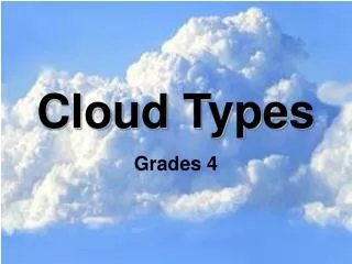
Basic Cloud Types
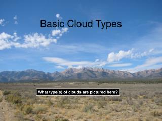
Basic Cloud Types. What type(s) of clouds are pictured here?. High Clouds:. Middle Clouds:. Low Clouds:. Clouds are classified by what vertical level their bases (or bottoms) form at:. Low Clouds:. Low clouds can be on the ground (fog) to ~6,000’ above the surface. 6,000 ft above ground.


Basic Cloud Types
E N D
Presentation Transcript
Basic Cloud Types What type(s) of clouds are pictured here?
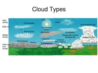
High Clouds: Middle Clouds: Low Clouds: Clouds are classified by what vertical level their bases (or bottoms) form at:
Low Clouds: • Low clouds can be on the ground (fog) to ~6,000’ above the surface. 6,000 ft above ground • Five low cloud types: • Cumulus • Stratus and Fog • Stratocumulus • Nimbostratus • Cumulonimbus Lyndon State Green Mountains
Cumulus Stratus: Layered or flat looking and grayish Stratus Cumulus: Heaped or lumpy looking, most commonly portrayed type in art, film
Stratocumulus Fog: when a stratus cloud touches the ground Fog Stratocumulus: looks both lumpy and layered, flatter than cumulus but more lumpy than stratus
Nimbostratus Cumulonimbus: a cumulus cloud that has precipitation falling from it and reaching the ground Cumulonimbus Nimbostratus: a stratus cloud that's precipitating – rain and/or snow is falling from the cloud and reaching the ground *Nimbus = precipitating
Green Mountains Middle Clouds: • Middle clouds can extend from ~6,000’ to ~20,000’ above • the surface. ~20,000 ft above ground • Two basic middle cloud types “Alto” prefix: • Altocumulus • Altostratus 6,000 ft above ground Lyndon State
Altocumulus Altostratus: layered and flat, but higher than stratus Altostratus Altocumulus: look like cotton balls, about the size of your fist or smaller if you extend your arm and look towards them
~20,000 ft above ground ~40,000 ft above ground High Clouds: • High clouds can extend from ~20,000’ to 40,000’ above the surface. • Three basic high cloud types “cirro” prefix: • Cirrus • Cirrostratus • Cirrocumulus 6,000 ft above ground Lyndon State
Cirrus Cirrostratus: wispy - especially on the edges, flat and fairly white, organized in sheets or layers Cirrostratus Cirrus: appear wispy in pieces or small patches, not organized in sheets
Cirrocumulus: fairly rare, look like small cotton balls, about the size of your pinky when you extend your arm and look at the cloud elements. Cirrocumulus
Contrail Special Clouds • Contrail: short for “condensation trail” – forms when water from air plane • exhaust forms clouds behind the plane Lenticular: type of mid-level cloud Produced by airflow over terrain, frequently mistaken for UFOs Lenticular