Download
1 / 68
680 likes | 834 Vues
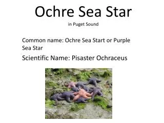
Patterns in Time of Extreme Tides and Sea Level Rise over The 21 st Century: Puget Sound and the Other Marine Waters of Washington State. Harold O. Mofjeld JISAO Senior Fellow and UW/Oceanography Affiliate Professor. Focus of the Talk:. Marine Waters of Washington State

E N D
Patterns in Time of Extreme Tides and Sea Level Rise over The 21st Century:Puget Sound and the Other Marine Waters of Washington State Harold O. Mofjeld JISAO Senior Fellow and UW/Oceanography Affiliate Professor
Focus of the Talk: • Marine Waters of Washington State • 21st Century Tides and Sea Level Rise • Providing the Best Available Science
Reporting Results of a Pilot Study to: • Provide initial scientific results and insights • Identify next steps to improve the science and make it available to those who need it
Complementary to Ongoing Work by the Climate Impacts Group, e.g.: • Mote et al. (2008) on sea level rise in Washington’s marine waters • Petersen (2007) Masters thesis on providing useful information to governments and agencies in the region • Doug Canning’s work on sea level rise and fieldwork on high waters
Some Stakeholders: • Counties, cities, and towns • Local, state and federal planning and regulatory agencies • Property owners and investors • Interest groups • Public
Approach: • Compute tidal predictions at long-term tide stations • Add Mote et al. (2008) sea level rise scenarios • Look for patterns in the occurrences of extreme (high and low) water level events
REF.: TIDAL DATUMS AND THEIR APPLICATIONS NOAA Spec. Publ. NOS CO-OPS 1, 2000
Dividing WA Marine Waters into Four Regions: • Puget Sound • Eastern Straits • Northwest Olympic Peninsula • Outer & Southern Coast, Including Large Embayments
Examples of Coastal Types in the Four Tidal Regions WA Dept. of Ecology Shoreline Aerial Photos http://apps.ecy.wa.gov/shorephotos/
Tahuya River Mouth, So. Hood CanalPrivate Shoreline Development, Habitat
Near Padilla Bay NER Reserve, Eastern StraitsShoreside Agricultural, Natural Habitat
Observed Sea Level Trends at Reference Tide Gauges -- The Recent Past --
Assumed Sea Level Rise Profiles for the 21st Century Based on Mote et al. (2008) Scenarios • Relative to Mean Sea Level in 2000 • Mote et al. (2008) values given for 2050 and 2100 • Smooth curve (quadratic) fit through these values • Allows for increasing upward trends toward the end of the 21st Century
Predicted Tides For The 21st Century • Looking for patterns in the high and low tides in their 18.6-yr cycle • Noting that the tides vary significantly with location in the WA marine waters • Sea level rise to be added later
Predicted Tides on May 12-13, 2008 -- Straits of JdF and Puget Sound
FOCUSING ON SEATTLE EXTREME PREDICTED TIDES:LOOKING AT HEIGHTS AND TIMING REFERENCE LEVEL FIXED AT MLLW FOR THE 1983-2001 TIDAL EPOCH
Adding Sea Level Rise To The Extreme Predicted Tides At Seattle