Download
1 / 38
380 likes | 576 Vues
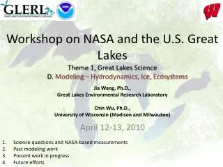
Workshop on NASA and the U.S. Great Lakes Theme 1 , Great Lakes Science D. Modeling – Hydrodynamics, Ice, Ecosystems. Jia Wang , Ph.D., Great Lakes Environmental Research Laboratory Chin Wu, Ph.D., University of Wisconsin (Madison and Milwaukee). April 12-13, 2010.

E N D
Workshop on NASA and the U.S. Great LakesTheme 1, Great Lakes ScienceD. Modeling – Hydrodynamics, Ice, Ecosystems JiaWang, Ph.D., Great Lakes Environmental Research Laboratory Chin Wu, Ph.D., University of Wisconsin (Madison and Milwaukee) April 12-13, 2010 • Science questions and NASA-based measurements • Past modeling work • Present work in progress • Future efforts
What is the Great Lakes Climate System?Climate System=AUHUCULUB (UHD) HUA: Lake Hydrodynamics
Science Questions • What are the general circulation patterns? • Factors controlling circulation: wind, density, pressure gradient, etc • What processes control transport (sediment, nutrients) and mixing across nearshore(rivers) and offshore? • What are the roles of lake ice? • on circulation, air-sea fluxes, water level, waves/seiches, mixing, ice/water albedo, ecosystems, etc. • -- Given a climate forcing (atmosphere, river runoff, nutrient loadings), how do ecosystems interact with hydrodynamics and lake ice: bottom-up or/and top-down processes? Are they the same in each lake?
NASA-based Measurements • Surface winds • 3-Dimensional current structure • Temperature structure • Internal waves • Water level (short and long time scales) • Surface gravity waves • Sediment transport • Lake ice (H, C, V) • CPA (chl, doc, and sm) concentrations • Location of Harmful Algal Blooms (HABs) • Primary productivity • Bathymetry • Lake Bottom Type • Others
2. Past Modeling Work • POM (Princeton Ocean Model) (Schwab, Beletsky, etc) • ROMS (Regional Ocean Model System) • MITgcm (Canadian) • FVCOM (Chen) • Others • Weaknesses --No ice model: artificial winter --One lake at a time (such as GLCFS)— no capability for downscaled climate simulation no natural (transport) connections between lakes GLERL GLCFS: lake by lake
Mean Circulation in Lake Superior FVCOM Observation
Offshore - Nearshore Transport Temperature– KITES - 1999
3. Present Modeling Work Great Lake Ice cover and AO and ENSO (Large natural variability) Wang, Bai, Leshkovich, Colton, Clites, and Lofgren (2010), AGU EOS
3. Present Modeling Work Great Lake Ice-circulation Model (GLIM) in Lake Erie: 2003-04 Wang. Hu, Schwab, Leshkovich, Hawley, Beletsky, Clites (2010), JGLR (in press)
GLIM-simulated ice concentration a) 1/9 b) 1/16 d) 1/30 c) 1/23 e) 2/27 f) 3/12
a) 1/9 b) 1/16 c) 1/23 d) 1/30 e) 2/27 f) 3/12 Satellite-measured ice concentration
a) 1/9 b) 1/16 m d) 1/30 c) 1/23 e) 2/27 f) 3/12 GLIM-simulated ice thickness
GLERL/USGC Helicopter-measured ice thickness in February 27, 2008 7.5-10 m/s 0:OW 0:OW 0cm 25 0:OW 15 cm 15cm 20 18 25 20cm 9
GLIM-simulated water velocity and SST a) 1/9 b) 1/16 C c) 1/23 d) 1/30 e) 2/27 f) 3/12
AVHHR-measured SST in 2004 Jan Feb Mar Apr May Jun Aug Jul Sep Oct Nov Dec
GLIM-simulated SST in 2004 Jan Feb Apr Mar May Jun Jul Aug Sep Oct Dec Nov
Model Observation C Fig. 15: Stations 4, 5, 7, 12, 14, 15
GLERL GLCFS with Ice Forecast • http://www.glerl.noaa.gov/res/glcfs/erie-ice.php?lake=e&type=F&hr=01
4. Future Effort • Development of an integrated, GL watershed-scale model system (GLERL) with data-assimilation (NASA) capability: Great Lakes Earth System Model (GLESM) • Overarching goal: Understanding and forecasting downscaled responses of hydrodynamics, ice, and ecosystems to a changing climate for decision making
Why Basin-scale GLESM? • An integrated modeling system for linking regional climate change, process studies, hypothesis testing, and management of resources needs to be developed. • All subsystems interact and couple. So far, only RCM works on its own with no connection to other subsystems • Response to the same climate forcing may be different in each lake; so comparative study is needed. • Downscaled climate simulation and projection need to be carried out for the Great Lakes region. • Management planning and policy making for mitigation of future changes in the GL system require accurate climate scenario simulation and projection.
The Role of NASA • Nearshore Bathymetry • Wave Growth and Propagation • Long Period Wave Motions (seichesand Infra-gravity) • Ice thickness, growthand decay • High-resolution surface wind
Great Lakes Modeling and Assessment Center • NCEP, GLERL, NASA and GLOS RA • Capabilities: • Observation and Monitoring • Data Assimilation and Modeling • Dissemination • Education & Outreach • Research to Applications