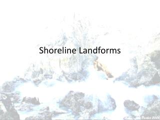
Shoreline Features
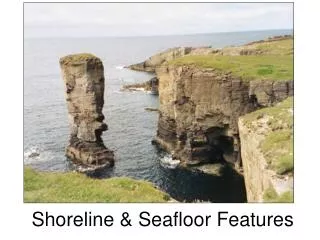
Shoreline Features. Erosional Landforms. Wave refraction straight wave crests bend when in shallow water due to the decrease in wave speed. Shoreline Features. Erosion and removal of weaker rocks near sea level, produces sea stacks , sea arches , and sea caves.

Shoreline Features
E N D
Presentation Transcript
Erosional Landforms • Wave refraction straight wave crests bend when in shallow water due to the decrease in wave speed.
Shoreline Features • Erosion and removal of weaker rocks near sea level, produces sea stacks, sea arches, and sea caves. Landforms of Rocky Headlands
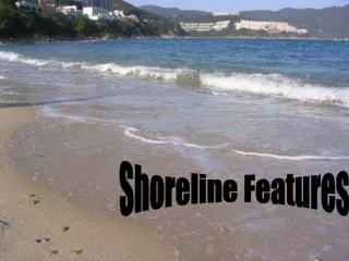
Beaches • A beach is a sloping band of sand, pebbles, gravel, or mud at the edge of the sea.
Estuaries • An estuary is the end of a freshwater river or stream entering the ocean.
The water in an estuary is: brackish–a mixture of freshwater and salt water. • Estuaries are nurseries to the young of many different species.
Longshore Currents • The longshore bar is a sand bar that forms in front of most beaches. • longshore current flows parallel to the shore
_ rip currents flow out to sea through gaps in the longshore bar and are created by waves. • These dangerous currents can reach speeds of several kilometers per hour. • If you are caught in a rip current do not try to swim against it! Swim parallel to the shore to get out of it.
Shoreline Features Rip Currents
Barrier islands are long ridges of sand or other sediment, deposited or shaped by the longshore current, that are separated from the mainland.
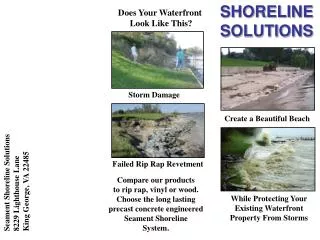
Protective Structures • In many coastal areas, protective structures are built in an attempt to prevent beach erosion and destruction of oceanfront properties. • Seawall • Groin • Jetty • Breakwater
Groins walls built into the water perpendicular to the shoreline for the purpose of trapping beach sand. • Seawalls reflect the energy large storm waves back towards the beach. • Jetties are walls of concrete built to protect a harbor entrance from drifting sand. • Breakwaters are built in the water parallel to straight shorelines to provide anchorages for small boats. Groin Seawall Jetty Breakwater
Changes in Sea Level • In the last 100 years, the global sea level has risen 10 to 15 cm and will be 30 cm higher in 70 more years • sea level will rise 1.5 to 3.9 mm/year. • Many scientists contend that this continuing rise in sea level is the result of global warming.
Shoreline Features • Tectonic sinking along a coastline causes a relative rise in sea level along that coast. • Tectonic uplift along a coastline produces a relative drop in sea level. • Much of the United States West Coast (California) is being pushed up by tectonic forces much more quickly than the sea level is rising. Effects of Tectonic Forces
Shoreline Features Section Assessment 1. Match the following terms with their definitions. ___ beach ___ estuary ___ longshore bar ___ barrier island B D C A A. a long ridge of sand or other sediment, deposited or shaped by the longshore current, that are separated from the mainland B.a sloping band of sand, pebbles, gravel, or mud at the edge of the sea C.a sand bar that develops parallel to the coast in many locations D. the area where the lower end of a freshwater river or stream enters the ocean
Shoreline Features Section Assessment 3. Identify whether the following statements are true or false. ______ On an uneven coast, most wave energy is directed toward headlands. ______ Waves speed up down when they encounter shallow water. ______ Chesapeake Bay is an example of an estuary. ______ Construction of a breakwater might lead to the development of a tombolo. true false true true
This rise would totally flood some countries, such as the Netherlands, along with some coastal cities in the United States, such as New York City, and low-lying states such as Florida and Louisiana.
Changes in Sea Level Effects of Sea Level Changes • Although unlikely anytime soon, if Earth’s remaining polar ice sheets melted completely, their meltwaters would raise sea level by 70 m. • This rise would totally flood some countries, such as the Netherlands, along with some coastal cities in the United States, such as New York City, and low-lying states such as Florida and Louisiana. • If Earth’s temperature keeps rising, an unstable part of the Antarctic ice sheet eventually could melt and cause a rise in sea level of about 6 m.
Shoreline Features Section Assessment 2. What is the purpose of a jetty and what are its negative effects? Jetties are walls built to protect a harbor entrance from drifting sand. Jetties trap sand upshore from a harbor and prevent sand from reaching beaches downshore leading to excessive erosion.