Download
1 / 60
600 likes | 755 Vues
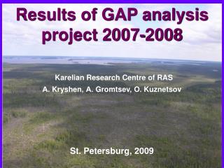
. Results of GAP analysis project 2007-2008 Karelian Research Centre of RAS А. Kryshen , А. Gromtsev , О. Kuznetsov. St. Petersburg, 200 9.

E N D
. Results of GAP analysis project 2007-2008Karelian Research Centre of RASА. Kryshen, А. Gromtsev, О. Kuznetsov St. Petersburg, 2009
“Gap analysis is a tool used in wildlife conservation to identify gaps in conservation lands or other wildlands where significant plant and animal species and their habitat or important ecological features occur.”
Contents • Partners and other participating organisations in Russia • Workshops, seminars, conferences • Expeditions (field work) • Publications • Databases, GIS, Digital libraries and Internet resources • PA network development in Republic of Karelia
Partners and other participating organisations in Russia • SYKE • NGO’s (KROO “SPOK”) • Republic of Karelia Government • Botanical Institute, Petrozavodsk University, Joensuu University and other research organisations
Organization and implementation of conferences, seminars, workshops Aim: sharing data and opinions, developing best solutions for nature conservation
Biotope seminar within GAP analysis work-group took place in Alexandrovka village near Petrozavodsk, May 2007.
Green Belt seminar in Petrozavodsk (June 2008). • Over 80 specialists from North-West Russia and Finland took part in the seminar
The 9th Taiga Rescue Network conference “Effective use of forest - Effective forest protection” (Petrozavodsk, 1–5 October, 2008). • Over 100 participants represented ten different countries and about 40 different NGOs.
Working meetings with Finnish colleagues on GAP analysis took place in Joensuu (9.04.08–11.04.08), Helsinki (October 28-30, 2007, November 18 – 21, 2008), Petrozavodsk, (January 25, 2008; February 20–21 2008; May 12–14, 2008; May 19–22, 2008)
Expeditions (field work) Aim: gathering data on the nature of Karelia, and finding potential gaps in the PA network
Yangozero area. Expedition comprising researcher from KRC of RAS, representatives of SPOK NGO and logging organizations was carried out to determine the conservation value of a pristine forest fragment. The Yangozero area was included in “RK Land Use Planning Scheme” (2008) and excluded from forest use accounts of the “RK Forest Management Plan” (2008).
The area and boundaries of the Chukozero landscape reserve were negotiated among SPOK, KRC Forest Research Institute, RK Forestry Agency and Karellesprom JSC, and submitted to the relevant regional authority
Over 30 researchers from 6 scientific organizations took part in the multidisciplinary expedition to the Gridino village area.
Multidisciplinary expedition to Mt. Vottovaara area to define the PA boundaries and status Природный комплекс горы «Воттоваара»: особенности, современное состояние, сохранение
Another activity in the period was large-scope surveys of the whole territory of Karelia with focus on surviving undisturbed forest areas. This work includes inventory of operating regional PAs started following the initiative and with financial support from the Ministry of Agriculture, Fishery and Ecology.
A revised edition of the Red Data Book of Karelia was preparedusing new (2001) IUCN categories. Editors: E. Ivanter, O. Kuznetsov
A. Markovskiy, O. Ilyina and A. Zorina prepared a colourful brochure – Identification guide of key biotopes (for biodiversity conservation) in central Karelia.
Природный комплекс горы «Воттоваара»: особенности, современное состояние, сохранение 2009
Databases, GIS, Digital libraries and Internet resources Compilation of shared scientific databases on various natural resources, biodiversity and specific features of territories, permitting scientifically grounded decision-making.
Wetland mapping was accomplished, digitalized contours (over 7000) were submitted to “Transparent World”; identification of mire type is underway. • Болотапереданы желтыми, охряными и светло-зелеными тонами в зависимости от типа болотных участков • Лес– темно-зелеными (хвойный) и охряными (лиственный) цветами • Озера выглядят как пятна черного цвета • 688,1206 и 3522 –номера болот по справочнику Торфяные месторождения Карельской АССР. М., 1979. 464 с.
Inventory of Republic of Karelia PAs began, and the pilot version of the GIS “Protected areas of Republic of Karelia” was produced
Practical implementation of KRC proposals: All in all, > 400000 hawithin< 10 years
Kalevalsky NP (74400 ha) and Voinitsa LR (8400 ha – formerly part of the park).
Ladoga Skerries NP (up to 220 000 ha) 2009 – 2010 • Researchers from KRC actively participated in public hearings on organization of the Ladoga skerries NP. • Author of the feasibility study for the Ladoga skerries NP designation A. Kravchenko became a member of the working group on the park organizationand project leader in KRC
To be designated before 2015: • six LR and nature monuments in a combined area of 140 000 ha • (included in the “Land Use Planning Scheme”, excluded from the “RK Forest Management Plan, 2008”).
Развитие сети ООПТ Карелии PA network development in Karelia Map of the largest operating and planned PAs (game reserves excluded). Colours: green – zapovednik,yellow – NP,pink – landscape reserves (LR),light blue – planned NP and LR, dark blue – largest waterside protection zones(water bodies having none are not shown in the map).
В 2008 подготовлена Концепция развития сети ООПТ РК (рук. А. Громцев).Схема развития сети ООПТ в РК (подготовлена совместно со СПОК) In 2008, the Concept of PA network development in Republic of Karelia was prepared (leader A. Gromtsev).
Conservation managers or scientists can use GAP analysis as a basis for providing recommendations to improve the representativeness of nature reserves or the effectiveness of protected areas so that these areas provide the best value for conserving biodiversity. • The regional ad hoc programme “Republic of Karelia ecology and natural resources”, comprising projects on PA development and biodiversity studies and conservation, is underway (financed from the budget of Republic of Karelia)
Current network of operating PAs in Republic of Karelia • Officially, nature conservation fundas of 01.01.2008 is 1,029,500 ha, i.e. 5.75 % of RK total area(de facto 3-4 %)and comprises 224 PAs (State Report…, 2008) + Voinitsa landscape reserve (8,400 ha – designated in 2008). Современная сеть действующих ООПТ в Республике Карелия • Официально природно-заповедный фонд на 01.01.2008г. составляет 1029,5 тыс. га или 5,75 % от общей площади республики (фактически 3-4 %) и включает 224 объекта (Госдоклад…, 2008) + ЛЗ «Войница» (8,4 тыс.га – учрежден в 2008г.).
Current network of operating PAs in Republic of Karelia • PAs of federal subordination: 2 strict nature reserves (zapovedniks): Kostomukshsky, Kivach, 3 national parks: Paanajärvi, Vodlozersky, Kalevalsky, zoological reserves Kizhsky, Olonetsky. Современная сеть действующих ООПТ в Республике Карелия • ООПТ федерального подчинения: 2 государственных заповедника: «Костомукшский», «Кивач»; 3 национальных парка: «Паанаярви», «Водлозерский» и «Калевальский»; зоологические заказники «Кижский», «Олонецкий».
Current network of operating PAs in Republic of Karelia PAs of regional subordination: nature park Valaam Archipelago, nature reserves, nature monuments, Petrozavodsk State University Botanical Garden, health resort forests around “Martial Waters” spa, buffer zones of Kivach and Kostomukshsky strict nature reserves, Kizhi Historical, Architectural and EthnographicMuseum-Reserve, and of Paanajärvi NP, plus tree stands. Современная сеть действующих ООПТ в Республике Карелия ООПТ регионального подчинения: природный парк «Валаамский архипелаг», государственные природные заказники, государственные памятники природы, ботанический сад ПетрГУ, курортные леса вокруг санатория «Марциальные воды», охранные зоны ГПЗ «Кивач»и «Паанаярви», государственного историко-архитектурного и этнографического музея-заповедника "Кижи" и НП «Паанаярви» и лесные плюсовые насаждения.
Objects with bedrock and Quaternary sediments(geological nature monuments).Over 200 GNM* are recommended for inclusion in the PA list (160 of them shown in the figure).Объекты с коренными породами и четвертичными отложениями(геологические памятники природы).Рекомендуется включить в список ООПТ более 200 ГПП* (на рис. показаны 160 из них).
Operating and planned PAs cover part of the ranges of all soils subject to protection, and designation of new areas for this purpose is not needed. • Действующая и планируемая сеть ООПТ покрывает часть ареалов всех почв, подлежащих охране,поэтому нет необходимости в выделении дополнительных участков для этих целей. • The priorities among planned PAs in this sense are: • С данной точки зрения к первоочередным планируемым объектам следует отнести: Zaonezhje PA, «Заонежье», Ladoga Skerries NP, НП «Ладожские шхеры» Gridino, ЛЗ «Гридино», Syrovatka, ЛЗ«Сыроватка» Vottovaara NM, Ппр«Воттоваара».
Locations of 10 waterfalls - potential PAs Prioritized among 17 proposed aquatic PAs are 7 objects, for which sufficient information is available or feasibility studies are ready.Most of them are already included in the list of planned PAs. В первоочередные ООПТ предлагается 7 водных объектов (из 17), для кото-рых в настоящее время имеется достаточно инфор-мации или подготовлены экологические обоснова-ния. Основная часть из них уже включена в перечень планируемых ООПТ.
Locations of wetlands proposed for designation Provisional list of 200 valuable wetlands covering a combined area of ca. 300 000 ha was compiled.Four large wetland areas were defined as designation priorities. Составлен перспективный список 200 ценных болот для охраны на общей площади около 300 000 га.К первоочередным ООПТ отнесены 4 крупных болотных и водно-болотных объекта.
Feasibility studies were prepared for three landscape reserves comprising the last surviving substantial areas of pristine taiga. Locations of largest pristine forest areas.
Potential objects of the flora (15) – most important in terms of conserving regional diversity of species and vegetation in general.
Operating game reserves, proposed zoological reserves (15 reserves in 320 000 ha), and areas of the zoological nature monument rank (mainly bird breeding areas). Clear-cutting must be forbidden in zoological reserves. Game reserves are not PAs – hardly any nature use limitations (temporary ban on hunting).
Recreational zoning. Landscapes of:1 – minimal, 2 – low,3 – average, 4 – high, 5 – exceptionalrecreational quality.All landscapes of top categories are represented by substantial areas in operating and proposed PAs of different categories.
Zoning by landscape representativeness. Areas: 1) unique, 2) rare, 3) peculiar, 4) common, 5) reference.Given the PA network state-of-the-art, and if the proposals submitted are realized, the situation in conservation of the regional diversity of geographic landscapes (area of ca. 100 000 ha) would be satisfactory.
All natural complexes most vulnerable to human impact are partially “covered” by operating and planned PAs in a combined area of about 1/3 mln. ha,waterside protection zones not included.
ОТ “ОСТРОВОВ” К ЭКОЛОГИЧЕСКИМ СЕТЯМ FROM “ISLANDS” TO ECONETS