Download
1 / 15
150 likes | 299 Vues
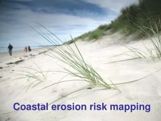
FishNET Digital Mapping Technology to Fight Coastal Threats. Shah Selbe With support from Stanford University and the Center for Ocean Solutions. The FishNET Solution. A map-based, integrated data collection and management tool to track, monitor, and analyze coastal threats.

E N D
FishNETDigital Mapping Technology to Fight Coastal Threats Shah Selbe With support from Stanford University and the Center for Ocean Solutions
The FishNET Solution A map-based, integrated data collection and management tool to track, monitor, and analyze coastal threats • An integrated, web-based information platform incorporating: • Real-time user input • Inexpensive detection solutions • Input from existing systems • Aimed at stopping destructive and/or illegal activities in our oceans • Allows for global tracking and monitoring analytics for targeted enforcement solutions by coastal protection organizations cloud
Intelligent Solutions to Location-Based Coastal Threats are needed • Location-specific threats have • far-reaching implications on: • Environment • Economy • Marine Spatial Planning • Human Rights • Food Security • Treaties and International Regulations Illegal Fishing & Overfishing Ecosystem Destruction Pollution & dumping Resource Misuse Trespassing & Trafficking Effective monitoring, control, and surveillance is the key to eliminating these threats from harming our coasts
Intelligent Solutions to Location-Based Coastal Threats are needed Old Methods: New Approach: cloud Governing organizations at the local-, national-, regional- and international-levels have a clear incentive to collaborate
FishNET Benefits • Low cost and high scalability • High network effects and data integrity capabilities • Promotion of improved data standards for tracking ocean threats • Multiple avenues of data input and reporting • Prosecution tool to stop repeat offenders • Utilizes existing technologies and can incorporate data feeds from developing technologies
Current Capabilities:User and Community Input System: Data Collected: Input Methods: FishNET Record: Infraction info Location Time/Date Vessel info Including: Pictures Video GPS info Other metadata Call-in hotline Mobile phone SMS integration Smartphone app FishNET website APIs cloud Crowd-sourcing of reporting expands capacity beyond coastal enforcement organizations
Current Capabilities:Data Coordination and Integration Data Types: • Comprehensive record based on infraction type or vessel • Incorporate existing legacy systems • Allow for input from new systems • Real-time visualization and analytics for: • Targeted patrolling • Enforcement • Prosecution of offenders • Working with relevant partner organizations to ensure scalability, usability, and focus FishNET RFMO data Vessel Registry VMS data Position Reports Licenses National databases Current Systems Existing databases Port Inspection Observer Reports Catch Logs MCS data cloud
Current Capabilities FishNET baseline: • Next Steps: • Integration of other data sources • Verification and reputability technologies • Additional monitoring technologies incorporated • Addition of information from current legacy systems • Implementation plan and a directed marketing strategy
Risk Analysis Risks are minimal and manageable
Development Roadmap 5-Year Technology Roadmap
FishNET Team Shah Selbe • Focus: Founder and leader • Career Background: Boeing Spacecraft Propulsion Engineer, Systems Architect; Engineers Without Borders Los Angeles, President • Over 2½ years dedicated to studying tech solutions to ocean threats • Educational background: Masters in Systems Architecture and Engineering, USC; Masters in Management Science and Engineering (in progress), Stanford University; Chemical Engineering, UC Riverside Omeed Selbe • Focus: Operations and technology development • Career background: International development and public sector contracting experience • Educational background: MBA, Harvard Business School; Mechanical Engineering, UC Berkeley Key Advisors: • Prof.TomKosnik, Stanford University Professor of entrepreneurship and management science • Center for Ocean Solutions, Research Partnership between Stanford University, Monterey Bay Aquarium, and Monterey Bay Aquarium Research Institute to develop sustainable solutions to address ocean issues
Support and Backing • FishNET born from Stanford Engineering graduate studies with ongoing support from advisor Prof. Tom Kosnik • Support from notable ocean-conservation orgs • Center for Ocean Solutions • Environmental Defense Fund • Pew Environment Group • Sustainability competition honors: • Buckminster Fuller Challenge, Semifinalist • Katerva Award, nomination in Protected Areas • Savannah Ocean Exchange, Finalist • Ushahidiopen-source mapping tool utilized for initial development Strong support networks provide regular feedback and advice to ensure a realistic and high-impact solution
The Time is Now • Ocean ecosystems in a fragile state and must be protected now • Increased monitoring capacity will give us • Better control over the sustainability of our fisheries • Smarter decisions about fishing quotas • Quantifiable assessment of our ocean’s state of health • Improved access to technology allows for greater data gathering and tracking • Network effects can reduce data collection cost and increase data quality to all participating organizations • Increased traceability and stakeholder engagement helps communicate the issue and foster environmental stewardship Maintaining environmental sustainability, improving economic livelihoods, promoting food security, and filling in critical information gaps