
Uploaded by
denis
16 SLIDES
286 VUES
160LIKES
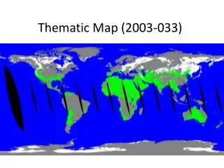
Snow Fraction Thematic Maps: 2003-036 Overview
DESCRIPTION
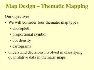
This collection of thematic maps displays snow fraction data from the years 2003 to 2006. Each map (2003-033 to 2003-196) illustrates the spatial distribution of snow cover, providing insights into seasonal variations and regional patterns. This data is crucial for understanding the impact of snow on climate, hydrology, and ecosystems. The maps serve as a valuable resource for researchers, environmentalists, and educators interested in snow dynamics and climate studies.
Download
1 / 16
Télécharger la présentation 
Snow Fraction Thematic Maps: 2003-036 Overview
An Image/Link below is provided (as is) to download presentation
Download Policy: Content on the Website is provided to you AS IS for your information and personal use and may not be sold / licensed / shared on other websites without getting consent from its author.
Content is provided to you AS IS for your information and personal use only.
Download presentation by click this link.
While downloading, if for some reason you are not able to download a presentation, the publisher may have deleted the file from their server.
During download, if you can't get a presentation, the file might be deleted by the publisher.
E N D
Presentation Transcript


More Related