Download

1 / 19
190 likes | 377 Vues
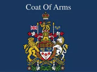
Royal coat of arms. Capital: London Official language: English (de facto) Recognised regional languages: Irish, Ulster Scots, Scottish Gaelic, Scots, Welsh, Cornish Ethnic groups: 92.1% White 4.0% South Asian 2.0% Black 1.2% Mixed 0.4% Chinese 0.4% Other.

E N D
Capital: London Official language: English (de facto) Recognised regional languages: Irish, Ulster Scots, Scottish Gaelic, Scots, Welsh, Cornish Ethnic groups: 92.1% White4.0% South Asian2.0% Black1.2% Mixed 0.4% Chinese0.4% Other
Government: Parliamentary democracy and constitutional monarchy • Monarch: Queen Elizabeth II • Prime Minister: Gordon Brown Legislature: Parliament • Upper House: House of Lords • Lower House: House of Commons Formation: • Acts of Union 1707 -1 May 1707 • Act of Union 1800 - 1 January 1801 • Anglo-Irish Treaty - 12 April 1922
EU accession: 1 January 1973 • Area: 244,820 km2 • Population: 2009 (estimate) 61,113,205 2001 consensus 58,789,194 • Density: 246/km2
The United Kingdom of Great Britain and Northern Ireland (commonly known as the United Kingdom, the UK, or as Britain) is a sovereign state located off the north-western coast of continental Europe. It is an island country spanning an archipelago including Great Britain, the north-eastern part of Ireland, and many small islands. Northern Ireland is the only part of the UK with a land border, sharing it with the Republic of Ireland. Apart from this land border, the UK is surrounded by the Atlantic Ocean, the North Sea, the English Channel and the Irish Sea. The largest island, Great Britain, is linked to France by the Channel Tunnel.
The United Kingdom is a constitutional monarchy and unitary state consisting of four countries: England, Northern Ireland, Scotland and Wales. It is governed by a parliamentary with its seat of government in London, the capital, but with three devolved national administrations in Belfast, Cardiff and Edinburgh, the capitals of Northern Ireland, Wales and Scotland respectively.
The Channel Island bailiwicks of Jersey and Guernsey, and the Isle of Man are Crown Dependencies and are often not considered part of the UK, though they are treated as part of it for many purposes including nationality.
The UK has fourteen overseas territories all remnants of the British Empire, which at its height in 1922 encompassed almost a quarter of the world's land surface, the largest empire in history. British influence can continue to be observed in the language, culture and legal systems of many of its former colonies.
The UK is a developed country, with the world's sixth largest economy by nominal GDP and the seventh largest by purchasing power parity. It was the world's first industrialised country and the world's foremost power during the 19th and early 20th centuries, but the economic cost of two world wars and the decline of its empire in the latter half of the 20th century diminished its leading role in global affairs.
The UK nevertheless remains a major power with strong economic, cultural, military, scientific and political influence. It is a nuclear power and has the fourth highest defence spending in the world. It is a Member State of the European Union, holds a permanent seat on the United Nations Security Council, and is a member of the Commonwealth of Nations, G8, OECD, NATO, and the World Trade Organization.
The physical geography of the UK varies greatly. The geography of England consists of lowland terrain, with mountainous terrain north-west of the Tees – Exe line including the Cumbrian Mountains of the Lake District, the Pennines and limestone hills of the Peak District, Exmoor and Dartmoor. The geography of Scotland is distinguished by the Highland Boundary Fault – a geological rock fracture – which traverses the Scottish mainland from Helensburgh to Stonehaven. The fault line separates the two distinctively different regions of the Highlands to the north and west and the lowlands to the south and east.
The geography of Wales is mostly mountainous, though south Wales is less mountainous than north and mid Wales. The geography of Ireland includes the Mourne Mountains as well as Lough Neagh, at 388 square kilometres (150 sq mi), the largest body of water in the UK and Ireland. The overall geomorphology of the UK was shaped by the combined forces of tectonics and climate change, in particular glaciations. The exact centre of the island of Great Britain is disputed. Depending upon how it is calculated it can be either Haltwhistle in Northumberland, or Dunsop Bridge in Lancashire.
The climate of the United Kingdom is classified as a mid-latitude oceanic climate, with warm summers, cool winters and plentiful precipitation throughout the year. However a plausible argument can be made that some parts of East & South-East England (for example, Essex) actually have a semi-arid climate through virtue of having less than 500mm average annual rainfall. The principal factors that influence the country's climate include its northerly latitude (which ranges from 50° to 60° N), the close proximity to the Atlantic Ocean, and the warming of the surrounding waters by the Gulf Stream. The weather can be notoriously changeable from one day to the next but temperature variations throughout the year are relatively small.
The boundary of convergence between the warm tropical air and the cold polar air lies over the United Kingdom. In this area, the large temperature variation creates instability and this is a major factor that influences the often unsettled weather the country experiences, where many types of weather can be experienced in a single day.
Regional climates in the United Kingdom are influenced by the Atlantic Ocean and latitude. Northern Ireland, Wales and western parts of England and Scotland, being closest to the Atlantic, are generally the mildest, wettest and windiest regions of the UK, and temperature ranges here are seldom extreme. Eastern areas are drier, cooler, less windy and also experience the greatest daily and seasonal temperature variations. Northern areas are generally cooler, wetter and have a smaller temperature range than southern areas.
Though the UK is mostly under the influence of the maritime tropical air mass from the south-west, different regions are more susceptible than others when different air masses affect the country: Northern Ireland and the west of Scotland are the most exposed to the maritime polar air mass which brings cool moist air; the east of Scotland and north-east England are more exposed to the continental polar air mass which brings cold dry air; the south and south-east of England are more exposed to the continental tropical air mass which brings warm dry air; Wales and the south-west of England are the most exposed to the maritime tropical air mass which brings warm moist air.