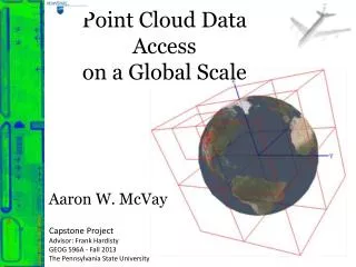
Point Cloud Data Access on a Global Scale
Point Cloud Data Access on a Global Scale. Aaron W. McVay. Capstone Project Advisor: Frank Hardisty GEOG 596A - Fall 2013 The Pennsylvania State University. Project Goal

Point Cloud Data Access on a Global Scale
E N D
Presentation Transcript
Point Cloud Data Access on a Global Scale Aaron W. McVay Capstone Project Advisor: Frank Hardisty GEOG 596A - Fall 2013 The Pennsylvania State University
Project Goal The goal of this project is to design and implement a prototype 3D partitioning scheme that provides an efficient, contiguous, and global approach to handling massive point clouds containing trillions of points.
Presentation Discussion • Point Cloud Definition • Current Limitations • Spatial Partitioning • Data Storage / Access • Approach • Team Structure
Point Clouds Sampled 3D (X, Y, Z) Surface Coordinates of an Object KC-135 Aircraft Room Interior (Open Perception, 2013) The Stanford Bunny Model (Turk, 2000)
Light Detection and Ranging (LiDAR) Point Clouds Linear Mode Airborne LiDAR (NOAA, 2012)
Data Volume Scalability Limitations Example DARPA’s High Altitude LiDAR Operations Experiment (HALOE) Sensor • Geiger Mode System (1000s of points per pulse) • Generates over a terabyte of data per hour of flight • “Gazillions” of Points • Processing Exploitation and Dissemination (PED) cycle takes days to months
Coordinate System Scalability Limitations • GIS community still thinks in terms of imagery UTM Zone 18 (NGA, 2013) WGS84 Earth Centered Earth Fixed (ECEF) Coordinate System (NOAA, 2007)
Earth Centered Earth Fixed(ECEF) Pros • Contiguous Global Coverage • Cartesian (Euclidian) Coordinate System (X, Y, Z) Cons • Requires 64-bit storage • Can use local coordinate systems with offsets (translation, not projection) • Z is not up • Store elevation values along with coordinates (increase storage requirement)
Workflow Limitations USGS Earth Explorer http://earthexplorer.usgs.gov Denver 2008 - Democratic National Convention (DNC) • 6.4 Trillion Points • 167 G (LAS files) • 1163 Tiles Metadata • Shapefiles • KML ESRI ArcMap
Workflow Limitations Data Assembly
Software Limited by RAM and Local Storage • Local disk storage • Network disk storage • Most software loads entire dataset into RAM • Manual Load/Unload Tiles QT Modeler (Applied Imagery, 2013)
Spatial Partitioning (Acceleration) Techniques Quadtree Spatial Partitioning of DenverDNC dataset
Octree Spatial Partitioning of DenverDNC dataset
Octree Data Insertion Not all cells contain data Each cell represents a storage bucket of N points Z WGS84 ECEF Coordinate System (NOAA, 2007) Mt. Everest Cells divide when size exceeds N Y Marianas Trench WGS84 Ellipsoid
Hybrid Approach • Spatial Partitioning in Geographic Coordinates • Data in ECEF JView World (Moore & McVay 2008) 228 Individual Quadtrees
Data Access Techniques(Client / Server) Sphere (r) • X, Y, Z Value • Longitude / Latitude / Elevation 2D Geospatial Bounds • Rectangle • Polygon View Frustum for Visualization Clients • Level of Detail
Visualization Clients • “A view frustum is a 3D volume that defines how models are projected from camera space to projection space” (Microsoft) Near Plane
View Frustum Z WGS84 ECEF Coordinate System (NOAA, 2007) Mt. Everest Only access cells that overlap frustum Y Marianas Trench WGS84 Ellipsoid Some cells will contain points outside frustum
Approach • Assemble Data • Relevant to the Department of Defense (DOD) • Design Spatial Partitioning Scheme • ECEF Octree? • Develop Spatial Partitioning Prototype(s) • Linux Based • C++ • API suitable for Multiple Client Categories • Measure Performance of Prototype • Determine Key Performance Parameters (KPPs)
Open Source Software libLAShttp://www.liblas.org/ PDAL – Point Data Abstraction Libraryhttp://www.pointcloud.org/ GDAL – Geospatial Data Abstraction Library http://www.gdal.org/ PCL – Point Cloud Library http://pointclouds.org/ Megatreehttp://wiki.ros.org/megatree
Team Structure Air Force Research Laboratory (AFRL) • In-house research, this project will provide internal research teams with simplified access to their datasets. • Starting point for a Contractual Effort currently listed on Fed Biz Ops https://www.fbo.gov/index?s=opportunity&mode=form&tab=core&id=d55798394c9f7ec782d7b433deaab7b7&_cview=0 Collaboration • US ARMY Corps of Engineers (USACE) Cold Regions Research & Engineering Laboratory (CRREL) • Geospatial Repository and Data Management System (GRiD) • National Geospatial-Intelligence Agency (NGA) • National Reconnaissance Office (NRO)
References • Air Force Research Laboratory (AFRL). (2013). JView 1.7+ JAVA/OpenGL API. Retrieved No 7, 2013, from https://software.forge.mil • Applied Imagery. (2013). Quick Terrain Modeler. Retrieved Dec 2, 2013, from http://appliedimagery.com • Microsoft. (n.d.). What Is a View Frustum? Retrieved Nov 20, 2013, from http://msdn.microsoft.com/en-us/library/ff634570.aspx • Moore, J., & McVay, A. (2008, Jul). Out-of-Core Digital Terrain Elevation Data (DTED) Visualization. Retrieved Oct 30, 2013, from DTIC Online: http://www.dtic.mil/dtic/ • Nayegandhi, A., & USGS. (2007, June 20). Lidar Technology Overview. Retrieved Nov 2013, 2013, from lidar.cr.usgs.gov • NOAA. (2007). Datums, Heights and Geodesy. Retrieved Aug 30, 2013, from http://www.ngs.noaa.gov/GEOID/PRESENTATIONS/2007_02_24_CCPS/Roman_A_PLSC2007notes.pdf • NOAA. (2012, Nov). Lidar 101. Retrieved Nov 19, 2013, from http://csc.noaa.gov/digitalcoast/_/pdf/lidar101.pdf • Open Perception. (2013, Aug 28). Point Cloud Library (PCL) Module Octree. Retrieved Nov 19, 2013, from http://docs.pointclouds.org/1.7.0/group__octree.html • Turk, G. (2000, Aug). The Stanford Bunny. Retrieved Nov 20, 2013, from http://www.gvu.gatech.edu/people/faculty/greg.turk/bunny/bunny.html