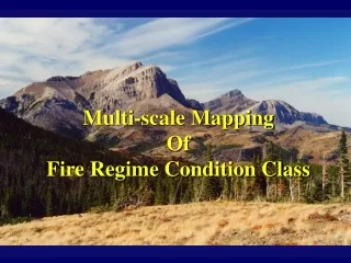
Fire regime
Fire regime. The nature of fires occurring over an extended period of time General, long-term pattern of recurring fires over a particular time and place Typically includes frequency and severity Ideally includes size, spatial pattern, season, and variability. Describing fire regimes.


Fire regime
E N D
Presentation Transcript
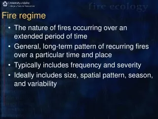
Fire regime • The nature of fires occurring over an extended period of time • General, long-term pattern of recurring fires over a particular time and place • Typically includes frequency and severity • Ideally includes size, spatial pattern, season, and variability
Describing fire regimes • Frequency: how often, usually characterized as interval in years between fires • Extent: typical size • Magnitude: • Intensity • Severity • Rotation • Seasonality • Predictability • Spatial patterns
Fire frequency • Point frequency • Fire return interval • Weibull mean fire interval • Probability of occurrence • Area frequency both express the length of time necessary to burn an area equivalent to the study area • Rotation • Fire cycle is calculated based on the distribution of ages in a time-since-fire map • Number of fires in a given area
Quantifying fire regimes: point fire frequency • Measures • Mean fire interval (Heinselman 1973, Agee 1993) • Wiebull mean fire interval (Johnson 1992, Finney 1995, Grissino-Meyer 1999) • Explicitly spatial, but represent spatial patterns as aggregates of point samples
Fire severity: degree of ecosystem change • Tree mortality • Heat penetration into the soil (Lea and Morgan 1993) • Degree to which fires consume organic biomass on and within the soil (Lenihan et al. 1998) • Change in color of ash and soil (Wells et al. 1979, Ryan and Noste 1985) • Combination of fire effects (Turner et al. 1994)
Fire intensity • Physical description of fire behavior • Defined as the amount of energy released by a flaming front • Closely correlated with flame length (Albini 1976)
Understanding fire regimes across spatial and temporal scales is challenging • Fire is a stochastic, spatially complex disturbance process • Data are from points or from small areas and often from relatively short time series • Extrapolation is difficult • Interpretations are often biased by truncated time series (Finney 1995), which causes us to overestimate fire frequency.
Understanding fire regimes across spatial and temporal scales is challenging • Climate, vegetation, and topography all interact with fire • Legacy of past events varies • Fire and fire effects are inherently variable and heterogeneous • Fire regimes are not static
Errors • Imperfect recording of fire events • Not all fires scar trees • Subsequent fires may consume evidence • Sampling may not detect all fires • Heterogeneity and variability • Autocorrelation in time and space
Heinselman Kilgore Flora Volume Hardy et al. Morgan et al. Frequent, light surface fires (2) Frequent, low-intensity surface fires (1) <35 yr. Low Severity fires (forest) Nonlethal fires (forest) Understory fires, (forest) Infrequent, light surface fires (1) Infrequent, low-intensity surface fires (2) <35 yr. Stand-replacement fires (forest & grassland) Nonlethal fires (grassland) Infrequent, high-intensity surface fires (3) Infrequent, severe surface fires (3) Stand replacement fires (forest & grasslands) 35-100+ yr. Stand replacement fires (forest & grassland) Short-return interval, stand-replacement fires (4) Stand replacement fires (forest) Short-return interval, crown fires (4) Very long-return interval, stand-replacement fires (6) Very long-return interval, crown fires (6) 200+ yr. Stand replacement fires (forest) Variable or mixed fires (forest) Mixed fires (forest) Variable: Frequent, low-intensity surface & long-return interval stand-replacement fires (5) Long-return interval, crown fires (5) 35-100+ yr. Mixed severity fires (forest) Rarely burns No natural fires (0) Non fire regimes No burn
Why map fire regimes? • Assessment and planning • Contrasting past to present • Modeling • Understanding the influence of climate, topography, and vegetation • Identifying gaps in knowledge
Departures • Changes in fire intervals can be used to prioritize fire and fuels management based upon “ecological need” (Caprio et al. 1997) • http://www.nps.gov/seki/fire/frid97.htm
Departures • Fire Return Interval Departure = (RImax - TSLF)/RImax • RImax = maximum average return interval for vegetation class • TSLF = time since last fire, yrs • Moderate (0 to –2), high (-2 to –5), and extreme (> -5)
Fire Regime Condition Class • Condition classes (relative to historical fire intervals) • I: No significant departure (<1 fire interval) • II: Moderate departure in fire freq. (>1 interval) • III: Significantly altered fire freq. (by multiple intervals) and vegetation from historical range • In condition class III, critical ecosystem elements may be lost when fires occur. In all condition classes vegetation composition and structure has changed, more for condition class II and the most for condition class III.
Historical Fire Regimes of the United States Version 1.0 Version 2.0 Legend 0-35 yr. frequency, Non-lethal Severity 0-35 yr. frequency, Stand Replacement Severity 35-100+ yr. frequency, Mixed Severity 35-100+ yr. frequency, Stand Replacement Severity 200+ yr. frequency, Stand Replacement Severity Agriculture (Only Version 1.0) Water Barren http://www.fs.fed.us/fire/fuelman
Natural archives of fire history data • Dated fire scars in tree rings: yr and season • Time-since-fire maps reconstructed from ages of trees, usually from even-aged stands burned in stand-replacing fires • Charcoal from sediment in lakes and bogs • Networks of precisely dated fire-scar samples and sites have been used to estimate area burned based upon the proportion of sites scarred in a given year
Fire history from fire-scarred trees • Multiple fire scars from single trees and groups of trees • Works best for surface fires that burned relatively frequently • Cross-date to identify exact year of scar • Prepare surface and magnify to identify season of fire. This is done by examining the cells damaged by fire
Dated fire scars on trees • Low severity fires • Some trees survive • Part of cambium is killed • Crossdate fire scars using dendrochronology (http://web.utk.edu/~grissino/) • Composite dates from multiple individual trees • Calculate fire frequency from distribution of intervals between fires
Strengths of fire-scar data • Extraordinary time depth -- typically 300 to 500 years, and more than 2,000 years in giant sequoia (Swetnam 1993) • Long records encompass extreme events • High temporal resolution: fires are dated to the year, and often season, of occurrence • When accurately dated it is possible to correlate fire events across spatial scales, and to compare the highly synchronized events (or asynchronous events) with independent temporal and spatial data • Can infer other things: climate, suppression-release
Limitations • We know more about fire frequency than fire size, severity, rotation, variability, and other characteristics of fire regimes • Accuracy and precision of fire history data are seldom quantified • Variability of fire regime characteristics over time and space is seldom evaluated • Few fire history data available for grasslands, shrublands and woodlands
Fire history from mixed and stand-replacing fires • Stand age reconstruction • Time-since-fire maps
Time-since-fire maps • Stand-replacing fires • Even-aged cohorts of trees established post-fire • Assume patch age-class distribution is relatively stable over time (steady-state shifting mosaic) • Assume frequency of disturbance is spatially homogeneous, stationary Poisson process • If small, old stands are not detected or aged accurately, the frequency of disturbance is overestimated
Human archives • Operational databases of fire occurrence • Atlases: maps of fire perimeters and locations • Remotely sensed fire location, perimeter and severity • Interviews, personal diaries, or literature searches • Land survey records • Aerial photographs • The National Interagency Fire Management Integrated Database (NIFMID)
Fire atlases • Compilations of mapped fire perimeters • Paper or digital • Include date and perimeter of fires, but typically do not include information on fire severity, rate of spread, or perimeters of small fires • Only larger fires (>50 or 100 ac) are included, but they likely to represent a large proportion of area burned • Errors in spatial location and date of fire occurrence are difficult to assess, likely vary through time and and can be severely limiting
Fire atlases • Perimeters often only approximate • Spatial pattern of burned areas within the mapped perimeters is seldom known • Can do spatial analyses of fire location, area burned through time, and frequency • Typically only larger fires are mapped • Accuracy likely varies through time • Accuracy has not been assessed
20 k N Rollins/LTRR
Fire frequency from fire atlases • “Wall-to-wall” • Example is from the Gila/Aldo Leopold Wilderness complex in New Mexico and the Selway-Bitterroot Wilderness Area in Idaho and Montana • In this example, only fires >50 ha in size are included
Aerial photographs • Fire perimeter, size, location, severity, pattern • One of the few sources of fire severity information other than detailed field sampling during or immediately after a fire
NIFMID • National Interagency Fire Management Integrated Database • Includes all fires by size class, location, and cause, but only for recent decades • Individual fires are represented as points (not necessarily the ignition point), size class, whether human or lightning ignited • Includes small fires, and thus can complement fire atlases and other databases
Remote sensing from planes or satellites • Not used extensively • Great potential for mapping post-fire tree mortality and severity • Lightning occurrence
Example of using multiple data sets • Compare and contrast fire patterns in two areas • Selway-Bitterroot Wilderness Area (Idaho and Montana) • Gila/Aldo Leopold Wilderness Complex (New Mexico) • What are the fire patterns through time? • How are fire patterns related to topography, fire management policy, and to drought? • From: Rollins et al. 2000
Study areas • SBWA • 547,370 ha • 500 m to 1500 m • GALWC • 486,673 ha • 1300 m to 1500 m
Area burned • Selway-Bitterroot Wilderness Area • 474,237 ha burned in 437 fires from 1880 to 1996 • 7 yrs of extensive fire, 72% of all area burned • 1889, 1910, 1919, 1929, 1934, and 1988 • Gila-Aldo Leopold Wilderness Complex • 147,356 ha burned in 232 fires from 1909 to 1993 • 6 yrs of extensive fire, 71% of all area burned • 1909, 1946, 1951, 1985, 1992, 1993
Topography • 30 m DEMs • Level I and II
Fire frequencies and landscape characteristics:K-S two-sided probabilities
Logistic regression models McFadden’s McFadden’s
What is the fire evidence from lake sediments – Burnt Knob Lake • ~4 m of sediment, pollen and charcoal • Recent deposition rate of 0.08 cm/yr or 12.23 years/cm • Periods of high fire activity occur between 13,000 and 11,500 14C yr B.P. and at ca. 6000, and 2250 14C yr B.P. • Severe, probably stand-replacing fires occurred at ~13,000 14C yr B.P., ~12,000 14C yr B.P., and ~6000 14C yr B.P.
Fire history • 12 fire years in Burnt Knob Lake basin between 1580 and 1883 based on dated fire scars in tree rings • Charcoal peaks in lake sediments match fire events in AD 1900/1904, 1883, and 1838 • No evidence of 1910 fire in lake sediments, fire scars, or fire atlases
Age structure • Lodgepole pine and whitebark pine establish very quickly following fire • Many large diameter whitebark pines survive fires that are lethal to many surrounding trees • Some pulses of regeneration are not related to fires