INSPIRE/Hydrography and distributed geographic databases architecture
150 likes | 166 Vues
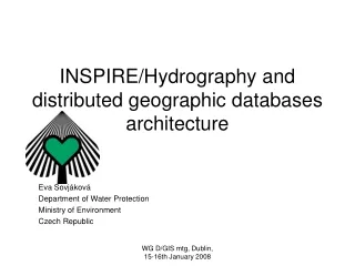
INSPIRE/Hydrography and distributed geographic databases architecture. Eva Sovjáková Department of Water Protection Ministry of Environment Czech Republic. Part I: Hydrographic data of the Czech Republic. Simplification of the river network for reporting to WISE

INSPIRE/Hydrography and distributed geographic databases architecture
E N D
Presentation Transcript
INSPIRE/Hydrography and distributed geographic databases architecture Eva Sovjáková Department of Water Protection Ministry of Environment Czech Republic WG D/GIS mtg, Dublin, 15-16th January 2008
Part I: Hydrographic data of the Czech Republic WG D/GIS mtg, Dublin, 15-16th January 2008
Simplification of the river network for reporting to WISE - rivers with Strahler'sordernumber 6 and more and theirs water bodies WG D/GIS mtg, Dublin, 15-16th January 2008
Part II: Responsibility andspecification of web map technology in the Czech Republic WHO:Ministry of Environment - competent authority T.G.Masaryk Water Research Institute – outsourcing organization, which ensure technical background TECHNOLOGY:The Czech Republic disposes in general ESRI technology at ArcIMS 9.2 level (Arc Internet Map Server), which is prepared to being used for the considered WISE technological innovations WG D/GIS mtg, Dublin, 15-16th January 2008
WFD (2010) MS fulfill obligations to report RBMP on the basis of hydrological features, including metadata INSPIRE (2011) MS ensure restructured geographical information for hydrography according to INSPIREimplementation rules MS ensure metadata for hydrographic features INSPIRE is fully ensured of ISO,CEN and national bodies for standardization. Part III: Inter-relation between INSPIRE and WISE WG D/GIS mtg, Dublin, 15-16th January 2008
Part III: Inter-relation between INSPIRE and WISE Quotation from INSPIRE: For the data according to point 8 of Annex I – Hydrography), the Member States have committed themselves to establish and operate a network of services that are described under Article 11 (1). These are: • discovery services (making it possible to search for spatial data sets and services on the basis of the content of the corresponding metadata and to display the content of the metadata), • view services (making it possible, as a minimum, to display, navigate, zoom in/out, pan, or overlay viewable spatial data sets and to display legend information and any relevant content of metadata), • data download services (enabling spatial data sets, or parts of such sets, to be downloaded and, where practicable, accessed directly full data sets or their parts), • transformation services (enabling spatial data sets to be transformed with a view to achieving interoperability), • services allowing spatial data services to be invoked. WG D/GIS mtg, Dublin, 15-16th January 2008
Part III: Inter-relation between INSPIRE and WISE CEN Recommendation (1) The development of geo-portal occurs in threegenericsteps: • Definition of the technological framework • Definition of layouts and information structure • Developing of aggregator of different services or web sources WG D/GIS mtg, Dublin, 15-16th January 2008
Part III: Inter-relation between INSPIRE and WISE CEN Recommendation (2) Technical report of CEN lists 6 categories of services for geo-portal development. In analyzing them it is obvious that of these services some already now are significantly missing in ensuring of the digital reporting to WISE: • CatalogService: Publish, search and query metadata; • GazetteerService: Geocoding functionalities to relate a geographic name, spatial code etc. to an adequate spatial representation and vice versa; • ThesaurusService: Services that help to provide harmonized vocabularies for the publishing of resources as well as for queries and analysis on geographic information; • FeatureService: These services realize access to geodata; • PortrayalService: Often also simply referred to as mapping services, realize the cartographic representation or visualization of geoinformation; • Processing Service: It denotes a super class for various services to process WG D/GIS mtg, Dublin, 15-16th January 2008
CZ web map server Part IV: Idea of distributed geographic databases architecture Yours/ European web map server =>Task given on the level of EC <= Search metadata using national metadata services <= Proved quality of data and their readiness regarding the task <= Initiate/invoke national services &.. =>Download data => Add additional value/prepare map Erase national data from your server! Hydrographical data of the Czech Republic WG D/GIS mtg, Dublin, 15-16th January 2008