Forest Watershed Management
Forest Watershed Management. Course Objective:

Forest Watershed Management
E N D
Presentation Transcript
Forest Watershed Management Course Objective: Understand the impact of forest management activities on water yield and quality. Become familiar with best management practices (BMP’s), the specific BMP programs of several states, and the role of foresters in BMP implementation and watershed management.
Grading • Grades are based on: • Four quizzes - 30% • Final examination - 30% • Project - 30% • Class participation - 10%
Research Paper • Due Date: December 8, 2000 • Length: 1,200 words • Topic:You may write about anything related to the course or watershed management in general. I suggest selecting a topic of particular interst to you. Prof. Hoover is available to discuss possible topics. • Format: This is to be a research paper. This means all factual statements must be based on published research. Any conclusions should be based on the evidence available in the literature, not mere opinion. • Number of citations: Provide a minimum of six citations for sources of information included in your paper.
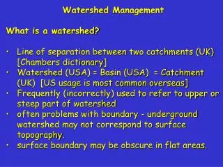
What Is A Watershed? Also referred to as a “catchment” • Topographically delineated area drained by a stream system • No specific scale implied • Total land area above a designated point on a stream or river that drains past that point • For planning and management purposes it’s a • Physical-biologic unit • Socioeconomic-political unit
Historically focus was forest hydrology Hydrological effects of vegetation and land management practices on water quantity and quality, erosion, and sedimentation at specific sites Hydrology – science of water concerned with the origin, circulation, distribution, and properties of the waters of the earth. Why Study Forest Watershed Management?
Construction sites Cropland Forest roads Forest land Sources of Soil Erosion –“It’s All Relative Folks”
Soil Erosion on Forest Land Piedmont Region of Southeastern U.S. = 0.4 tons/acre/year (conversion factor: kg/ha x 0.892183 = lb/acre) = 0.04 tons/acre/year Source: John D. Hewlett. 1982. Principles of Forest Hydrology, Univ. Ga. Press, p. 150
Forest Activities & Soil Erosion(in order of contribution to erosion) • Roads and skid trails • Channel encroachment • Site preparation • Harvesting activities • Fire prevention and suppression • Recreation activities • Flatwoods drainage • Wildlife management activities Source: John D. Hewlett. 1982. Principles of Forest Hydrology, Univ. Ga. Press, p. 149
Clearcut Expose mineral soil Increase soil temperatures Reduce evapotransporation Increase exposure to wind and associated evaporation Increase erosion and stream sedimentation Hydrologic Affects of Silvicultural Practices
Creates impermeable surface Increases surface flow Channelizes surface water flow May channelize shallow subsurface flow Hydrologic Affects of Road Systems
Forest Watershed Management • Clean Water Act • Sec. 1329 focuses attention of forest land through nonpoint source pollution requirements • Citizen interest • Poor practices would cause shutdowns of forest operations • Best management practices (BMP) adopted in most states
An Issue in All States • Areas of abundant rainfall • Impacts of storm events • Droughty areas • Capture and allocation of available water
Best Management Practices • Focus of forestry and forest products community • BMP’s are either regulations or guidelines for silvicultural activities • Planting • Harvesting • Roads • Usually emphasize water quality
Focus of Course: Knowledge to Implement Forest BMP Practices • Understand action of water in forest environments • Knowledge of applicable BMP’s • Skill to apply BMP’s to a specific project on a specific site
Knowledge of Precipitation Amounts and Patterns • Plan drainage structures • Size temporary culverts to handle storm events during period of operations • Size permanent drainage structure to handle 100 year storms
Knowledge of Precipitation Amounts and Patterns • Time operations • Expose soil during dry periods if possible • Establish vegetative cover as soon as possible • Use native vegetation whenever possible
Become familiar with precipitation patterns • Sources of data • NOAA • NWS • State climatologist • Usually at Land Grant University • Vast amount of data available on line
National Climatic Data Center National Climatic Data Center
National Weather Service National Weather Service
Indiana Climate Page http://shadow.agry.purdue.edu/index.html
Variation in Precipitation • Random • Seasonal • Proximity to water body (lake affect) • Prevailing winds with moisture • Topographic
Topographic Affect • Rising air cools • Dew point reached • Water vapor condenses to form clouds • Precipitation may occur
Cloud patterns induced by passage of air current over mountains • Precipitation concentrated on windward side of mountain, and mountain top • Tends to be rain shadow on leeward side
Fidalgo Island in rain shadow of the Olympic Mountains. • Rainforests with up to 200 inches of precipitation on the west side. • Rain shadow area northeast of the Peninsula with only one-half (20 inches) of the normal rainfall for the rest of the region.
Puget Sound Area, Washington Clearwater 118.5” Coupeville 21.14”
Some Basic Hydrologic Concepts Weir are used to measure volume of water flowing past a point.
What Happens to Precipitation? • Hydrologic cycle P = RO + ET + S, Where, • P ≡ precipitation • RO ≡ runoff • ET ≡ evapotranspiration • S ≡ storage
Evapotranspiration • Loss of water from a given area during a specified time by evaporation from the soil surface and by transpiration from the plants. • Supports plant life • Reduces water yield
Runoff Provides Major Benefits RO = P – ET Moose Creek, Clearfield County, PA WLH
Where does runoff go to? • RO = CI + SRO + SSF + BF, • where, • CI ≡ channel interception • SRO ≡ surface run off • SSF ≡ subsurface flow • BF ≡ base flow
Where does runoff go to? • CI ≡ channel interception • Precipitation falling directly into channel Susquehanna River, Clearfield, PA, WLH
Where does runoff go to? • SRO ≡ surface runoff or overland flow • Precipitation not infiltrating soil Source: http://www.agric.gov.ab.ca/agdex/500/72000003.html Sheet erosion of cropland resulting from surface runoff
Where does runoff go to? • SSF ≡ subsurface flow, or interflow • Infiltrating precipitation intercepted by hardpan or bedrock before entering groundwater pool
Where does runoff go to? • BF ≡ base flow or ground water flow • Precipitation entering water table
Research results come from experimental watersheds such as: Hot Link to Website
What We’ll Look At • Erosion • Impacts of • Roads • Harvests • Water flows • Storm events • Storage • Water yield • Amount • Timing Montgemory Reservoir, Clearfield, PA, WLH