Download

1 / 12
120 likes | 287 Vues
Infrastructure for Spatial Information in Europe - INSPIRE -. Marc Vanderhaegen. Infrastructure for Spatial Information in Europe - INSPIRE -. 1. Policy context 2. Legal Framework 3. Implementation 4. Current status of legal framework. Policy context for INSPIRE.

E N D
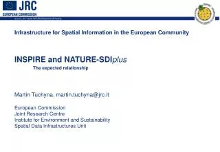
Infrastructure for Spatial Information in Europe - INSPIRE - Marc Vanderhaegen
Infrastructure for Spatial Information in Europe - INSPIRE - 1. Policy context 2. Legal Framework 3. Implementation 4. Current status of legal framework
Policy context for INSPIRE 6th Environmental Action Programme Sustainable Development Strategy Governance white paper State of the environment drives the policy cycle! Evaluation Policy action/implementation Monitoring Data layers/sets No Formulation Satisfactory? Yes Keep it like this!
6th Environmental action programme Complexity of environmental problems - interrelation between issues requires Integrated policy-making: 4 priorities climate change, nature and biodiversity, environment and health, waste and resources, 7 thematic strategies: soil, marine, natural resources, pesticides, air pollution, urban, waste recycling requires Integrated approach to knowledge gathering
Geography of Disease and Ill-health • Creation of GIS to assist in the analysis of • health impacts • • Exposure Data • • Health Data • • Socio-economic data • Geographical data • Environmental data Air Pollution Cancer Cases
INSPIRE Legal Framework: General Issues Initiators: ENV, ESTAT, JRC - supported by MoU also support of INFSO and RTD Context: Cross-sectoral initiative, starting as a platform for ENV policy needs, extendable to support multiple policies Objective: Unlock spatial information to support our policies Scope: • Creation of spatial data infrastructure • Existing spatial data from Public sector • Electronic format • National to local • 17 themes - Environmental data - Cross-sector data
1. Legal Framework (Cont.) 17 Themes: 10. Spatial planning/ Area regulation 11. Air and climate 12. Water/hydrography 13. Ocean and seas 14. Biota/biodiversity 15. Natural resources 16. Natural and technological risks and natural disasters 17. Areas under anthropogenic stress 1. Geographical location 2. Administrative units 3. Properties, buildings and addresses 4. Elevation 5. Geo-physical environment 6. Land surface/land cover 7. Transport 8. Utilities and facilities 9. Society and population
1. Geographical location 1.1 Geodetic reference systems 1.2 Geographical names 1.3 Geographical grids 2. Administrative units 2.1 Official administrative units 2.2 Government management zones 2.3 Blocks, census and statistical districts 2.4 Civil security units 2.5 Environment management & reporting units 2.6 Postal codes/regions 3. Properties, buildings and addresses 3.1 Properties 3.2 Buildings 3.3 Addresses 4. Elevation 4.1 Terrestrial elevation 4.2 Bathymetry 4.3 Coastline 5. Geo-physical environment 5.1 Soil 5.2 Geo-morphology 5.3 Bedrock geology 6. Land surface/Land cover 6.1 Land cover 6.2 Landscape 6.3 Orthophoto-images 6.4 Unclassified satellite data 7. Transport 7.1Transport networks 7.2 Transport services 8. Utilities and facilities 8.1 Transmission lines and pipelines 8.2 Environmental protection facilities 8.3 Government service facilities 8.4 Production facilities, industry Agricultural 8.5 Trade and service facilities 9. Society and population 9.1 Urban and rural settlement 9.2 Demography 9.3 Human health and safety 9.4 Cultural heritage 9.5 Natural amenities 10. Spatial planning/Area regulation 10.1 Land use plans 10.2 Protected sites 10.3 Area restriction/regulation zones 11. Air and climate 11.1 Air and atmospheric conditions 11.2 Meteorological spatial features 11.3 Climate zones 12. Water/ Hydrography 12.1 Hydrographic networks/ Surface water bodies 12.2 Water catchments 12.3 Groundwater bodies/aquifers 13. Ocean and seas 13.1 Oceanographic features 13.2 Sea regions 14. Biota/biodiversity 14.1 Biomes/ Bio-ecological 14.2 Vegetation 14.3 Habitats and biotopes 14.4 Species distribution 15. Natural resources 15.1 Ecosystem resources 15.2 Water resources 15.3 Agricultural land and soil resources 15.4 Forest resources 15.5 Fishery resources 15.6 Geological resources 15.7 Renewable energy resources 16. Natural and technological risks and natural disasters 16.1 Natural risk vulnerability zones 16.2 Technological risk vulnerability zones 16.3 Technological accidents and natural disasters 17. Areas under anthropogenic stress 17.1 Polluted areas 17.2 Noise and radiation zones 17.3 Areas of intensive exploitation
Legal Framework: Obstacles & Measures Obstacle 1: Documentation on information is lacking Measure 1: (ST – MT) Document to standards and maintain Obstacle 2: GAPS in spatial data Measure 2: (MT – LT) Make cross-sector spatial data available = NOT IN INSPIRE FRAMEWORK , BUT DAUGHTERS!! Obstacle 3: Data is not compatible Measure 3: (MT – LT) Contribute to standards and harmonise Obstacle 4: Incompatible GIS initiatives Measure 4: Establish IT service network to publish, discover, evaluate, view and access according to common standards Obstacle 5: Barriers to use of spatial data Measure 5: Establish licensing framework to share
Implementation • Preparation of implementation on a voluntary basis: • establishment of precursor co-ordination structures • definition of implementation programme and starting its execution • preparation of implementing legislation • Key issues for implementation: • Linkage to GMES • Use of existing funding programmes • Engagement of stakeholders: geospatial interest groups
Current status and future steps • Internet consultation finished since 29 May: • ->More than 180 replies • ->Strong support from stakeholders: 88% of the respondents consider that at least some of the obstacles should be addressed by INSPIRE (76% consider that all should be addressed) • Ongoing extended impact assessment: due by end of June 2003 • Future Steps • -> October: Adoption of proposal • -> November: Start discussion in Council under IT presidency and in European Parliament