Download
1 / 22
220 likes | 383 Vues
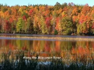
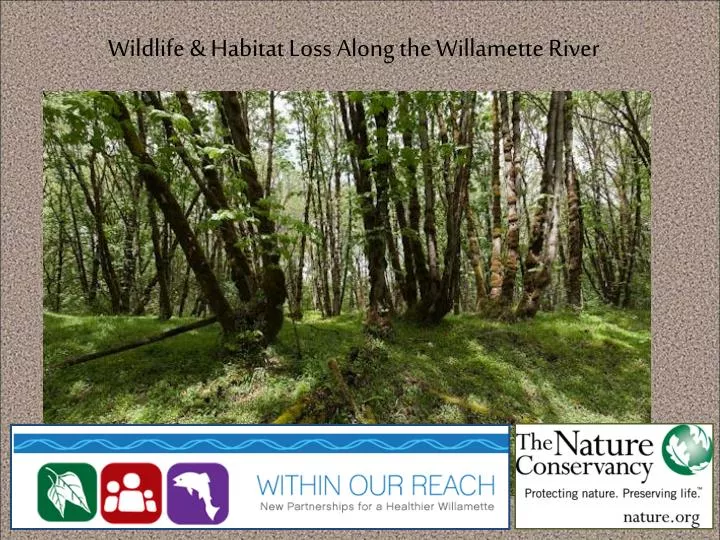
Wildlife & Habitat Loss Along the Willamette River. The Riparian Forest in the Mid-1800’s. Frequently flooded areas were largely timbered, and were connected with the channel through flood events.

E N D
The Riparian Forest in the Mid-1800’s Frequently flooded areas were largely timbered, and were connected with the channel through flood events. “The adjacent country [between Eugene and Harrisburg] is level…the river bottom is from one to two miles in width…The timber, consisting of cottonwood, maple, ash, alder, and willows, is dense, and…is traversed by sloughs and bayous, large and small, and in times of floods is covered by swiftly-running water to a depth of from 5 to 10 feet.” (U.S. Army, 1875) Wooded floodplains provided habitat for wildlife- trees slowed river flood waters, protected the land from erosion and recycled carbon and nutrients to the floodplain and river. “Before the Willamette bottomlands were cleared and placed under cultivation the heavy timber and underbrush with which they were covered retarded the water during periods of their overflow.” (U.S. Army, 1891)
Willamette ValleyVegetation Changes 1850 2004 “Vegetation patterns change over time under the influences of climate, succession, and disturbance regimes. However, it appears that the array of vegetation types in the Willamette Valley has remained relatively consistent over the last 3,000-5,000 years.” ---- “Historical Vegetation of the Willamette Valley, Oregon in the mid-1800’s” by John A. Christy, Oregon Biodiversity Information Center, and Edward R. Alverson, The Nature Conservancy (2010).
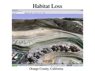
Most riparian stands along the Willamette River, originally ranging from 1 to 7 miles wide, have shrunk to only a few hundred feet, depending on width of the floodplain (Benner and Sedell 1997). Many streams now have only a thin strip of vegetation one or two tree lengths in width, and others have had all of the riparian forest removed (Hulse 1998).
Riparian and Wetland Forests • Represented 7.2% of mid-1800’s WV vegetation, in bands of varying width along floodplains of larger streams and rivers- up to 5 miles wide along the Willamette River floodplain. • Willow, red alder, and black cottonwood typically occurred along active channels. • Oregon ash, bigleaf maple, and white oak occurred on higher terraces. • Ash and oak were particularly important along smaller streams where a narrow wooded riparian corridor was bounded by open prairie.
Riparian and Wetland Forests • Extensive areas of riparian forest have been lost to agricultural and urban development. • Typically only a narrow band of forest remains along larger rivers where pre-settlement riparian forests were much wider. • Most of today's surviving stands of riparian forest are second-growth and have been degraded by a variety of non-native species such as reed canarygrassand Himalaya blackberry.
Wet Prairie • Represented approximately 10% of mid-1800’s WV vegetation (roughly one-third of “prairie” in Valley was wet prairie). • Heavy clay soils on valley floor that were perennially saturated or seasonally flooded • Typically dominated by tufted hairgrass, rushes and sedges (Carex spp.). • TNC estimates that less than 2,024 ha of wet prairie, remain in the Willamette Valley today—less than 2 percent of the former extent of these ecosystems.
Emergent Wetlands • Covered 3,650 ha, or just under 0.3% of the mid-1800’s WV vegetation • Under-estimated since GLO land surveyors did not typically note these- Most were simply recorded as "marsh" or "swamp." • “Swamps” were typically associated with smaller streams, and many contained beaver dams. • Nearly all larger historical emergent wetlands have been drained and converted for agricultural use. Source for all data: “Historical Vegetation of the Willamette Valley, Oregon in the mid-1800’s” by John A. Christy, Oregon Biodiversity Information Center, and Edward R. Alverson, The Nature Conservancy (2010).
Riparian Wildlife Habitat • Most wildlife is not restricted entirely to stream riparian areas, but several use stream riparian areas predominantly. • Focal species include: American dipper, bald eagle, American merganser, harlequin duck, red-eyed vireo, willow flycatcher, American beaver, river otter, coastal tailed frog Yellow-billed Cuckoo: Extirpated from WV due to loss of mature riparian forest Photo Credit: Ronnie Maum, USFWS
Role of Riparian Habitats in Ecological Function • Act as vegetative filters, screening out sediment and other pollutants from nearby runoff. • Vegetation controls stream temperature and contributes organic matter/ wood used by aquatic organisms for food and shelter. • Link land and water habitats and have a high level of biodiversity, providing the interface between aquatic and terrestrial species. • Contribution of wood from riparian forests also impacts channel form and complexity.
In Channel Abundance of Wood • In 1868, the Corps began removing downed trees (snags) from the Willamette (Sedell and Froggatt, 1984). Yearly snagging records show that about 1000 downed and streamside trees were removed annually from the mainstem Willamette between 1868 and 1935. • In 1875, the Corps suggested continued annual removal of snags and reported that “not until the dense growth of timber disappears from the banks…can real and permanent good be accomplished” for navigation. Source: “Patterns and Controls on Historical Channel Change in the Willamette River” (2007) http://photos.salemhistory.net/cdm4/item_viewer.php?CISOROOT=/specialcol&CISOPTR=881&CISOBOX=1&REC=3
In Channel Abundance of Wood • Numerous downed trees helped to create and maintain shoals, multiple channels, oxbow lakes, and complex aquatic habitats at the outside bends of the river. • Snagging in combination with the widespread conversion of floodplain forests to agriculture (which diminished recruitment of large wood) and dam construction (which limited the transport of wood from tributary channels to the main-stem Willamette) greatly reduced the in-channel abundance of wood. • With both wood supply and flood peaks reduced, the Willamette’s channel was far less prone to avulsions (and other ecological variability) due to wood clogging of channels. Source: “Upper Willamette River Landscape: A Historical Perspective” by Benner and Sedell (1997)
Trends and Strategies • Improved Riparian Mapping • Synthesis: Unified Vision/ Focusing Resources • Land Acquisition, Restoration and Management of Non-Native Species • Integrating Flow and Restoration
Willamette Valley Riparian Mapping Streams & rivers modeled using new technique for LiDAR data, which works well even in urbanized low relief areas
Willamette Valley Riparian Mapping Closeup area for landcover example High Low
Height class--- LiDAR highest hit above ground elevation, shown with NAIP infrared band 0 - 0.5 ' 0.5 - 3 ' 3 - 6 ' 6 - 30 ' 30 - 80 ' 80 - 120 ' 120 ' +
LiDAR coverage within study area. Floodplains can be delineated without LiDAR data, but vegetation height is impossible.
Integrating flow and Restoration Willamette River Environmental Flow Recommendations • Phase 1: Middle Fork and Coast Forks of Willamette • Environmental Flows • Willamette Floodplain Restoration Study • Phase 2: McKenzie River • Environmental Flows