Download
1 / 39
390 likes | 531 Vues
GPS Performance in Southern Hardwood Forests. Pete Bettinger Warnell School of Forestry and Natural Resources University of Georgia. 2007 Society of American Foresters National Convention. Introduction. In forests, vegetation plays a significant role in obstructing signals and

E N D
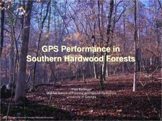
GPS Performance in Southern Hardwood Forests Pete Bettinger Warnell School of Forestry and Natural Resources University of Georgia 2007 Society of American Foresters National Convention
Introduction In forests, vegetation plays a significant role in obstructing signals and introducing error into the system through the multipath effect of signals being redirected from obstructive surfaces. More multipath can be found, and lower SNR values realized, in areas under a forest canopy. These effects may be reduced by antenna design, processing techniques related to the data collected, and other methods, however the improvement to data quality of an individual receiver in high multipath environments is often unknown. 2007 Society of American Foresters National Convention
Introduction Manufacturer's stated accuracy of GPS receivers are usually ambitious. We have embarked on a set of studies to determine the accuracy of various receivers and antenna configurations in a forested environment. Our goal is to better understand the behavior of data positioning as well as to better understand the capabilities of GPS receivers. 2007 Society of American Foresters National Convention
Introduction 2007 Society of American Foresters National Convention
Introduction 2007 Society of American Foresters National Convention
Introduction Two recent developments in GPS technology - WAAS and DGPS - may help improve the accuracy of GPS-determined positions. These are on-the-fly differential correction processes, as opposed to traditional differential correction, which can be performed after data has been collected. 2007 Society of American Foresters National Convention
Introduction The Wide Area Augmentation System (WAAS) was begun in 1994 as a joint project between the United States Department of Transportation and the Federal Aviation Administration (FAA). WAAS was meant to provide service for all classes of aircraft in all phases of flight in the United States. It is now available for use in a variety of hand-held GPS receivers. As of September 28, 2007, WAAS service is now available to users throughout Canada and Mexico. The cost to provide the WAAS signal is about $50 million per year. 2007 Society of American Foresters National Convention
Introduction WAAS consists of: • A monitoring network • Processing facilities • Geostationary satellites • Reference stations (~34) • Central data processing sites The reference stations collect measurements from the GPS and WAAS satellites so that near real-time differential correction can be made given ionospheric delay information that is determined. 2007 Society of American Foresters National Convention
Introduction WAAS is said to improve basic GPS accuracy to approximately 7.6 meters vertically and horizontally, at least 95% of the time. Actual performance measurements of system at specific locations have shown it typically provides better than 1.0 meters laterally and 1.5 meters vertically throughout most of the U.S. In forested conditions, however, this may not hold. 2007 Society of American Foresters National Convention
Introduction Differential Global Positioning System (DGPS) is an enhancement GPS that uses a network of fixed ground-based reference stations to broadcast the difference between their positions as indicated by the GPS satellites and their known fixed positions. DGPS can refer to any type of ground-based augmentation system. Static mode DGPS is where the rover and the base station remain in fixed places (are stationary). Kinematic mode DGPS is where the base station remains in a fixed position, yet the rover moves from unknown location to unknown location. According to the US Coast Guard, 47 countries operate systems similar to the US NDGPS. 2007 Society of American Foresters National Convention
Introduction The U.S. Coast Guard DGPS system consists of two control centers and 86 remote broadcast sites in 2007 - many more are planned. The Coast Guard DGPS became fully operational in 1999. The accuracy is said to be about 10 m. 2007 Society of American Foresters National Convention
Introduction Lower-population areas, and areas away from waterways, most notably the Rocky Mountains, Texas, West Virginia, and Alaska, have poor coverage by the Coast Guard's ground-based DGPS. 2007 Society of American Foresters National Convention
Introduction Both WAAS and DGPS require dual frequency capability in GPS receivers (one frequency is a signal from the GPS satellites, the other frequency is the signal from the WAAS or DGPS satellites or beacons). 2007 Society of American Foresters National Convention
Introduction GPS technology changes rapidly. Advances in all aspects of GPS technology require continual review of this technology and its effect on positional accuracy. The potential cost savings made available from an evaluation of a range of receivers might encourage forest managers to more readily apply this technology to their day-to-day operations. 2007 Society of American Foresters National Convention
Introduction Three general categories of GPS receivers: Survey-grade GPS receivers are reported to be capable of providing sub-centimeter positional accuracy, at a cost of $10,000 dollars or more per unit. Mapping-grade receivers, which in some cases can provide sub-meter accuracy, range from about $1,500 to $5,000 or $10,000. These are frequently used in forestry applications. Recreation-grade receivers generally provide the least accurate positional information - between 3m and 10m accuracy under optimal conditions - and range in price from $100 to about $1,000. Recreation-grade receivers have become popular among many outdoors enthusiasts, and this popularity has likely influenced the wide variety of inexpensive GPS receivers available on the market today. 2007 Society of American Foresters National Convention
Introduction Extrex ~$100 GPS Rino ~$650 GPS 60 ~$200 GPS 72 ~$130 Magellan Triton 300 ~$150 Magellan eXplorist 100 ~$120 Magellan eXplorist XL ~$400 Magellan eXplorist 600 ~$350 2007 Society of American Foresters National Convention
Introduction Brunton Atlas ~$400 Delorme Mapping GPS ~$400 Lowrence iFinder ~$100 to 300 Bushnell Onix 200 ~$200 Mio P550 PDA ~$300 2007 Society of American Foresters National Convention
Introduction Trimble Juno ST ~$650 Trimble Recon ~$1,000 Trimble GeoXM ~$2,600 Trimble GeoXH ~$5,300 Leica GS20 Professional data mapper ~$4,800 Magellan Promark 3 ~$3,000 CMT PDA GPS ~$1,300 CMT MC-GPS ~$2,500 CMT March-II-E ~$2,500 2007 Society of American Foresters National Convention
Introduction Research was conducted at the GPS test course facility in Whitehall Forest, Athens, Georgia. Three OPUS benchmarks were established within two kilometers of the field course. Position determination of twenty-seven permanent monuments was then made using standard surveying techniques. Each survey point consists of a brass survey cap mounted on a 0.6 m rebar post, which is encased in concrete. Survey points were established under a range of topographical and forested conditions, and positional accuracy is known to < 2 cm. 2007 Society of American Foresters National Convention
Introduction Twenty-four of the points were classified as under full canopy (not influenced by forest edge). Aspect ranges from North to Southeast, while slopes vary from 2 - 40%. Forest conditions changed nominally over these positions, a general pattern of species gradation occurs, changing from bottomland hardwood forest with a larger component of beech (Fagus grandifolia) and related species to an upland dominated by oak and hickory (Quercus spp., Carya spp.) with some remnant shortleaf pine (Pinus echinata) still present. 2007 Society of American Foresters National Convention
Introduction A laser-level tripod stand was designed and used to allowed all receivers to be placed directly over each monument, at a height ranging from 1.3 m to 1.5 m, which varied based on ground conditions. 2007 Society of American Foresters National Convention
Study #1 Study #1: A Comparison of GPS Performance in a Southern Hardwood Forest: Exploring Low-Cost Solutions for Forestry Applications 2007 Society of American Foresters National Convention
Methods GPS receivers studied: Mapping-grade: Trimble ProXR Recreation-grade: Garmin Etrex Garmin Map 60C Thales Mobile Mapper Conditions: Upper slope, mid-slope, lower slope positions Leaf-on time of year (summer) Leaf-off time of year (winter) 2007 Society of American Foresters National Convention
Results Leaf-on RMSE95 Lower Slope 24.6 18.6 36.4 24.1 54.5 14.1 5.4 Mid- Slope 18.3 18.1 27.6 21.0 53.7 14.6 5.2 Upper Slope 16.2 12.8 23.7 21.7 38.7 9.7 5.3 Receiver Etrex Etrex with WAAS Map 60C Map 60C with WAAS Thales Mobile Mapper Trimble ProXR Trimble ProXR diff. corrected 2007 Society of American Foresters National Convention
Results Leaf-off RMSE95 Lower Slope 10.9 10.4 56.1 31.7 56.4 15.4 3.5 Mid- Slope 9.6 8.2 55.2 25.3 33.2 12.9 3.5 Upper Slope 13.3 11.5 45.1 15.3 36.8 9.8 3.6 Receiver Etrex Etrex with WAAS Map 60C Map 60C with WAAS Thales Mobile Mapper Trimble ProXR Trimble ProXR diff. corrected 2007 Society of American Foresters National Convention
Results General trends: Positional accuracy increased as slope position increased. However, improvements with WAAS correction were found across the slope positions studied. Change in RMSE with increasing number of position fixes was not as predictable as one would have hoped. Mapping-grade receiver outperformed the other receivers on all slope conditions. Differentially corrected (post-processed) data was better than WAAS corrected data (on the fly). 2007 Society of American Foresters National Convention
Study #2 Multipath mitigation under a forested canopy: Using a choke-ring antenna 2007 Society of American Foresters National Convention
Methods GPS receivers studied: Mapping-grade: Trimble ProXR Topcon Choke ring antenna Conditions: Upper slope, mid-slope, lower slope positions Leaf-on time of year (summer) Leaf-off time of year (winter) 2007 Society of American Foresters National Convention
Results Leaf-on RMSE95 Lower Slope 11.2 5.4 4.9 0.5 Mid- Slope 14.1 4.9 3.4 0.3 Upper Slope 9.7 5.2 3.4 0.4 Receiver Trimble ProXR Trimble ProXR diff. corrected Choke ring Choke ring diff. corrected 2007 Society of American Foresters National Convention
Results Leaf-off RMSE95 Lower Slope 15.0 3.3 4.8 0.6 Mid- Slope 12.7 3.3 3.7 0.4 Upper Slope 9.8 3.3 4.1 0.4 Receiver Trimble ProXR Trimble ProXR diff. corrected Choke ring Choke ring diff. corrected 2007 Society of American Foresters National Convention
Results General trends: Positional accuracy increased as slope position increased. Differentially corrected (post-processed) data was better than raw data collected on the fly. Change in RMSE with increasing number of position fixes was not as predictable as one would have hoped. 2007 Society of American Foresters National Convention
Results General trends: The choke ring antenna more effectively mitigated signal degradation. Real-time RMSE with the choke-ring configuration was about as good as the RMSE associated with differentially-corrected ProXR data. a) One might assume that 3.5 m of inaccuracy is associated with other factors than multipath (uncorrected choke-ring data - differentially corrected choke-ring data) b) Similarly, multi-path results in 5-12 m of inaccuracy depending on slope and canopy position and time of year. (uncorrected ProXR data - uncorrected choke-ring data) 2007 Society of American Foresters National Convention
Study #3 A Comparison of GPS Performance in a Southern Hardwood Forest: Exploring Real-time Data Accuracy of Forestry Receivers 2007 Society of American Foresters National Convention
Methods GPS receivers studied: Mapping-grade: Trimble ProXH Trimble GeoXH Garmin 17 HVS TDS Nomad Recreation-grade: Garmin Etrex Trimble Juno Conditions: Random positions Leaf-on time of year (summer) 2007 Society of American Foresters National Convention
Results Leaf-on RMSE95 Lower Slope 4.0 6.1 20.1 11.3 22.3 21.5 Mid- Slope 15.7 4.3 10.5 30.9 10.8 17.0 Receiver Trimble ProXH Trimble GeoXH Garmin 17 HVS TDS Nomad Trimble Juno Garmin Etrex 2007 Society of American Foresters National Convention
Results General trends: - Positional accuracy increased as slope position increased (for most situations). Change in RMSE with increasing number of position fixes was not as predictable as one would have hoped. While the order of units tested at each site was randomly determined, the RMSE results are curious, and require further examination. These were one-time measurements, typical of operational work. Repeated measurements, as what were collected in the other studies, may temper some of the results, but then the study will not be reflective of typical operational work. 2007 Society of American Foresters National Convention
Results Overall Observations: 1. With a mapping-grade GPS receiver, real-time positional accuracy may be 4-15 meters under tree canopies. 2. WAAS does slightly improve real-time position estimates. 3. Post-process differential correction significantly improves position estimates. With a mapping-grade GPS receiver, 3-5 m accuracy may be obtained. 4. Positional accuracy changes with slope position. 5. Error levels do not necessarily change (get smaller) with more position fixes. 6. Multi-path accounts for about 5-12 m of error, depending on slope and canopy position and time of year. 7. Time of year matters. 2007 Society of American Foresters National Convention
http://warnell.forestry.uga.edu/Warnell/Bettinger/GPS/UGA_GPS.htmhttp://warnell.forestry.uga.edu/Warnell/Bettinger/GPS/UGA_GPS.htm 2007 Society of American Foresters National Convention
http://warnell.forestry.uga.edu/Warnell/Bettinger/GPS/UGA_GPS.htmhttp://warnell.forestry.uga.edu/Warnell/Bettinger/GPS/UGA_GPS.htm 2007 Society of American Foresters National Convention