What Happens Next?
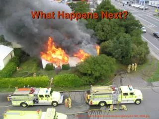
What Happens Next?. Source: http://runryder.com/helicopter/gallery/62/105_0569.jpg. The Problem:. Little or no on-site tactical information available to firefighters at the scene of an emergency. The Solution:

What Happens Next?
E N D
Presentation Transcript
What Happens Next? Source: http://runryder.com/helicopter/gallery/62/105_0569.jpg
The Problem: • Little or no on-site tactical information available to firefighters at the scene of an emergency. The Solution: • Geographic Information Systems (GIS) allow users easy access to a wide variety of relevant data on site, on time, and on target.
Stakeholders • Dearborn Fire Department • Dearborn Public Schools • City of Dearborn Management Information Systems (MIS) Department (Sue Katsiyiannis) • Police • Building and Safety • Downtown Development Authority • Public Works
Extent • Map extent: One quarter mile beyond Dearborn city limit. • Project Extent: Limited to City Hall complex at Michigan Avenue and Schaefer.
Resources People Data Hardware Software
Human 5 second-year GIS students at MBCC (GeoDudes). Instructor-John Bayerl Dearborn GIS Supervisor-Sue Katsiyiannis.
Streets (TeleAtlas) (Wayne County Emergency Management—Jay Timco) Railroads (US Census) City Boundries (US Census) Water (MIS) Sewers (MIS) Gas Lines (DTE-Simulated) Hydrants (MIS/Fire) Fire stations (Planning) Police stations (Planning) Hospitals (Planning) 2002 Orthophoto (MIS) 2005 Pictometry (Wayne County Emergency Management—Jay Timco) Data
Hardware Development (what we used): Dell Optiplex GX280 • P-IV 2.81 GHz processor • 1 GB RAM • 32MB Video Adapter • Access to network drives HP Laser Printer
Hardware Deployment (What is used in the field) Requirements (From www.esri.com) • Pentium or Xeon Processor (2GHz+) • 1+ GB RAM recommended • 50+ MB Hard Drive • Advanced Video Adaper (256 MB RAM)
Hardware Other Considerations: • Durablity • Fire and Water Resistance • Portability • WiFi Compatibility • Long Battery Life • Outdoor Visibility
Hardware • (Best) “Money is no object” • (Better) “Lots of features” • (Budget) “Meets minimum requirements”
Best Toughbook CF-29 • Large Memory • Fire/Water/Shock Resistant • WiFi Capable • Tablet PC Capable $3,425
Better LifeBook S Series • Good Memory • Light • Portable • Long Battery Life $1,299
Budget Inspiron B130 • Inexpensive • Very Light • Slower Performance $688
SoftwareDevelopment Deployment • Arc Reader (free) • Arc View (licensed) • Arc GIS 8.3 and 9.1 • Image Analyst • Adobe Photoshop • Macromedia Fireworks. • Microsoft Office XP (Word, Excel, Power Point) • Electronic Field Study (EFS)
Building a GIS • Geographic Information Systems • A GIS is a collection of computer, information and people used to display and interpret data based on location.
First Steps • Gathered resources (people, data, hardware and software). • Created a plan • Assigned jobs to each team member • Met weekly to discuss project and progress.
Creating the GIS Map • Data was loaded into ArcMap. • Data was customized as needed. • Data was symbolized on map. • Map layouts generated to display data. • Data grouped together and organized in layers.
Data Layers • Base Map Layer • Ground Transportation • Utilities • Emergency Services • Aerial Imagery • Floor Plans (Engineering Drawings) • Other
This Presentation has been brought to you by the “Unleashing the Power of GIS in Your Home Town”