Download
1 / 12
120 likes | 147 Vues
Caro-COOPS is a partnership among the University of South Carolina, North Carolina State University, and the University of North Carolina-Wilmington. It provides a comprehensive system of coastal observations for user-driven research, including instrumented moorings, data management, and integrated models.

E N D
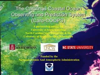
The Carolinas Coastal Ocean Observing and Prediction System (Caro-COOPS) A partnership among the University of South Carolina, North Carolina State University, & the University of North Carolina-Wilmington Funded by the National Oceanic And Atmospheric Administration
What is Caro-COOPS? A system of coordinated coastal observations for user-driven research: • An extensive array of instrumented moorings/stations • A comprehensive data management system • An advanced suite of integrated models
Primarymeasurements Instrumented moorings (10) Current velocity & direction, wave height/direction, temperature, salinity, pressure, chlorophyll • Water level/meteorological stations (5) • Supplement NOAA NWLON, NDBC, & C-MAN stations • * 3 cross-isobath “picket fences” • WLS, 10, 30, & 100+ m
Basic principles guiding the design of Caro-COOPS • Integrated architecture (spans the atmosphere, ocean, & land) • Flexible system for broad user base • Integration with other regional & national observing systems • Open access to long-term & real-time data • User-driven products
A comprehensive data management system… www.carocoops.org
Integrated models… Central Caro-COOPS Goal: To establish reliable forecasting tools for regional coastal ocean processes Initial Demonstration: Real-time forecasts and analyses of storm surge and flooding before & after coastal storms NOAA Photo Library
Hugo Storm Surge Model Simulation NCSU Coastal and Estuarine Modeling and Environmental Prediction System (CEMEPS) This screenshot shows flooding elevations overlaying orthographic images of the Charleston peninsula from the 4th to 8th hours after Hugo has struck land.
Partnerships: NOAA CSC USC NCSU UNC at Wilmington SCDNR National Water Level Observation Network National Data Buoy Center With developing partnerships involving: North Inlet-Winyah Bay NERR ACE Basin NERR Mote Marine Laboratory
Future Products • Improved forecasts of natural hazards • Alerts for anomalous conditions e.g. T/S extremes, hypoxia, HABs • New information relevant to fisheries e.g. essential fish habitat conditions, dispersal of eggs & larvae • New information on ocean/coastal conditions • Testbeds for new technologies related to port operations and homeland security
Contact info • www.caro-coops.org • Madilyn Fletcher, Director • fletcher@sc.edu • (803) 777-5288 • Braxton Davis • bdavis@caro-coops.org • (803) 777-5538 • Subscribe to our e-mail list for Caro-COOPS news and updates