Download
1 / 12
120 likes | 332 Vues
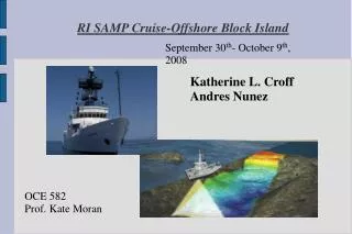
RI SAMP Cruise-Offshore Block Island. September 30 th - October 9 th , 2008. Katherine L. Croff Andres Nunez. OCE 582 Prof. Kate Moran. RI SAMP Cruise-Offshore Block Island. - SAMP = Special Area Management Plan -Run by the Rhode Island Coastal Resources Management Council

E N D
RI SAMP Cruise-Offshore Block Island September 30th- October 9th, 2008 Katherine L. Croff Andres Nunez OCE 582 Prof. Kate Moran
RI SAMP Cruise-Offshore Block Island - SAMP = Special Area Management Plan -Run by the Rhode Island Coastal Resources Management Council - One of its objectives: ensure the potential addition of alternative energy infrastructure (wind farms and wave energy) in RI's coastal waters
RI SAMP Cruise-Offshore Block Island - For this purpose, the R/V Endeavor was used to determine three potential areas for wind farm construction. - Along with these exploration activities, applied research in wind, waves, marine surge, seafloor geology, foundations and offshore structures is being done by URI research teams.
RI SAMP Cruise-Offshore Block Island The three potential areas considered for alternative energy facilities
RI SAMP Cruise-Offshore Block Island -The information aboard the ship was acquired by high resolution bathymetry, side scan sonar and sub-bottom data. - All the data was collected by using a towfish, which enclosed a Teledyne Benthos side scan, bathymetry sensor and sub-bottom profiler module.
RI SAMP Cruise-Offshore Block Island The towfish is being installed in the starboard side of the ship at the dock. A pole is used to attach the device to the ship
RI SAMP Cruise-Offshore Block Island Finally, the towfish is screwed to the ship's deck, where it will stay working until the end of the cruise
RI SAMP Cruise-Offshore Block Island - The process of seafloor scanning aboard the ship is called “mowing the lawn” because it entails going back and forth along parallel lines to collect data in a systematic way
RI SAMP Cruise-Offshore Block Island - The final result is plotted as bands of scanned seafloor on a daily coverage plot. The resulting images of the sea bottom will help design the foundations for the future wind turbines, according to the topography and sedimentary materials present in the area.
RI SAMP Cruise-Offshore Block Island - One extra duty was to be done: the deployment of two acoustic moorings. - Four Passive Aquatic Listeners (PAL's) were sunk in two specific points of the cruise attached to buoys so they could be retrieved later. - They will measure ambient underwater noise like rain or marine fauna.
RI SAMP Cruise-Offshore Block Island In the figure, one of the moorings is laid on the deck, ready to be deployed
RI SAMP Cruise-Offshore Block Island Hopefully, all the effort put into this campaign will give useful results for the Rhode Island Alternative Energy project.