Download
1 / 8
80 likes | 223 Vues
This seminar, presented by Dr. Alexis Livanos, President of Northrop Grumman Space Technology, explores the past 50 years of technological advancements in Earth observation. From the 1940s-2000s, the evolution from local to global observation is detailed, showcasing critical satellites like ERTS-1 and TIROS-1. Topics include climate change monitoring, hurricane forecasting, and the integration of data from various systems, highlighting the increasing role of space-based technologies in understanding global phenomena such as ozone depletion and volcanic activities.

E N D
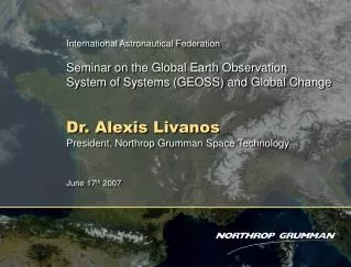
International Astronautical Federation Seminar on the Global Earth ObservationSystem of Systems (GEOSS) and Global Change Dr. Alexis Livanos President, Northrop Grumman Space Technology June 17th 2007
50 Years of Technological Advances Moved the Vantage Point from Local to Global Earth Observation Abovethe Horizon Line of Sight Surface 1940s 1950s 1960s 1970s 1980s 1990s 2000s
Early Satellite Climatology DMSP 1960s - 2000s 1st multi-spectral remote sensing satellite ERTS-1 1972 Early meteorological data TIROS-1, 1960s NOAA - POES 1980s-90s
State-of-the-Art Satellites Serve Many Global Missions France fromEOS Aqua MODIS OceanHealth Cloud make up Polar Ice Cap Erosion Hurricane Tracking/Forecasting Real TimeGlobal Weather OZONE Depletion
Nations Worldwide are Building Earth Observing Systems Space-Based Earth Observation Systems 58 Systems 42 Systems 12 Systems 11 Systems 10 Systems 5 Systems
Mt. Etna Eruption, Sicily 2001 Weather and Climate are Global Dry Saharan air caused mild 2006 hurricane season Merged Aqua / Metop data MODIS Aqua 03 Camera aboard ISS Summer 2001 Camera aboard ISS Summer 2001 GOME ERS-2 Summer 2001 ATRS ERS-2 Summer 2001 ATRS ERS-2 Summer 2001 NASA METOSAT Summer 2001 SIR-C Shuttle Radar 2001 Volcanoes effect vast regions Mt. Pinatubo POES 11 Summer 91 See the story at the following nasa web site http://rst.gsfc.nasa.gov/Sect13/Sect13_4d.html
Universal, Data Driven Methodology INPUTS High Altitude Space Low AltitudeSpace Airborne Surface Processing