Download
1 / 20
200 likes | 344 Vues
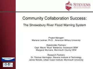
Community Collaboration Success: The Shrewsbury River Flood Warning System. Project Manager: Mariana Leckner, Ph.D. , American Military University Stakeholder Partners: Capt. Mauro “Buzz” Baldanza, Oceanport OEM Margaret Murnane , Monmouth County OEM Research Partners:

E N D
Community Collaboration Success: The Shrewsbury River Flood Warning System Project Manager: Mariana Leckner, Ph.D. , American Military University Stakeholder Partners: Capt. Mauro “Buzz” Baldanza, Oceanport OEM Margaret Murnane, Monmouth County OEM Research Partners: Dr. Thomas Herrington, Stevens Institute of Technology James Nickels, Urban Coast Institute, Monmouth University
Introduction • This presentation is the result of collaborative efforts between: • Monmouth County OEM • NJ Municipalities of: • Highlands • Little Silver • Long Branch • Middletown • Monmouth Beach • Oceanport • Rumson • Sea Bright • Urban Coast Institute of Monmouth University • Stevens Institute of Technology • IOOS and MACOORA
Background • Genesis of collaboration: • Oceanport’s NWS StormReady designation • Multi-jurisdictional impacts of flooding • Funding proposal troubles • Existing IOOS infrastructure in place • Strength in numbers! • Planning • Matching funds & services • Operations and maintenance • Regional mitigation • Partnership successful in obtaining FEMA • PDM funding
Issue Extensive Floodplain Nor’easters Inland Rainfall Hurricane Surge Extremely Vulnerable No existing historical or real time water level information.
Historical flood heights/categories March 2010 flooding *NAVD88
Purpose • Monitoring • Alert/warning • Creating a • database for future • benchmarking Shrewsbury River at Route 36 (Photo: M. Leckner)
Developed System • Installed in 2010 • Five gauges • Integrated into existing MARCOOS • system
System Operation • Receiver/Decoder • Monmouth University, Urban Coast Institute • Website • Stevens Institute of Technology, The Center for Maritime Systems • System Management • Monmouth County OEM • Operations • All stakeholders through operations board
Gauge Locations Installed gauge locations (not to scale)
Example of System Application Comparison of gauge readings Oct 4th – Oct 7th Coastal flooding
Extended Benefits of Collaboration • System provides data in previously unsampled region within MARCOOS • Data will aid in the development of improved and expanded nowcast/forecast model. • Reporting to NWS FO to develop improved flood impact tables
Extended Benefits of Collaboration • Research Initiatives • New Jersey Marine Science Consortium Vulnerability Project • Collaborative Proposal to NOAA Climate Program to develop Historic and future (sea level rise) visualizations for community planning and preparedness