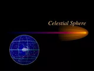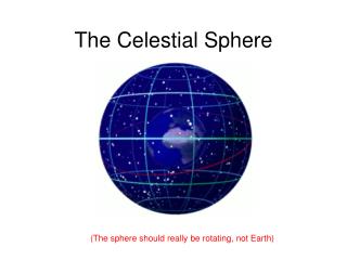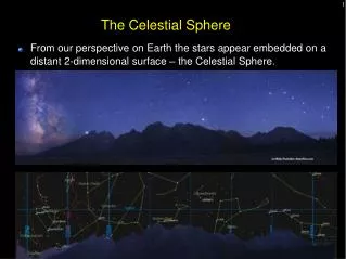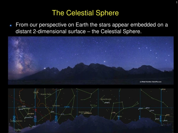
The Celestial Sphere
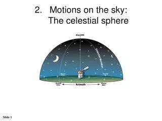
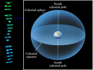
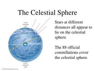
The Celestial Sphere. Lab 2. Celestial sphere. Geocentric model. zenith - the point on the celestial sphere that is directly over our heads always 90 ˚ from the horizon celestial meridian - the arc that goes through the North point on the horizon, Zenith, and South point on the horizon .

The Celestial Sphere
E N D
Presentation Transcript
The Celestial Sphere Lab 2
Geocentric model • zenith - the point on the celestial sphere that is directly over our heads always 90˚ from the horizon • celestial meridian - the arc that goes through the North point on the horizon, Zenith, and South point on the horizon
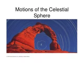
Geocentric model • All objects are slowly changing their positions on the celestial sphere • The only noticeable changes (for a human lifespan) are diurnal and intrinsic motion • Diurnal motion of celestial sphere – due to earth’s rotation, does not change relative positions • Intrinsic motion – the “wanderers”
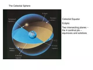
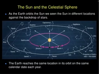
Ecliptic • Ecliptic – “road of the sun” • imaginary path that the Sun follows on the celestial sphere over the course of a year
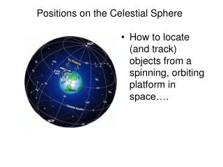
Celestial Coordinate System • To measure distances on the imaginary celestial sphere, we use angular separations instead of miles/km • There are 360˚ in a full circle and 90˚ in a right angle • Each degree is divided into 60 minutes of arc • Each minute of arc is divided into 60 seconds of arc
Celestial Coordinate System • Sun and Moon are both ~0.5˚=30 arc min in diameter • The pointer stars in the bowl of the Big Dipper are about 5˚ apart • The arc from the N point on the horizon, through the point directly overhead, to the S point on the horizon is 180˚, so any object directly overhead is 90˚ above the horizon • Similarly any object ½-way up in the sky is ~45˚ above the horizon
LA example details • Los Angeles latitude 34° N. • The NCP is therefore 34 degrees above the north horizon. • Because the Earth's equator is 90° away from the north pole, the celestial equator as seen in LA will arc up to 90 - 34 = 56˚ above the southern horizon at the point it crosses the meridian. • It still intercepts the horizon due east and west. • The stars rise in the E, move in arcs parallel to the celestial equator reaching maximum altitude when they cross your meridian, and set in the W part of the sky • The star paths make an angle of 90 - 34 = 56˚ with respect to the horizon.
animation • http://www.star.ucl.ac.uk/~idh/STROBEL/nakedeye/csph1t5.htm
Summary so far….. • Meridian always goes through due North, zenith, and due South points • Altitude of zenith always equals 90° • Altitude of celestial pole = observer's latitude. Observers in northern hemisphere see NCP; observers in southern hemisphere see SCP • Altitude of celestial equator on meridian = 90 - observer's latitude • Celestial equator always intercepts horizon at due East and due West points • Angle celestial equator (and any star path) makes with horizon = 90 - observer's latitude • Stars move parallel to the celestial equator
RA • Longitude lines run N-S • Analogous celestial reference are lines of right ascension • RA is measured in hours, minutes, and seconds, instead of degrees, and increases in an easterly direction on the sky • Zero RA is where the Sun crosses the celestial equator • The full 360 degrees circle is broken up into 24 hours, so one hour of RA = 15 degrees. • The lines of RA all converge at the celestial poles, so two stars one hour of RA apart will not necessarily be 15 degrees in angular separation on the sky (only if they are on the celestial equator will they be 15˚ apart)
Dec • Latitude lines run E-W parallel to the equator • When projected onto the sky, they become lines of declination • Like the latitude lines on Earth, declination (Dec) is measured in degrees away from the celestial equator, + for objects north of the celestial equator and - for objects south of the celestial equator • Objects on the celestial equator are at 0˚ Dec • objects ½-way to the NCP are +45˚ • objects at the NCP are +90˚ • objects at the SCP are -90˚ • Polaris's position is RA 2hr 31min, Dec +89˚ 15 arcmin
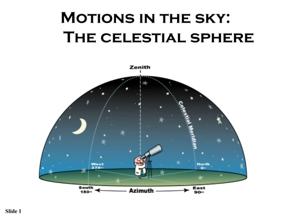
Altitude and Azimuth • Azimuth and altitude are usually used together to give the direction of an object in the topocentric coordinate system. • We use altitude and azimuth to describe the location of an object in the sky as viewed from a particular location at a particular time. • The altitude is the distance an object appears to be above the horizon. The angle is measured up from the closest point on the horizon. • The azimuth of an object is the angular distance along the horizon to the location of the object. By convention, azimuth is measured from north towards the east along the horizon
Altitude • Altitude is the angle up from the horizon. Zero degrees altitude means exactly on your local horizon, and 90 degrees is "straight up". Hence, "directly underfoot" is -90 degrees altitude.
Azimuth • Azimuth is the angle along the horizon, with zero degrees corresponding to North, and increasing in a clockwise fashion. Thus, 90 degrees is East, 180 degrees is South, and 270 degrees is West. Using these two angles, one can describe the apparent position of an object (such as the Sun at a given time).
Azimuth • We sometimes include the nearest compass direction as an abbreviation to help clarify the azimuth angles value in degrees. Up to three letters are used and they represent azimuth angles in the following order; • N (0°), NNE (22.5°), NE (45°), ENE (67.5°), E (90°), ESE (112.5°), SE (135°), SSE (157.5°), S (180°), SSW (202.5°), SW (225°), WSW (247.5°), W (270°), WNW (292.5°), NW (315°), NNW (337.5°)
Horizontal Coordinate System (Alt/Az coordinate system) • The horizontal coordinates are: • altitude (Alt), that is the angle between the object and the observer's local horizon. • azimuth (Az), that is the angle of the object around the horizon (measured from the North point, toward the East). • The horizontal coordinate system is fixed to the Earth, not the stars • Used for determining the rise and set times of an object in the sky. • When an object's altitude is 0°, it is rising (if its azimuth<180°) and setting (if its azimuth >180°)
Summary of Celestial Coordinates for Positional Astronomy • Altitude varies from 0 to 90°. Vertical position of object • Azimuth varies from 0° to 360°. Due N = 0°, due E = 90°, due S = 180°, due W = 270°. Horizontal position of object • Right ascension varies from 0 to 24 hours.Horizontal position of object. • Declination varies from -90° (at SCP) to +90° (at NCP). Celestial equator declination = 0° • Meridian altitude of any object = 90 - (observer's latitude) + declination degrees. If declination is negative, then addition of declination becomes a subtraction