Download
1 / 1
10 likes | 149 Vues
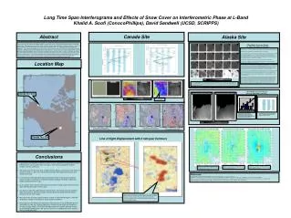
Long Time Span Interferograms and Effects of Snow Cover on Interferometric Phase at L-Band Khalid A. Soofi (ConocoPhillips), David Sandwell (UCSD, SCRIPPS). Canada Site. Abstract. Alaska Site.

E N D
Long Time Span Interferograms and Effects of Snow Cover on Interferometric Phase at L-BandKhalid A. Soofi (ConocoPhillips), David Sandwell (UCSD, SCRIPPS) Canada Site Abstract Alaska Site ALOS-PALSAR imagery has proven to be a valuable tool to generate correlated interferograms over long time spans (as long as two years). In contrast the C-Band systems, over the same area, can only generate interferograms few months apart at best. The target areas are at high latitude in Alberta, Canada and north slopes of Alaska, so there is a four to six months period in winter when the ground is frozen and covered with snow. The summer time produces rather lush vegetation. These seasonal changes make it impossible to use C-Band systems (ENVISAT, ERS and RadarSAT) to get adequate correlations to generate interferograms for long time spans. In general we found that C-Band systems can only generate usable interferograms when the time lapse between the images is less then 3 months. In contrast, we noticed that L-Band Interferometry has decent correlation for time span as long as three years, provided both acquisitions are in summer or winter period. The two year winter to winter interferograms has the best coherence but there are variations in the phase that may be related to snow thickness. The poster will show 22 examples of these long time span interferograms as well as discuss the phase delay noted in winter seasons possibly due to snow cover. C-Band Radar Coherence Resultsfor Short Time Spans (1-3 months) Changes in the snow pack have implications for the phase (and therefore the coherence) of the radar response. In snow-free environments interferometric phase (φ) is comprised of the following: φ = φ flat earth + φ topography + φ atmosphere + φ noise + φ deformation In the case of wet snow the φ deformation term relates to changes of the wet snow surface, rather than the underlying ground. The wet snow surface is easily affected by additional snowfall accumulation or drifting, and coherence is usually poor. In the case of dry snow (and based upon the assumption that in dry snow conditions backscatter stems primarily from the ground surface) the interferometric phase is comprised of the following: φ = φ flat earth + φ topography + φ atmosphere + φ noise + φ snow + φ deformation The φ snow term relates to the different refractive index of dry snow compared to air which introduces a phase delay to the received signal. Location Map The good coherence recorded between 21st November 2009 and May 8th 2010 (correlating to low temperatures) suggests that snow cover was largely dry and stable. The dry snow cover may well have ‘protected’ the underlying ground from disturbance (compared to non dry-snow covered months characterized by snow accumulation, wet conditions and vegetation change) leading to relatively high coherence associated with backscatter from the snow/ground interface. Poor coherence recorded post 8th May 2010 suggests that the snow cover is shifting into a period of melt during late Spring / early Summer. As the summer months continue, and the period of snow/ice melt comes to an end, it is possible that higher coherence could be yielded for short temporal separation SAR image pairs and deformation signals (free of snow artifacts) could be successfully sampled. In most cases the ‘HH to HH’ SAR images pairs contained greater coherent information than the corresponding ‘HV to HV’ SAR image pairs due to the different scattering mechanisms of the surface. The polarization signature of snow changes as the snow pack develops due to changes in snow profile. Co-polarization responses typically relate to direct surface scattering (e.g. the snow/ground interface) and double bounces. Cross-polarization response typically relate to volume scattering. The higher coherence of the co-polarized SAR image pairs suggests that scattering is from the ‘stable’ snow/ground interface under the dry snow cover. Low High Coherence Coherence Map Thumbnails (naming convention – master, slave, polarization). As seen, most of the C-Band pairs show poor coherence primarily due to temporal decorrelation caused by snow cover, variable snow cover pack and perhaps by wet versus dry snow. At C-Band, wet snow is an absorber and dry snow is transparent with typical penetration depth of dry snow being around 20 meters. L-Band Radar Coherence Resultsfor Long Time Spans (1-2 Years) Alaska Test Site Coherence Map Sep 18, 2007 & August 8, 2009 Coherence Map Sep 20, 2007 & August 8, 2009 Anomalous phase pattern, perhaps due to variable snow thickness/wetness Low High Coherence Scatter plot showing correlation between ALOS and GPS data. The GPS data in this case was limited to 1 cm accuracy, which probably accountsfor the scatter around 1 cm axis. Baseline Plots for the two ALOS Imagesused for long time span Coherence andSubsidence Measurements Low High Coherence Canada Test Site Line of Sight Displacement with 5 mm/year Contours Conclusions • In general ALOS-PALSAR imagery has proven to be a valuable tool to generate correlated interferograms over long time spans (as long as three years) compared to C-Band systems, over the same area. • The target areas for this study were at high latitude in Alberta, Canada and north slopes of Alaska, so there is a four to six month period in winter when the ground is frozen and covered with snow. • In all cases we found that interferograms generated during similar ground conditions (frozen to frozen or unfrozen to unfrozen) provided adequate coherence to generate reliable subsidence/heave maps. • To our surprise frozen ground interferograms provided very high quality coherence maps even after long time spans of three years. • Our efforts to generate interferograms between frozen and unfrozen ground conditions were not successful. Moreover images collected during the springtime thaw did not correlate with any other images. • We noted some anomalous phase patterns in winter to winter interferograms, which we attributed to variable snow thickness and/or wetness conditions. • We compared some GPS based deformation measurements to ALOS PALSAR derived deformation and we see a general agreement, however the GPS data was limited to 1 cm/year accuracy which is worse then the higher precision numbers obtained from the ALOS PALSAR interferograms. We are in the process of validating the results obtained from ALOS PALSAR data. Location DS1F – Subsidence calculated from ALOSInSAR processing is 2.5 cm/year. GPS measured valuefor this location was 1.5 cm/year Location DS2A – Subsidence calculated from ALOSInSAR processing is 2.5 cm/year. GPS measured valuefor this location was 3.5 cm/year Location DS1A – Subsidence calculated from ALOSInSAR processing is 3 cm/year. GPS measured valuefor this location was 1.1 cm/year References [1] Interferograms computed with GMTSAR which is freely available at http://topex.ucsd.edu/gmtsar [2] Zebker H A, and Villasenor J. Decorrelation in Interferometric Radar Echoes. IEEE Transactionsm on Geoscience and Remote Sensing, 1992, 30(5): 950-959. [3] Wei, M., and D. T. Sandwell, Decorrelation of L-band and C-band interferometry over vegetated areas in California. IEEE Trans. Geosci. Remote Sensing, in press, March 2010. [4] Masanobu Shimada, “The Overview of ALOS,” J. Remote Sens. Soc. Japan, vol.27, no.4, pp. 394-396, 2007 (in Japanese) Stack of 13 interferograms using ALOS PALSAR imagery acquired between 2007 and 2010. Red areas indicate uplifted areas with 5 mm/year contours overlaid. The green triangles indicate the location of 20 Corner Reflectors installed and monitored using C-Band RadarSAT imagery.


