Interactive Environmental Information for the Black Sea Basin: An Overview of the Map Service
This project, led by the Ministry of Environmental Protection of Ukraine and implemented by the Ukrainian Scientific Centre of Ecology of the Sea, develops an interactive web-based environmental information system for the Black Sea Basin. Utilizing ESRI technology, it integrates critical ecological data such as hydrophysics, pollution, and hydrobiology, and offers online access to nautical and topographical charts. The Marine Accidental Oil Spills Information System (MAOSIS) is a key feature, providing essential data for conservation and management within Marine Protected Areas. Visit www.sea.gov.ua for more details.

Interactive Environmental Information for the Black Sea Basin: An Overview of the Map Service
E N D
Presentation Transcript
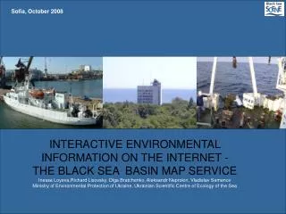
Sofia, October 2008 INTERACTIVE ENVIRONMENTAL INFORMATION ON THE INTERNET - THE BLACK SEA BASIN MAP SERVICEInessa Loyeva,Richard Lisovsky, Olga Bratchenko, Aleksandr Neprokin, Vladislav Semenov Ministry of Environmental Protection of Ukraine, Ukrainian Scientific Centre of Ecology of the Sea
Data processing resources UkrSCES at the moment (financial support EU PlanCoast) Router Powerful Firewall Web server Switch UkrSCES LAN Windows 2003 Server Windows 2003 Server Mirror 11 modern workstations
Hydrophysics Radioactivity Hydrochemistry Hydrobiology Geology Pollution Ecological information
Certified Marine Nautical Charts ESRI ARCinfo workstation ESRI SDE server Certified Thopographical Charts SQL requests Mapping system
S-57 charts of Ukrainian coast Donets’ka Oblast Zaporiz’ka Oblast Odesa Oblast Mykolaiv Oblast Kherson Oblast Crimean Republic S-57 is the electronic data transfer standard prepared by the International Hydrographic Organization (IHO) committee.
A set of available information became a fundamental set for creating information systems on the basis of ArcGIS and ArcIMS. At the present time an interactive map services - ecological ATLAS and Marine Accidental Oil Spills Information System (MAOSIS) test version is located on www.sea.gov.ua Internet Map Services
WWW server IMS server Data Base (SQL + SDE) Interactive Service
Application Layer Web-applications Desktop applications Data collectionand edition Maps development Special applications “Easy” clients Web browsers Services Layer Information services Database services Services Data Layer Database control system Spatial database Special database Metadata GIS general model
Server side Client side Web Server Application Connectors ArcIMS Web browser Development ArcInfo ArcView ArcCatalog ArcSDE Database Connectors DB UkrSCES GIS realisation
ArcXMLrequest Application Server ESRIMAP ArcXMLresponce Servlet Connector Featureserver Geocodeserver Queryserver Imageserver Data Request processing
Layer’s metadata (ISO 19115) Layer’s description Resource hyperlink Layers information
Object identification Query Server aimsIdentify.js Request Processing Display Data
Conservation Management System (CMS) Within the MPA Project for UkrSCES a CMS v. 7. EU standard software was purchased produced by exeGesIS - a well respected environmental and IT consultancy that has developed and manages many of the UK's leading countryside management software applications. The main task of the work using this software is Preparation of the draft management plan, as well as the draft Presidential decree, for Karkanitsky Bay. CMS will help in upgrading of the UkrSCES GIS system to make it compatible with EU protocols for marine habitat mapping and online interrogation of data sets via the existing IMS facility which is already well advanced and very useful for this and future projects and make it possible to share and use these possibilities for other institutions and organizations within the Project period time duration and after the end of the Project. At the present moment our specialists are working on Ukrainian and Russian localization of CMS.
Thank You for attention And Welcome to www.sea.gov.ua