Download
1 / 2
20 likes | 226 Vues
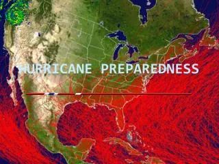
US Fish and Wildlife Service Hurricane Preparedness. Your agency’s data products that would be useful for hurricane preparedness and response * Federal facilities and personnel duty stations Links to Regional and Washington office phone numbers: http://www.fws.gov/offices/phone.html

E N D
US Fish and Wildlife Service Hurricane Preparedness Your agency’s data products that would be useful for hurricane preparedness and response* Federal facilities and personnel duty stations Links to Regional and Washington office phone numbers: http://www.fws.gov/offices/phone.html Web sites FWS National Data Sets, http://www.fws.gov/data/FWSNatlData.htm, Links to: • CMT Data - http://www.fws.gov/data/cmtgis.htm - contains location information on all the offices within the Service that have an organization code. Unstaffed offices and some other facilities may not be included. • IMADS - http://www.fws.gov/data/IMADS/index.htm - Data includes FWS Offices, National Wildlife Refuge Boundaries, State Data Links, Gulf of Maine Coastal Program • National Wetlands Inventory - http://www.fws.gov/nwi/ - The National Wetlands Inventory (NWI) of the U.S. Fish & Wildlife Service produces information on the characteristics, extent, and status of the Nation’s wetlands and deepwater habitats. • Migratory Bird Conservation Data Center - http://www.fws.gov/birddata/databases/db_selection.html The Bird Conservation Node provides access to bird population and habitat information relevent to population management, conservation planning, and evaluation. In order to make important agency databases available through the Bird Conservation Node, the FWS and USGS formed this Migratory Bird Data Center. Databases available include North American Breeding Bird Survey, Mid-Winter Waterfowl Survey, and Waterfowl Breeding Population and Habitat Survey • FWS Interactive Mapping Sites - http://www.fws.gov/data/fws_ims.htm Links to Interactive Mapping sites throughout FWS including Critical Habitat Portal for Endangered Species data, Wetlands Mapper (NWI Data), Environmental Conservation On-Line System (ECOS), Bird Conservation Node (under Migratory Bird Conservation Center), Great Lakes lake sturgeon tributary database and Geographic Information System (GIS), Pacific Region Interactive Mapping Site, and Alaska Region Interactive Mapping Site - North Pacific Seabird Colony Database • FWS National Wildlife Refuge Data - http://www.fws.gov/data/NWRdata.htm Links to Regional Approved Acquisition Boundary Data - by FWS Region and by individual refuge when available, Land Ownership Status Boundary Data - where available, Wilderness Area Boundaries, Vegetation Data - limited sites, and Public Roads. • Other FWS Geospatial Data - http://www.fws.gov/data/fwsregdata.htm - Links to Regional sites including Prairie Pothole ( North Dakota, South Dakota, and Montana) - Land Cover and Wetland Basin information, Louisiana Lands Protected through Federal Sponsorship, Region 5 Data Library, and Region 6 Data Library. • Services
Recent Activities/Agency Efforts • Activity related to hurricane preparedness: • Activity or outcome: Southeast Region did an internal review of their Hurricane response for FY 2005 and 2006: what worked, what did not, how to improve. This is the Region hit the hardest with close to $250 million in damages in 2005 hurricane season. • Issue: How to be better prepared to respond rapidly, protect lives and property • Needs or Gaps: Better communication was probably the biggest issue: radios and phones that work together, emergency frequencies and temporary transmission towers. Availability of trained people (GIS, GPS, Emergency response) and the funding to pay them is also a need; GPS was used to navigate when road signs were lacking. Ability to tie into existing data via GPS or other portable devices is crucial and the use of wireless communications and devices needs to be facilitated. IT security issues have not been a huge problem but have the potential to become one as more data security issues arise. • *training, data, data distribution mechanisms etc.