Download
1 / 17
311 likes | 4.03k Vues
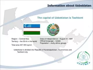
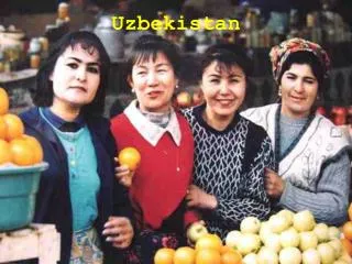
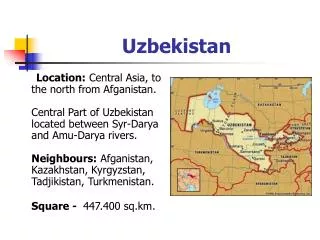
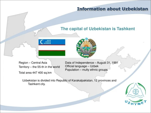
Information about Uzbekistan. The capital of Uzbekistan is Tashkent. Region – Central Asia Territory – the 55-th in the world Total area 447 400 sq . km. Data of Independe nce – August 31, 1991 Official language – Uzbek Population – m ult y ethnic groups.

E N D
Information about Uzbekistan The capital of Uzbekistan is Tashkent Region – Central Asia Territory – the 55-th in the world Total area 447 400 sq.km Data of Independence – August 31, 1991 Official language – Uzbek Population– multy ethnic groups Uzbekistan is divided into Republic of Karakalpakistan, 12 provinces and Tashkent city.
The Centre of Hydrometeorological Service at Cabinet of Ministers of the Republic of Uzbekistan (Uzhydromet) is the state governing body specially authorized for the solution of tasks in the field of hydrometeorology in the Republic of Uzbekistan. Information aboutUzhydromet The objectives of Uzhydromet are the development and improvement of the state system of hydrometeorological observations, hydrometeorological provision of the sectors of economy, scientific research activities, improvement of short-term and long-term weather forecasts, water availability of rivers, climate change.
StructureofUzhydromet The network united under Uzhydromet includes more than 400 stations of environment observation. Meteorological, hydrological and agrometeorological observations are carried out on the territory of republic since 1921. The ecological observations of the conditions of water bodies, air and soil are carried out since 1972. The Meteorological network of Uzhydromet consists of 79 stations. The observations are conducted by programme M-1 (1st grade weather station) at one of them. On 78 weather stations the operations are conducted by programme M-II (2nd grade weather station). All of 79 stations are operating in traditional mode. The automatic weather station is operated only at Chimgan snow avalanche station.19 stations of 79 are stations of international exchange, 8 of them are stations of exchange of hydrometeorological information with CIS countries.
The Uzhydromet and WMO The Uzhydromet actively participates in international activities of the Republic. In 1993 Uzbekistan acceded to Convention of the World Meteorological Organization and actively participates in implementation of all WMO Programmes. Uzhydromet is the component of one of UN links – World Meteorological Organization (WМО), the main aim of which is weather and climate observation, cooperation for collection and exchange of data of meteorological, hydrological and other observations of environment conditions. Uzhydromet annually gets free costly information (upper-air data, various weather maps, actual weather data and short-term forecast over foreign airports, synoptic information, satellite data) from the world's leading meteorological centers, from satellites, which is necessary for the hydrometeorological provision of the country economy.
The Uzhydromet and WMO Recently with the assistance of WMO and international organizations, the instrument pool of the hydrometeorological service is partially modernized. With the assistance of the government the upgrading of remote sensing equipment was carried out for Doppler weather radars with special software, which is a structure of technical, information means and technologies.
VHDD-350C Doppler weather radar of "Baron" firm Weather Radars
VHDD-350C Doppler weather radar of "Baron" firm Weather Radars VHDD-350C meteorological radars installed in the cities of Tashkent and Nukus are designed for detection of the severe weather phenomena associated with cloudiness (hail, storm, heavy shower, squall, long and intensive continuous precipitation, turbulence) in a radius of 240 km and operating at frequency from 5.4 to 5.9 GHz, for meteorological provision of aircraft operations and solving of task of informing the relevant authorities, agencies, as well as population of the Republic of Uzbekistan about severe weather events.
Meteor-500 Doppler weather radar of "Selex" company Weather Radars Meteorological radar Meteor-500 installed in Samarkand is similar to "Baron" system an в is also designed for detection of severe weather phenomena associated with cloudiness (hail, storm, heavy shower, squall, long and intensive continuous precipitation, turbulence) in a radius up to 250 km and operating at frequency of 5.4 to 5.6GHz, as well as for meteorological provision of aircraft operations and solution of task of informing the relevant authorities, agencies, as well as the population of the Republic of Uzbekistan about severe weather events.
Weather Radars Installation and operation of weather radars can provide for: 1 Receiving and display of space patterns of cloud and precipitation fields at the maps of the regions 2 Producing of maps of hazardous weather phenomena (squall, thunder storm, hail, heavy rainfall) over a map of the region. 3 Tracking of the evolution of cloud structures and determination of the direction and speed of movement of clouds of the cloud systems and hazardous weather phenomena 4 Calculations and display of maps, intensity and amount of precipitation in the region 5 Calculations and display of maps, intensity and amount of precipitation in the region
Weather Radars Thus the usage of automated systems and radars allows the objective assessment of the state of the atmospheric phenomena and provision of the weather forecasts. In the nearest future the further modernization of meteorological stations in the WMO synoptic system is being planned.
KRAMS-4Aeronautical Meteorological Station of civil aviation of "VAISALA" firm Meteorological Airport Station The equipment of aeronautical meteorological stations of civil aviation is completely updated with the equipment such as KRAMS-4 of "VAISALA" firm designed for measuring and collection of information about the basic parameters of the atmosphere at the airport, processing this information, formation of meteorological messages, display of this information, recording and dissemination of information through the communication channels for providing the safety of takeoff and landing for aircrafts. UZHYMET
AMIIS - 2000 Airport meteorological System Meteorological Airport Station Airport meteorological information-and-measurement AMIIS-2000 system is designed for collection and processing of meteorological information on the basic parameters of the atmosphere in the airport area, the formation of meteorological messages, displaying, recording and distributing of metadata through communication channels to ensure the take-off and landing of aircrafts.
System of receiving and processing of satellite meteorological data of CMACast China Meteorological Agency Satellite technologies
Satellite technologies Tasks: Keeping 24-hour processing and receiving of satellite and meteorological data 1 Analysis and forecasting of synoptic processes and associated weather conditions in Central Asia 2 Forecasting of movement and development of cloud formations 3 Development and implementation of new methods for subject processing, keeping the archive 4
Satellite data receiving system of MODIS (Terra and Aqua) Satellite technologies The satellite system allows using the data received from Terra and Aqua satellites in different areas of economical activity: • Operational assessment of the ice cover and snow cover. • Early detection and monitoring of the development of the forest and grassland fires, dust storms. A wide range of combination of parameters of the offered data types (spatial resolution, swath, spectral domain), frequent repetition of shooting (1-2 times a day). Besides, the received information allows to organize monitoring of farm lands, both in terms of compliance with the rules of crop rotation and from the point of view of the target land use, to conduct an operational assessment of the condition and the extent of degradation of agricultural and grazing lands.
Tasks of that system are: Satellite technologies 1 2 3 4
Conclusion The significant growth of computer technology, various telecommunications means can meet the challenges of consolidation and the integrated usage of various instruments, radar equipment for solution of the issues of tracking, short-term forecasting and modification of weather phenomena at the new level. The enhancing the functionality of existing technology allows to: