160 likes | 591 Vues
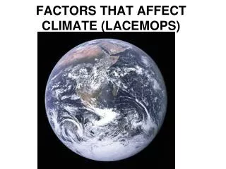
FACTORS THAT AFFECT CLIMATE (LACEMOPS). http://upload.wikimedia.org/wikipedia/commons/thumb/9/97/The_Earth_seen_from_Apollo_17.jpg/300px-The_Earth_seen_from_Apollo_17.jpg. Weather - The daily condition of the atmosphere which includes temperature and precipitation.
E N D
FACTORS THAT AFFECT CLIMATE (LACEMOPS) http://upload.wikimedia.org/wikipedia/commons/thumb/9/97/The_Earth_seen_from_Apollo_17.jpg/300px-The_Earth_seen_from_Apollo_17.jpg
Weather - The daily condition of the atmosphere which includes temperature and precipitation. Precipitation - Moisture that falls from the sky. Precipitation has 4 forms: rain, snow, sleet, and hail. Climate - Average weather. Measured over an extended period of time (usually 30 years). http://www.mnh.si.edu/archives/garden/images/4seasons.gif
L - LATITUDE The most important factor! The farther from the Equator - the colder and drier it becomes. Direct rays of the sun are always between the Tropics. Areas not in the tropics receive indirect sun rays. High Mid Low High
Polar Night • When the polar region is tilted away from the sun – the polar area receives 24 hours ofdarkness.
A - AIR MASSES In the Northern Hemisphere, cold air from the Polar Regions comes from the north. Hot air from the tropics comes from the south, (opposite in the Southern Hemisphere). Mountains to the north of a city (in the Northern Hemisphere) could block the cold air from reaching the city.
C - CONTINENTALITY Water moderates climate. Water takes longer to heat and cool than land. Areas inland from the coast will be hotter in the summer and colder in the winter than areas with the same latitude on the coast. http://images.google.com/imgres?imgurl=http://edc.usgs.gov/imagegallery/imageSrc/United%2520States-NED500.jpg&imgrefurl=http://edc.usgs.gov/imagegallery/imageDetail.php%3Fpage%3D18%26img%3DUnited%2BStates-NED%26id%3D2071%26col%3DStates%2B-%2BNED%2BShaded%2BRelief&h=353&w=500&sz=121&hl=en&start=17&um=1&tbnid=tsJBVC5mQRiZ6M:&tbnh=92&tbnw=130&prev=/images%3Fq%3Dunited%2Bstates%2B%26svnum%3D10%26um%3D1%26hl%3Den%26safe%3Dactive%26rls%3Dcom.microsoft:en-us:IE-SearchBox%26rlz%3D1I7GGLG%26sa%3DG
E - ELEVATION It gets colder as you go up a mountain. The formula for vertical climate is: Temperature decreases 3.5º F for every 1,000 feet increase in elevation (the opposite is also true). You can work out the temperature at the top of a tall mountain. http://images.google.com/imgres?imgurl=http://www.savetibet.org/images/images/MountEverest.jpg&imgrefurl=http://www.savetibet.org/news/newsitem.php%3Fid%3D1050&h=300&w=400&sz=22&hl=en&start=6&um=1&tbnid=ODjU-A29uyNbXM:&tbnh=93&tbnw=124&prev=/images%3Fq%3Dmt%2Beverest%26svnum%3D10%26um%3D1%26hl%3Den%26safe%3Dactive%26rls%3DGGLG,GGLG:2005-42,GGLG:en http://www.commondreams.org/headlines05/images/0314-01.jpg
It is 75º at the base of a 15,000 ft. tall mountain. What is the temperature on top of the mountain? First, count the thousands… (15,000) Second, multiply that number by 3.5… 3.5° (from formula) X 15 (how many thousands of feet the mountain is tall) 52.5° (how much colder at the top than the bottom) Third, Subtract that number from the temperature at the base to get the answer… 75° (temperature at bottom) - 52.5° (how much colder at the top) 22.5 ° (temperature at the top) Answer
M - MOUNTAIN BARRIERS Orographic effect: Wind containing moisture hits the windward side of a mountain (the side facing the wind). The moisture full clouds are too heavy to make it over the mountain so precipitation occurs, after the precipitation, the clouds have no moisture and are able to rise over the mountain. The side facing away from the wind is called the leewardside. The leeward side of a mountain is arid. The windward side has lush vegetation. The leeward side of a mountain is in the rain shadow and is usually a desert.
O - OCEAN CURRENTS • Cold currents bring dry, cool air to the coastal areas. • Warm currents bring warm, wet air to coastal areas. http://go.owu.edu/~jbkrygie/krygier_html/geog_111/geog_111_lo/geog_111_lo05_gr/3-16.jpg
A periodic reversal of the pattern of ocean currents and water temperatures in the mid-pacific regions. • Think about it - your farm is used to moist, warm air, and now it is getting cold, dry air….. El Nino & La Nina
P - PRESSURE AND PREVAILING WINDS: Pressure- High pressure is heavy, cold air. Low pressure is warm, light air. Heat rises. There are some fairly constant air pressure systems. Notice that these lines are located at 0, 30, 60, 90 (not 0, 23 ½, 66 ½, and 90)
Prevailing Winds- The Equator is surrounded by an area of calm called the Doldrums (ITCZ). The Trade Winds (Tropical Easterlies) blow from east to west (generally warm and moist). They run from about 30º N/S toward the Equator. Between 30º N/S and 60º N/S are the Westerlies (Prevailing Westerlies). They blow from west to east. Because the Westerlies and Trade Winds are traveling away from each other there is an area of calm between them called the Horse Latitudes. The PolarEasterlies blow from 90º in an eastward direction toward the Westerlies. There are serious thunderstorms around the 60º latitude line where the two wind patterns collide Notice that these lines are located at 0, 30, 60, 90 (not 0, 23 ½, 66 ½, and 90) http://www.worldstats.org/general_world/maps/prevailing_winds_big.gif
http://www.hurricane.com/hurricanes/hurricane-katrina/hurricane-katrina_files/image020.gifhttp://www.hurricane.com/hurricanes/hurricane-katrina/hurricane-katrina_files/image020.gif S - STORMS Where the Polar Easterlies meet the Westerlies there are thunderstorms. When hot air masses and cold air masses collide - there are storms. Cyclonic storms (hurricanes, typhoons, etc.) in the Northern Hemisphere spin counter-clockwise. In the Southern Hemisphere cyclones spin clockwise.
Climograph- Indicates average temperature and precipitation for an area. Line graph = Temperature Bar Graph = Precipitation http://www.uwsp.edu/geo/faculty/ritter/glossary/A_D/climograph.html