Download
1 / 37
380 likes | 500 Vues
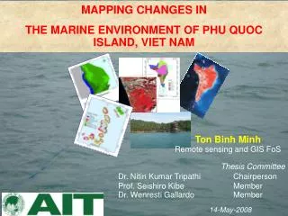
MAPPING CHANGES IN THE MARINE ENVIRONMENT OF PHU QUOC ISLAND, VIET NAM. Ton Binh Minh Remote sensing and GIS FoS. Thesis Committee Dr. Nitin Kumar Tripathi Chairperson Prof. Seishiro Kibe Member Dr. Wenresti Gallardo Member. 14-May-2008. Phu Quoc Island. Area 593 km 2 ,

E N D
MAPPING CHANGES IN THE MARINE ENVIRONMENT OF PHU QUOC ISLAND, VIET NAM Ton Binh Minh Remote sensing and GIS FoS Thesis Committee Dr. Nitin Kumar Tripathi Chairperson Prof. Seishiro Kibe Member Dr. Wenresti Gallardo Member 14-May-2008
Phu Quoc Island • Area 593 km2, • 26 small islands • Phu Quoc Island; An Thoi • Tho Chau archipelagoes • Coastal Hydrologic condition for ecotourism
Natural Resources Phu Quoc Island not only has potential for marine resources but also for ecotourism and relax
- Marine resource are: Over exhausted and none plan exploited Fish, turtles, dugong, dolphins are on the verge of extinction. - Unsustainable fishing techniques (small mesh fishnets, cyanide, dynamite, flying raking, and Increasing number of fishermen, fishing vessels with close shore fishery activities). - Detailed maps of marine habitats, changing rule of environment for monitoring marine environment management, conservation coastal ecosystems and sustainable development - Remote sensing and GIS are power tools for mapping and management of resources - Surface - Under Water
Objective - To apply remote sensing and GIS to monitor and evaluate coastal resources in Phu Quoc Island. - To detect the changes in sea grass beds, coral reefs during 2000-2004 and 1992-2007. Detail objectives - To map benthic communities: sea grass, coral (live and dead), sand, rubble around Phu Quoc Island, • To provide data for environmental and management of seagrass beds and coral reefs,
Study area- An Thoi- Bai Bon Bai Bon Aster 2004 Data base - Ancillary data, - Remote sensing data, - Field data. An Thoi Landsat 2007 - Ancillary data: + Administration, transportation + Bathymetric depth + Sediment maps + Previous reports.
Data base- Field data Data Surveillance and Collection tools • GPS, • Tape measurement (30m), • Digital camera, • Data form, • Secchi disk, • Diving equipment • Boat
20M 1m 1m 20M Field work techniques Quadrats Linear transect + = Integration linear transect and quadrat for collecting data in seagrass area
Analyzing Image Landsat 2007 Aster 2004 Mean DN value of coral, seagrass, sand in band 1, 2, 3 Mean DN value of coral, seagrass, sand in four bands
Digital image processing 1. Image Registration - Image-to-image registration - Aster image in 2000. - WGS 84, UTM 48 N. 2. Image masking - Segregating land and sea area - Near-infrared band (0.78-0.98μm) was used for masking
Water column corrected image Bai Bon area An Thoi area Landsat 2007 Aster 2004,
Image Enhance FCC, PCA, Band ratio
Color composite - Optimum Index factor Landsat 2007 Low OIF as true color composite (321) Landsat 2007 High OIF, as FCC (4,3,1)
Optimum Index Factor Landsat 2007 low OIF as true color composite (3,2,1) Landsat 2007 High OIF as FCC (4,3,1)
Image Classification - Maximum Likelihood classifier, field data , WCC image - Class hierarchies and definition Accuracy Assessment - Site specific error matrix and Kappa analysis
Map accuracy Map 2007: Overall accuracy = 70% KHAT = 64%, Map 2004 Overall accuracy = 77% KHAT = 74%
- Non site specific error matrix, - Map overlay Change detection
Non Site Post Classification Comparison Change detection analysis The overall accuracy = 42 % map 2007 agree 42%, with map 1992 Khat value = 29% category of map 2007 is same with map 1992 29%
Degeneration of live coral, seagrass in period 2000-2004, An Thoi. Decrease quality of live coral, seagrass in period 2000-2004 in An Thoi
Degeneration of live coral, seagrass in period 1992-2007, An Thoi Decrease quality of live coral, seagrass in period 1992-2007 in An Thoi
Regeneration of coral, seagrass in 2000-2004, An Thoi. 56.20
Benthic Habitats Mapping Using Medium and High Resolution Image Comparing a part of Duong Dong town by using Landsat 25m, Aster 15m and Quick Bird 2.4m imageries
Extending Quick Bird Imagery to Detect Bottom Type Data fusion technique for Quick bird imagery • The Gram Schmidt Spectral Sharpening • Sharpen multispectral data of QB at 2.4 m to panchromatic band at 0.6 m resolution. - Gram-Schmidt techniques: + Not limited to the number of bands that can be processed at one time. + Preserved the spectral characteristics of lower spatial resolution multispectral data in the higher spatial resolution
Extending Quick Bird Imagery to Detect Bottom Type Data fusion technique for Quick bird imagery Fused image with 0.6m resolution. Using Gram-Schmidt Spectral Sharpening band combination band 3,2,1. Fused image with 0.6m resolution. Using Gram-Schmidt Spectral Sharpening, band combination 4,3,2.
Quick bird data potential for detail mapping benthic community Comparing fusion image (2,4,3) with Aster(1,2,3) fusion image and original image
Applying enhance technique to Quick bird data True colour combine, square root enhance, various information Band ratio: composite of 3/1, 3/2, 2/1 (RGB) • . Several light yellow areas and light green appeared in reefs and terrestrial rock. Possible these have developed of marine algae or seagrass. Aster imagery because it lacks blue band.
Conclusion • Remote sensing and GIS are powerful tools for conservation and management marine resource. • as they provide data of difficult location and powerful analysis tools. • The coral reefs and seagrass beds map in 2007 and 2004 has been created using bands 1, 2 and 3 of Landsat and bands 1, and 2 of Aster. 3. RS techniques and image processing were used to enhance image reflectance and spectral characteristics. 4. Water column correction was employed to remove suspended matter effect. 5. Maximum likelihood classification yielded high overall accuracy =70% (Landsat 2007) and = 77 % (Aster 2004)
Conclusion 6. Live coral and seagrass changes were detected which can be very useful for managing marine resources 7. The comparison of the change area between 1992-2007 and 2000-2004 was not significant. 8. Degeneration and regeneration were successfully processed. Seagrass and coral reefs in study area are degenerating. Possible, sea environment of PQ is changing to worse status. 9. Quick Bird imagery with high resolution is better for mapping benthic communities in detail; • it is optical imagery thus, one scene covers small area, • cloud effect, • Image is more expensive than moderate resolution satellite image.
Thank you for your kind attention! I also thank to my Advisor, Examination committees members, Wetland Alliance Program!