Download
1 / 25
250 likes | 394 Vues
Geodic survey is used at pre-construction, during construction, and post-construction stages. Several geotechnical instruments are used to monitor the fundamental parameters affecting the construction. Letu2019s discuss more on geodetic surveying, its importance, and application areas.

E N D
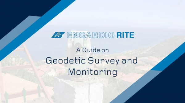
A Guide on Geodetic Survey and Monitoring
1 4 WHAT IS THE OBJECTIVE OF GEODETIC SURVEYING? INTRODUCTION TABLE OF CONTENT 2 5 GEODETIC SURVEYING APPLICATION WHAT IS THE GEODETIC SURVEY? 3 6 WHAT IS THE GEODETIC LEVEL? GEODETIC SURVEY SOLUTIONS
1 INTRODUCTION If used judiciously with geotechnical instrumentation, geodetic monitoring provides co-related data which is relevant and extensively used in civil construction and struc- tural monitoring. Encardio Group uses an in-house developed control box with ad- vanced software to control robotic total stations.
1 INTRODUCTION The system ensures valuable and timely monitoring of the displacements, providing high measurement density, simultaneous wireless transmission and automatic entry of the results in the monitoring database. Geodic survey is used at pre-construction, during construction, and post-construction stages. Several geotechnical instruments are used to monitor the fundamental parameters affecting the construction. Due to its relatively low-cost, it is widely spread and used in all civil engineering projects.
2 WHAT IS THE GEODETIC SURVEY? When there’s a large area, usually beyond 100 square kilometres, the surveying requires the consideration of curvature of the earth. Such type of surveying is known as the geodetic survey. In geodetic surveying, two stations (points) at a considerable distance from each other are chosen. The latitude and longitude of these two points are determined astronomically. The line joining these two points is known as the baseline, which is measured precisely. The position of a third station is defined by the angle made with each end of the baseline. The complete process is known as triangulation. It is continued until the entire survey land is mapped.
3 WHY IS GEOTECHNICAL MONITORING IMPORTANT? WHAT IS THE GEODETIC LEVEL? Geodetic levelling is the process of determining the relative height of the stations or points on the earth’s surface. • Level surface It is defined as the surface, which is parallel to the earth’s mean spheroidal surface. • Level Line It is the line lying in the level surface and, hence, it is normal to the plumb line at all points. • Horizontal Line It is a straight line tangential to the level line. • Vertical Line It is the line normal to the level surface.
4 WHAT IS THE OBJECTIVE OF GEODETIC SURVEYING? Following are the objectives of geodetic surveying: • • • • To define selected locations by establishing a system of reference points • To guide construction forces by setting stakes or otherwise marking lines, grades, and principle points and by giving technical assistance. • To measure construction items in place to prepare progress reports • To carry out dimensioning of structures for preparation of as-built plans • To detect settlement using pre-installed targets on buildings, structures, pavements, embankments etc. The main objective of geodetic surveying is to determine the precise position of distant points on the surface of the earth. To get reconnaissance information and preliminary data required by engineers for selecting suitable routes and sites. To prepare efficient structural designs.
4 WHAT IS THE OBJECTIVE OF GEODETIC SURVEYING? • • • To monitor the on-going construction project 24/7 so that the mishaps can be avoided. To monitor deformations taking place in the structures, bridges, tunnels, buildings. To ensure the safety of the nearby assets to the construction land.
5 WHY IS GEOTECHNICAL MONITORING IMPORTANT? GEODETIC SURVEYING APPLICATION Geodetic monitoring, along with geotechnical instrumentation provides data widely used for structural monitoring. Settlement detection Levelling measurement of preinstalled targets on buildings, structures, pavements, deep points, embankments using high accuracy digital levels and invar staffs. 3D optical targets Three-dimensional displacement measurements with bi-reflex targets or monitoring prisms that are installed in tunnels, structures and buildings etc., using high-end total stations provide for manual as well as automatic data. An in-house software by Encardio-rite named Terramon is available that can be installed on a tablet, laptop or a PC to achieve semi-automatic measurement, to maximize their accuracy, and to minimize the field time.
5 WHY IS GEOTECHNICAL MONITORING IMPORTANT? GEODETIC SURVEYING APPLICATION For automatic monitoring, Drishti or Terramove is available depending on the requirement from project to project. Terramove can also be used for co-relating data from TBM sensors with data available from geotechnical and geodetic instrumentation, whether manual or automatic.
5 WHY IS GEOTECHNICAL MONITORING IMPORTANT? GEODETIC SURVEYING APPLICATION Automatic monitoring system Projects safety requires 24/7, high frequency, & accurate measuring monitoring systems.
5 WHY IS GEOTECHNICAL MONITORING IMPORTANT? GEODETIC SURVEYING APPLICATION The Encardio group uses an in-house developed system that consists of a series of network robotic total stations, each one controlled by the Terramon software, installed in the dedicated total station control box. The system ensures valuable and timely monitoring of the displacements, providing high measurement density, simultaneous wireless transmission, and automatic entry of the results in the Terramove monitoring database.
5 WHY IS GEOTECHNICAL MONITORING IMPORTANT? GEODETIC SURVEYING APPLICATION Laser Scanning It is a method based on exceptionally dense mapping of three-dimensional coordinates of the points on the surface to be monitored.
5 WHY IS GEOTECHNICAL MONITORING IMPORTANT? GEODETIC SURVEYING APPLICATION Laser scanning is a rapid and reliable surveying method, collecting data in static, stop and go or kinematic mode. From the point cloud produced, the exported section profiles can be used to monitor deformations or displacements mainly in tunnels, but also on other structures or landslide and rock fall areas.
5 WHY IS GEOTECHNICAL MONITORING IMPORTANT? GEODETIC SURVEYING APPLICATION Monitoring using drones/UAV A rapid and safe way of collecting data for large scale areas like deserts, mountains where mm accuracy is not necessary but the motion of the mass is vital to be determined.
5 WHY IS GEOTECHNICAL MONITORING IMPORTANT? GEODETIC SURVEYING APPLICATION Unmanned and remotely piloted aircraft follow a pre-programmed flight path. Equipped with HD/IR/Thermal cameras, they capture aerial images over a defined area. The point clouds, meshes, and 3D models produced are the data to be compared between sequel flights during monitoring time.
5 WHY IS GEOTECHNICAL MONITORING IMPORTANT? GEODETIC SURVEYING APPLICATION Tunnel Boring Machines Tunnel excavation is associated inevitably with ground loss and high-pressure conditions which, in turn, results in associated ground movement.
5 WHY IS GEOTECHNICAL MONITORING IMPORTANT? GEODETIC SURVEYING APPLICATION Hence, it is important to closely monitor the TBM parameters when tunnelling, especially through urban areas. Through over advanced software, we can integrate the essential parameters from the TBM with the monitoring and geophysical data to provide essential information.
6 WHY IS GEOTECHNICAL MONITORING IMPORTANT? GEODETIC SURVEY SOLUTIONS Dilapidation Survey using advanced technologies Dilapidation survey is carried out using both advanced as well as manual methods. The advanced methodology involves Aerial mapping, laser scanning and mobile mapping. • Dilapidation survey involves an inspection of the existing structural condition of the surrounding buildings and structures and utilities. • All prominent defects in the form of cracks, settlement, movement, water seepage, spalling concrete, distortion, subsidence and other building defects are recorded in photographs together with notes. • Recording of the position of visible utility infrastructure • Determination of the type of utility, its age, depth, size, the material it is constructed • Drawings obtained from various utility agencies are used. • Physical inspection of the visible utility structures such as existing manholes, light poles, substations and other similar utilities
6 GEODETIC SURVEY SOLUTIONS • Checking the verticality of the light poles and other vertical features, visually. • Monitoring and recording in photographs for any broken light poles, broken manholes etc. • Dilapidation survey provides monitoring data for ensuring the safety of construction activities and structures in the zone of influence. It thus prevents any false claims that may be raised by the owner of the asset thus saving a lot of time and money on unnecessary litigation.
6 GEODETIC SURVEY SOLUTIONS Project Progress Drones are used to provide information to clients on the progress of the project. The drones and fixed wings (aeroplanes) UAVs that are equipped with HD/IR/ Thermal cameras or Lidars capture aerial images, videos or point clouds over a defined area and a specified height with a needed overlap between the image exposures. Following the progress of a project, quantity or quality is very important for all involved parties. This is a low cost and precise method to monitor the progress of any large scale project.
6 GEODETIC SURVEY SOLUTIONS • • • • • • • • Photos Orth photos Mesh 3D Models Texture 3D Models Drawings Videos- Presentations Contour Maps Area- Volumetric calculations
6 GEODETIC SURVEY SOLUTIONS Geometry control We provide Geometry control services for construction projects, laying railways tracks and design. Geometry control for construction • • • Accurate Surveying Network is the fundamental factor for any successful construction or design plan. It is the reference frame of every geodetic measurement; thus, the reliability of land surveys, stakeouts, quantity surveys, deformation monitoring measurements and as-built surveys is directly connected to it. By using high-end equipment, delicate techniques and methodologies, but mostly by gained experience, Encardio can establish extend or check the surface and underground Geodetic Networks of high accuracy in short time and finance terms
6 GEODETIC SURVEY SOLUTIONS Geometry control for Design • • • Building Information Modelling (BIM) is a strategy for the application of information technology to the building industry. Can be defined as the method in which we select in real-time 3D surface coordinates of an object, automatically and in a normal grid. The operation principle of a laser scanner is the transmission and reception of a visible or not, laser beam, in every desirable direction, which gives the position and intensity of every point of the desired measured surface. RGB data is also available if colour images overlaid on the point cloud.
THANK YOU www.encardio.com