Download
1 / 30
300 likes | 318 Vues
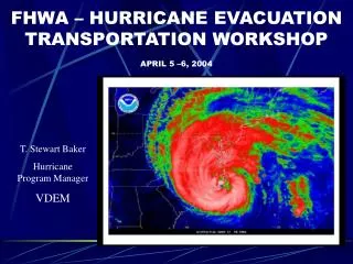
This meeting will discuss the outlook for the 2011 hurricane season and provide information on assessing evacuation risk. Topics include the NOAA forecast, track and cone size improvements, probabilistic storm surge models, and NHC social media updates.

E N D
NC/VA Hurricane Evacuation Meeting 2011 Seasonal Outlook & Assessing Evacuation Risk Bill Sammler Warning Coordination Meteorologist National Weather Service – Wakefield, VA
2011 Hurricane Season Forecast NOAA Forecast Issued May 19th “NORMAL” 11 storms • 12 to 18 Named Storms • 6 to 10 Hurricanes • 3 to 6 Major Hurricanes 6 hurricanes 2 major (Cat 3+) hurricanes
Hurricane Season Predictions The Seasonal Forecast Fallacy Graphic Courtesy Steve Lyons
2011 Atlantic “Cone” 2010 36 62 85 108 161 220 285 Substantial reduction in track cone size for 2011 due to 2005 season dropping out of the sample.
Recent Improvements in Track Forecasts Have Resulted in Less Uncertainty 2003 Operational Cone 2011 Cone
Probabilistic Storm Surge • Use an ensemble of SLOSH runs to create probabilistic storm surge (p-surge) • Intended to be used operationally so it is based on NHC’s official advisory • P-surge’s ensemble perturbations are determined by statistics of past performance of the advisories • P-surge uses a representative storm for each portion of the error distribution space rather than a random sampling
Errors Used by P-Surge • The ensemble is based on distributions of the following: • Cross track error (impacts Location) • Along track error (impacts Forward Speed, Timing) • Intensity error (impacts Pressure) • Rmax error (impacts Size)
Varying the Other Parameters • Size: Small (30%), Medium (40%), Large (30%) • Forward Speed: Fast (30%), Medium (40%), Slow (30%) • Intensity: Strong (30%), Medium (40%), Weak (30%)
When is P-surge Available? • Whenever a hurricane watch or warning is in effect • Available about 30 minutes after the advisory release time
Deterministic SLOSH run shows limited surge threat to Pensacola area Rmax=25 mi (forecast) Surge Based on NHC -12 hr. Advisory
Probabilistic product shows considerable surge threat to Pensacola area
P-surge Examples for Earl http://www.nhc.noaa.gov/
Facebook /US.NOAA.NationalHurricaneCenter.gov
Coming June 1 • Two NHC Twitter accounts – NHC_Atlantic and NHC_Pacific • Automated Tweets for: Public Advisory Special Advisory Tropical Cyclone Update Tropical Weather Outlook
Examples of NHC Atlantic TCP #earl getting farther from puerto rico (www.hurricanes.gov) TCU #alex makes landfall in northeastern mexico (www.hurricanes.gov) TWOAT #twoat Just issued a new Tropical Weather Outlook (www.hurricanes.gov)
Hurricane Evacuation Outer Banks vs. Hampton Roads There is a Difference!!!
Hurricane Return Periods Norfolk Cape Hatteras
Tropical Cyclones Since 1870 Norfolk Cape Hatteras
Hurricanes Since 1870 Norfolk Cape Hatteras
The End!! Are There Any Additional Questions? william.sammler@noaa.gov