Sensor System Infrastructure and Organization
This chapter explores the establishment of infrastructure necessary for the functioning of the sensor system, including neighbor discovery and organization, placement in temporal and spatial frameworks, topology control, clustering, time synchronization, and localization.

Sensor System Infrastructure and Organization
E N D
Presentation Transcript
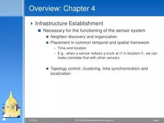
Overview: Chapter 4 • Infrastructure Establishment • Necessary for the functioning of the sensor system • Neighbor discovery and organization • Placement in common temporal and spatial framework • Time and location • E.g., when a sensor notices a truck at t1 in location l1, we can make correlate that with other sensors • Topology control, clustering, time synchronization and localization
Topology control • Neighbor discovery • nodes die or turn off/lower range to save power • Simple setup: • All nodes must transmit at the same power/range • Critical transmitting range problem: compute the minimum common transmitting range such that the network is connected • Length of the longest edge of the minimum spanning Euclidean spanning tree (MST) connecting nodes • Probablistic solutions: geometric random graphs • Realistic setup • Allow varying transmission ranges • Shorter range in dense deployments, longer in sparse • Range assignment problem: NP complete • Resource intensive for sensor scenarios • Distributed approaches (e.g. COMPOW)
Clustering • Nodes organize as hierarchical clusters, either naturally or for convenience • Resource rich sensors can act as cluster heads (GPS, energy etc.) • Frequently, nodes are picked to be cluster heads, rotating around to reduce resource demands on a single node • Resources managed locally within cluster • Communication between clusters (especially dense) are mediated via cluster heads • Group of Cluster heads work with gateways
Time synchronization • Readings must be correlated to a common time frame • Localization algorithms use ranging techniques that need time of flight • TDMA radio schedules need commonly understood time • Wired world, we use NTP (synchronize with multiple and well known stable clocks) • Constant communication to reduce drift • Sensors can tolerate local synchronization as well as time ordering of events (and not absolute time values)
Clocks • Hardware oscillator provides heartbeat clocks • Environmental conditions cause drift (skew) • Clock phase difference (clock bias) • To synchronize clocks, we use messages • Send time: Sending side, including OS delays • Access time: MAC specific access to wireless channel • Propagation time: long for multi-hop. Depends on environment, multipath etc. • Receive time: Network interface to OS • Interface can time stamp to reduce dependency
Clock phase difference estimation • Node I sends local clock t1 to node j • Node j records local time t2 = t1 + D + d • Node j at t3 sends message to node I with t1, t2, t3 • Node I receives message at t4 = t3 + D - d • D = (t2 - t1 - t4 + t3)/2 • Node I sends d to node j
Interval methods • Transform node I’s notion of interval into node j’s • Use acknowledgements to measure delays, piggyback measurements in future packets • Need to keep track of all prior communications - assume they will be needed in the future • Reference broadcasts • Clusterhead or some such node transmits one time. Receivers synchronize amongst themselves (because they all heard the same reference broadcast) • Repeat many times to offset measurement anomalies • Hierarchy of (overlapping) neighborhoods
Localization (spatial component) • For some scenarios, it is important to know where the event occurred • Especially true for ad hoc deployments • Self-localization- nodes figure out their location • GPS is becoming inexpensive, but still consumes energy • Use nodes with GPS as landmarks to localize other node • Ranging techniques • Estimate distance of receiver from a transmitter using received signal strength • Inaccurate because of fading, shadowing, multipath etc. • Sensor components are cheap and not precise • Bats seem to be fairly good at it though • Time of arrival * signal propagation speed • Time difference of arrival at two receivers
Range based localization algorithms • Use landmarks to localize • Collaborative multilateration • Create collaborative subtrees • Refine using iterative techniques such as kalman filters • Multipe triangle containment tests • Location services • Spatial quad-tree to allow node u to look for object at a certain location. The sensor at the location should let the location server know about it. U needs to be able to find this server