Download
1 / 16
160 likes | 339 Vues
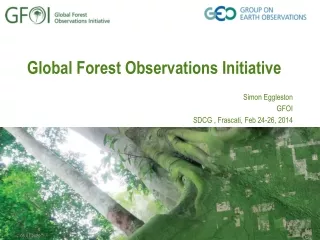
Global Forest Observations Initiative Giovanni Rum, GEO Secretariat. The user need – link to policy. Forests absorb and store atmospheric carbon so reducing the rates of deforestation and forest degradation is fundamental to mitigating global climate change.

E N D
Global Forest Observations InitiativeGiovanni Rum, GEO Secretariat
The user need – link to policy • Forests absorb and store atmospheric carbon so reducing the rates of deforestation and forest degradation is fundamental to mitigating global climate change. • To reduce deforestation and forest degradation, you need to know your forests and what’s happening to them. • Efficient and sustainable national forest monitoring systems require reliable, timely and affordable observations (a combination of remote sensing and in situ data). The Global Forest ObservationInitiative (GFOI) supports countries by facilitating access to coordinated satellite data and providing appropriate tools and technical guidance to help monitor changes in forests and their carbon stocks over time.
History of GEO Initiatives 2008 GEO members developed the Forest Carbon Tracking Task to demonstrate the benefits of integrating the use of satellite and in situ data for NFMS and MRV for REDD+ 2009 - 2011 GFOI was proposed to explore more formal and sustained arrangements and conceptually defined 2012 GFOI Implementation Plan endorsed at GEO PlenaryOffice Manager selected
Forest Carbon Tracking (FCT) Objectives • Show the feasibility of coordinated, large scale satellite data acquisitions • Test and compare the use of various data sets, models, tools and methodologies in order to provide options, advice and guidelines to countries • Achievements • Demonstrations and capacity building in 11 National Demonstrators countries • International coordination and cooperation to acquire and provide data
FCT National Demonstrators From 2009 • Brazil • Guyana • Mexico • Indonesia • Australia • Cameroon • Tanzania From 2010 • Colombia • DR Congo • Peru From 2011 • Nepal
GFOI initial focus • GFOI ultimate objective is to support the implementation of National Forest Monitoring Systems – NFMS, which require reliable, timely and affordable provision of observations and support services best suited to the needs of individual countries. • Considering the urgent need for support emerging from the negotiations of REDD+ policy requirements under the UNFCCC, GFOI will initially focus on supporting the monitoring and reporting of greenhouse gas fluxes from forests. • Not to forget that REDD+ also needs monitoring of safeguards and drivers e.g. biodiversity, conversion to agriculture and conservation of natural forests
GFOI overall objectives and areas of action Objectives • Fostering the sustained availability of observations in support of national forest monitoring systems • Supporting countries in the use of observations in NFMS – respecting national choices of data and tools Areas of action • Coordination of satellite data acquisition and supply • Capacity development • Research, Development and Demonstration • Methods and guidance documentation
Coordination of acquisition and supply of Satellite data • Fundamental to GFOI objectives: Aim is to support all countries’ participation in reporting and hence mitigation of forest emissions • Ad-hoc Space Data Coordination Group (SDCG) established by CEOS in support of GFOI needs with good participation from necessary agencies • Plan approved by CEOS in March 2013 (SIT-28) • SDCG seen as an important new capability for CEOS/GEO • Plan proposes phased provision of data needed for REDD+, starting with a list of REDD+ countries in 2013 and extending globally by 2015.
Sub 30m core satellite data streams for continuous, annual, global coverage
Capacity Building • AIM: Help nations develop capacity to utilise Earth Observation data in credible national forest monitoring systems • US Silvacarbon program 9 workshops in the Americas and Asia in 2011 and 2012 • Ongoing bilateral collaborations • Australia-Indonesia’s International Forest Carbon Initiative • Norway-Tanzania • Strategic framework for Capacity Building under discussion • Plans for geographic broadening in 2013/14 to Asia and Africa
Research & Development • AIM: to identify areas where current operation methods cannot deliver according to the GFOI goals and to coordinate R&D activities and country involvement to fill these gaps • E.g. ensuring time series consistency with new sensors & capabilities, monitoring forest degradation,, mapping of particular forest types (mangrove, peat forests, etc), measurement of forest biomass • R&D plan being completed • Coordination with GOFC-Gold is in place • Exploring complementary interests with research funding organisations
Methods & Guidance Document (MGD) • AIM: to produce a user-friendly reference on available tools and methodologies for the use of remotely-sensed and ground –based data in the establishment of countries’ National Forest Monitoring Systems, compatible with eventual funding through REDD+ • Advisory Group and Authors Team assembled • First draft document reviewed • Further drafting, review and field testing 2012-2013 • To be submitted for endorsement at GEO-X • Possible consideration by FAO
Near term actions While continuing to mobilize data and support for the countries currently engaged, GFOI is also expanding to sustained routine activities aiming to • encourage greater participation by new countries; • reflect priorities of UNFCCC, FAO, World Bank FCPF; • increase coordination of capacity enhancing within GFOI and with other organisations; • continue and enhance data provision and continue to develop the MGD; • Continue to perform R&D activities and in-country demonstrations • include additional donor countries and organisations in GFOI - mobilise resources
GFOI and EC (FP7) Past and present FP-7 Projects, namely RECOVER, REDDAF, REDD-FLAME, REDDINESS are directly contributing to FCT/GFOI objectives. In particular RECOVER and REDDAF activities are fully coordinated within FCT, providing essential contributions and support in different National Demonstrators and benefitting of FCT satellite data coordination
GFOI and EC (FP7 and beyond) Near future Need to move to sustainable operations. A GMES-Copernicus service, focused on providing support to developing countries in implementing and operating their National Forest Monitoring Systems seems to be the next logical step. This would constitute a suitable and needed European contribution to GFOI continued implementation and operations.