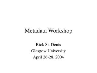
Metadata Workshop
Metadata Workshop. Frank Roberts, Coeur d’Alene Tribe GIS Bruce Godfrey, U of I, Inside Idaho Project (Funded by FGDC). Metadata Workshop. Agenda 1) Description of the FGDC metadata standard. (Frank)

Metadata Workshop
E N D
Presentation Transcript
Metadata Workshop Frank Roberts, Coeur d’Alene Tribe GIS Bruce Godfrey, U of I, Inside Idaho Project (Funded by FGDC)
Metadata Workshop • Agenda • 1) Description of the FGDC metadata standard. (Frank) • 2) What does a GIS person really have to collect to be compliant?--Structure and components of FGDC CSDGM-compliant metadata. (Frank) • 3) Why we create metadata and how it is useful--FGDC National Geospatial Data Clearinghouse introduction. (Bruce) • Lunch Break • 4) Overview of metadata collection/management tools. Focus on SMMS -- the metadata collection/management tool used by INSIDE Idaho. (Bruce) • 5) ArcInfo 8: What it has to offer for metadata collection. (Frank) • 6) Brief training on the metadata tool developed by Frank Roberts and the Coeur d'Alene Tribe GIS office. (Frank) • 7) Making your metadata available through a Clearinghouse Node--INSIDE Idaho. (Bruce)
Description of the FGDC Metadata StandardandWhat do we really have to collect Frank Roberts Coeur d’Alene Tribe Natural Resource Geographic Information Systems phone: 208-686-5307 email: froberts@dmi.net
What I’m going to cover • What is metadata • What is the FGDC Standard • What is the ISO Metadata Standard • What the GIS user need to collect to meet the standard
What are Metadata? • Shares the same Greek root as metamorphosis - meta means change • Metadata - data about data • Metadata describe the origins of & tracks the changes to geospatial data • Metadata answer who, what, when, where, why, and how about every facet of the data that are being documented
Federal Geographic Data Committee Metadata Standard • Gives us a predefined framework for metadata • Provides a common set of terminology to exchange metadata • Executive Order 12906: “requires Federal agencies to use the standard to document data they produce beginning in 1995.” • Gives us both required and optional elements
International Standards Organization (ISO) metadata standard • The US isn’t the only one thinking about metadata • This standard is currently being established • Since the FGDC standard is already been used in the US, many of the elements for the ISO standard are identical. • ISO will someday replace FGDC, however it is likely that a profile of FGDC standard will be made for the ISO standard.
Why support an metadata standard? • 100s of people across US have spent 4 years coming to consensus • Tools already exist for (FGDC compliant) metadata entry & capture • Defines appropriate use of data • Use of data from federal sources • Reservation wide data developed with federal dollars • Protects your investment • Without metadata, spatial data becomes useless - externally & internally • Information loses it’s meaning if we are not speaking the same language - we must have a International Standard. • Great Plains project encompasses 5 states and 2 provinces • 89 NSDI nodes already exist to search for FGDC compliant metadata • Helps people find data • Avoids duplication of effort
FGDC Metadata explained • No one is required to complete all metadata for the FGDC metadata standard • The standard is broken down into mandatory elements and optional elements • You can select as many as the optional elements as you wish
Metadata Content Standards for Digital Geospatial Metadata 1 2 3 4 5 6 7 Identification Information Spatial Reference Information Entity and Attribute Information Distribution Information Metadata Reference Information Data Quality Information Spatial Data Organization Information Legend Mandatory Mandatory If Applicable 10/06/95
The coolest Metadata Site http://biology.usgs.gov/fgdc.metadata/version2/index.htm
Component #1: Identification • Citation • Description & Abstract • Time Period • Status: Maintenance & Update Frequency • Spatial Domain • Keywords • Access Constraints • Use Constraints • Contact Info Manual AutomaticChoice
Component #2: Data Quality • Logical Consistency(Explanation of how data was digitally created) • Completeness Report (Defines minimum mapping unit) • Lineage (Source of Data) Manual AutomaticChoice
Component #3: Data Organization • Direct Spatial Reference Method (i.e. Raster, Point, Vector) Manual AutomaticChoice
Component #4: Spatial Reference • Geographic OR • Map Projection OR • GRID Coordinate System OR • Local Planar • Vertical Coordinate System Definitions are mandatory if applicable Manual AutomaticChoice
Component #5: Entity and Attribute Information • Entity Type (Captured automatically) • Attribute Label (Captured automatically) • Attribute Definition • Attribute Definition Source (may be “None”) • Attribute Domain Values (Captured automatically) Manual AutomaticChoice
Component #6: Distribution • Distributor (Automatic after 1st entry) • Distribution Liability (Automatic after 1st entry) • Standard Order Process (Automatic after 1st entry) • Digital Transfer Options (Automatic after 1st entry) • Fees (Automatic after 1st entry) Manual AutomaticChoice
Component #7: Metadata Reference • Metadata Date • Metadata Contact • Metadata Standard Name • Metadata Standard Version Manual AutomaticChoice
Summary of mandatory elements of FGDC Metadata • There are a total of 32 items for the mandatory elements of FGDC metadata standard • Only 4 of those items should require you to type something out. • 7 of the elements can have a picklist, to select the value • All (21) remaining elements should be automated
Resources Available • Federal Geographic Data Committee • What's new with metadata, Metadata Factsheet (pdf), Metadata Frequently Asked Questions, The Value of Metadata, Manager's Brochure, Content Standard for Digital Geospatial Metadata (CSDGM) • OGRIP, July 98 • http://www.fgdc.gov/metadata/toollist/ogrip/ • Metadata Tools for Geospatial Data,Oct 98 • http://badger.state.wi.us/agencies/wlib/sco/metatool/mtools.htm
$ Funding for metadata $ • If you get federal funding to that involves creating GIS data, it is legitimate that you can charge your time to make metadata to that funding • USGS via FGDC offers funding for making metadata (we even received some funding!)
Questions? Thanks for listening! Feel free to Email me at: froberts@dmi.net