Download

1 / 26
260 likes | 269 Vues
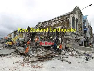
NEW ZEALAND EARTHQUAKE 2010. Walter Hays, Global Alliance for Disaster Reduction, University of North Carolina, USA. SHALLOW, EARLY-MORNING, M7.0 EARTHQUAKE STRIKES CHRISTCHURCH, NEW ZEALAND. 10 km focal depth on a strike-slip fault 4:35 am M7.0 SATURDAY, SEPTEMBER 4, 2010.

E N D
NEW ZEALAND EARTHQUAKE 2010 Walter Hays, Global Alliance for Disaster Reduction, University of North Carolina, USA
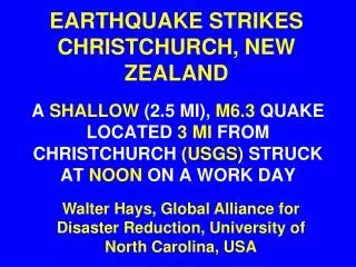
SHALLOW, EARLY-MORNING, M7.0 EARTHQUAKE STRIKES CHRISTCHURCH, NEW ZEALAND 10 km focal depth on a strike-slip fault 4:35 am M7.0 SATURDAY, SEPTEMBER 4, 2010
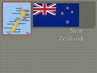
New Zealand is in the southwest Pacific Ocean astride the “ring of fire,” a distinct belt of volcanic and earthquake activity that surrounds the Pacific Ocean.
New Zealand straddles the boundary between the Pacific and Indian-Australian plates.
To the north of New Zealand and beneath the eastern North Island, the thin, dense, Pacific plate moves down beneath the thicker, lighter Indian-Australian plate in a process known as subduction (i.e., reverse faulting).
Within the South Island the plate margin is marked by the Alpine Fault and the plates rub past each other horizontally (i.e., strike-slip)
Every year, New Zealand experiences about 14,000 earthquakes, whichare mostly small to moderate in size.
THE BASIC FAULT MODELS Strike-Slip Reverse Normal
TSUNAMI FAULT RUPTURE DAMAGE/ LOSS TECTONIC DEFORMATION DAMAGE/ LOSS DAMAGE/LOSS FOUNDATION FAILURE EARTHQUAKE DAMAGE/ LOSS SITE AMPLIFICATION DAMAGE/ LOSS LIQUEFACTION DAMAGE/ LOSS LANDSLIDES DAMAGE/ LOSS DAMAGE/LOSS AFTERSHOCKS DAMAGE/ LOSS SEICHE DAMAGE/ LOSS GROUND SHAKING
CAUSES OF DAMAGE INADEQUATE RESISTANCE TO HORIZONTAL GROUND SHAKING SOIL AMPLIFICATION PERMANENT DISPLACEMENT (SURFACE FAULTING & GROUND FAILURE) IRREGULARITIES IN ELEVATION AND PLAN EARTHQUAKES FIRE FOLLOWING RUPTURE OF UTILITIES “DISASTER LABORATORIES” LACK OF DETAILING AND CONSTRUCTION MATERIALS INATTENTION TO NON-STRUCTURAL ELEMENTS
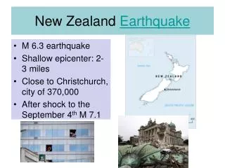
In Christchurch, a city of 372,000, power and water services were knocked out, facades fell off buildings, homes and bridges were damaged by strong shaking, and the Christchurch Airport was closed.
Numerous injuries, but no deaths, largely due to the 4:35 a.m. time of occurrence, NOT the resilience of the buildings
A lot of damage occurred in the central city area comprised mainly of old brick and unreinforced masonry buildings.
The initial estimate of the cost to repair the damage was $1.5 billion.
In the suburbs many houses had broken windows, toppled chimneys, cracked walls and interior damage (e.g., items thrown off shelves).