Download
1 / 60
600 likes | 708 Vues
Discover the stunning beauty of Minnesota in Section 43, home to lakes, forests, and charming small towns. Delve into the rich hunting and fishing experiences, unique ecological features, and historical landmarks of this vibrant region. From the spectacular Chippewa National Forest to the tranquil Star Island, immerse yourself in the diverse natural wonders and outdoor adventures available in this picturesque corner of Minnesota.

E N D
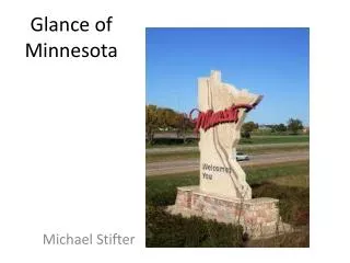
Glance of Minnesota Michael Stifter
Section 43 • The North west area that I have chosen because, it is where my cabin is and in my mind the most beautiful part of Minnesota.
Cities • Section 43 consists of Menahga, Park Rapids Walker, Nevis, Akeley, Hubbard, and Lake George. With its area consumed by many lakes and many multiple small towns. Paul Bunyan, Akeley Big Sand Lake, Park Rapids Fun on the Crow Wing chain of Lakes
Death Time • Hunting is a major attraction to the area. Major hunting activities include duck, deer, and bear.
Fish On! • Fishing is and every day event in the area with a large variety of to pick from. These species are regulated through the Department of Natural Resources to maintain population in the lakes and streams. Walleye Northern Pike Cappies
Accessibility • To reach the area from the twin cities one would follow US route 10 North and then US 71 North. 71 is the major route through the area, but it is also accessible with state routes: 64 and 87 from the south east, state 371 and US 2 from the east, state 113 and 200 from the west.
Northern Wet-Mesic Boreal Hardwood-Conifer Forest • This is the classification that the Department of Natural Resources characterizes the region. Located on glacial deposits with clayey soil with high water tables.
The dark blue section represents the majority of section 43. Glacial • Many of the lakes in the region were caused by glacial elements and Great Lake Agassiz, these were the construction mechanism that formed the region.
Where’d it go? • With the area being just below the origin of our countries greatest river. The water shed for the area drains into the Mississippi River.
Vegetation • In this region there are towering Jack Pines as the biome for the section is coniferous forest. With the presence of this species it is for seen a fire rich are because the Jack Pine needs the fire to clear the forests and to also rescind the resign that covers their seeds for reproduction.
How it was formed. • Lakes in the area were formed by glaciers retreating and leaving ice blocks which were covered by sandy outwash. When the ice melts it leaves a lake with sandy shores known as ice block lakes.
Battle of Sugar Point • This conflict took place at Bug-O-Nay-Gee-Shig’s cabin and is considered the last true Indian battle near Leech Lake. This left seven soldiers killed and 16 more wounded in 1898.
Chippewa National Forest • This forest spreads over 1.6 million acres, with 1300 lakes, over 900 mile of river, and 400,000 acres of wetlands.
Star Island • Cass lake is home of the lake in a lake. Star Island in Cass lake has a lake in its center which with the water being shallow makes for good for swimming area.
State forests • This area is home to five forests: Badoura, Huntersville, Two Inlets, Paul Bunyan, and Mississippi Headwaters state forests.
Section 35 • The north east region of Minnesota, home of wet lands forest and Mesabi Range.
State Forest • The area contains Bear Island, Burntside, and Kabetogama State Forest.
National Forest • Much of the area is also covered by Superior National Forest.
Mesabi Range • Also known as the iron range, Mesabi runs more than a hundred miles and is composed of ore. Ore is broken down into iron.
Wet Lands • This area is dominated by wetlands that are fire dependent to sustain the growth of the area.
Hunting • As it was back in the early establishment of Minnesota, this area is a boasting area for trapping goods. Today there is regulation in place to help sustain population.
Fishing • The area is well know for their monster Pike and Muskie. This with the Boundary Waters is a very large tourist attraction for the area.
Routes • 169, 1, 135, 110, and the only north route of 116, are the routes to access the region.
Water Shed • As seen in the figure the water shed for the region drains into the great lakes basin. This is the shed line that flows east to the atlantic.
Cities • Ely is the main stand out town of the area but south of the iron range and north of the range the are numerous small towns that run along the state routes.
Lakes • Lake Vermillion is the largest lake in the area, the is no shortages of fisheries to be found.
Northern Superior Uplands Section • The ecological classification that the area has been assigned by the Minnesota Department of Natural Resources. Which contain scoured bedrock terrain with the shortest growing season in the state.
Boundary Waters • Known as the most popular wilderness area in the United States was established in 1909 when 1.9 million acres were established as the Superior Refuge.
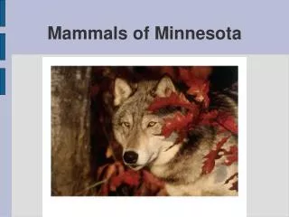
Bark at the Moon • Just outside of Ely, on 169 you can find the International Wolf Center. Minnesota also has the highest number of wolves in the continental 48.
Iron • Between 1900 and 1980 the region produced 60% of the nations iron ore output.
Section 66 • The south east region contains a major flood plain, the region structured as prime for settlement and farms.
Routes • With the area plotted in a grid like pattern access to the region is plentiful. Main state routes such as 40, 7, and 119cut through east to west and US routes 212 and 75 cross through the center.
North Central Glaciated Plains Section • The title given by the DNR is befitting because the De Moines Lobe of the glaciers carved the area.
Bedrock • From the glaciers, drift covers between 100 to 300 feet. But near Ortonville the granite is considered scoured bedrock.
Prairie Biome • With the upland prairies dominating the area fires are a necessity to protect the land from tree invasions.
Vegetation • Tallgrass prairie with some wetlands and deciduous Forests of silver maple, elm, cottonwood, and willow are native to the area. Trees are usually located near streams and lakes.
Climate • In the area precipitation is about 25 inches and only 11 raining down in the growing seasons. The growing season is usually about 150 days.
Water Shed • The area is the head waters for the Minnesota river. Which is high prone to seasonal flooding.
Agriculture • Before the European settlement prairies covered 18 million acres. Prairies were the largest ecosystem in the united states. With the rich fertile soil of the prairie it became the perfect location for farming.
Lac Qui Parle Wildlife Refuge • “The lake that speaks.” The name of the lake comes from the sound of geese that congregate in the spring and fall. This 35,000 acre area is heaven for bird watchers.
Big Stone National Wild Life Refuge • The area is a left over from Glacial Lake Agassiz. It is also a fly through for over 200 species of migratory birds.
Lac Qui Parle Hunting • With such wonderful fly ways, migratory gird hunting is a major attraction to the area.
Ortonville • Every year this once corn canning community celebrates its heritage with a festival. It is best known for the walleye fishing on Big Stone Lake.
Settlement • The area was unsettled until the 1890’s-1900’s, the railroads was the driving force the helped populate the area.
Section 85 • Mower, Olmstead, and Dodge counties are the final section to be displayed.
Glaciers • Glaciers? Never seen them. Is what this land would say. With the region being the oldest land in the state. The glacial advances never covered the area leaving the land open to the weather.
Watershed • Water in the region gathers in streams and rivers to drain into the lower part of the Mississippi.
Geology • Limestone, sandstone, and shale are some of the common bedrock exposed. With the minimal drift into the area many rocks are on or close to the surface to be observed.
Oak Savanna • The DNR categorizes the area of a deciduous forest. Which covers nearly 12 million acres in Minnesota. The root embed themselves over bed rock and till.
Oak Savanna • With frequent fires in the west that tend to enter the region, much of the plant life is burned. The trees are the oaks and maples that can live through the fires, and the area stays a savanna. Though the majority of the region is now farmed.