Download
1 / 8
0 likes | 20 Vues
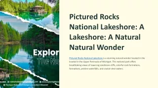
Discover the Majestic Beauty of Pictured Rocks National Lakeshore Pictured Rocks National Lakeshore is a stunning natural wonder located in the Upper Peninsula of Michigan. This national park offers breathtaking views of towering sandstone cliffs, colorful rock formations, pristine waterfalls, and crystal-clear waters.Choose from cozy cabins, lakeside cottages, or modern vacation homes, each providing a comfortable retreat after a day of exploration. Whether you're hiking along the scenic trails, kayaking through the turquoise waters, or simply admiring the breathtaking views, your adventure a

E N D
Pictured Rocks National Lakeshore: A Lakeshore: A Natural Natural Wonder Pictured Rocks National Lakeshore is a stunning natural wonder located in the located in the Upper Peninsula of Michigan. This national park offers breathtaking views of towering sandstone cliffs, colorful rock formations, formations, pristine waterfalls, and crystal-clear waters.
Location and Geography Location Geography Elevation Pictured Rocks National Lakeshore is located in the eastern Upper Peninsula of Michigan, along the southern southern shore of Lake Superior. Superior. The park encompasses a diverse diverse landscape of sandstone sandstone cliffs, waterfalls, beaches, forests, and inland lakes. It is approximately 42 miles long and features 15 miles miles of Lake Superior shoreline. shoreline. The park's elevation ranges from from 600 to 1,000 feet above above sea level. The highest point is Mount Curwood, which which rises 1,007 feet above sea sea level.
Geology and Formation of the Pictured Pictured Rocks Sandstone Deposition 1 Over millions of years, layers of sandstone were deposited by ancient rivers and glaciers. Glacial Erosion 2 During the last ice age, glaciers carved out the landscape, shaping the cliffs and cliffs and creating the iconic sandstone formations. Water Erosion 3 The waves of Lake Superior continue to erode the cliffs, creating unique and ever and ever- changing features. -
Hiking and Trails The Lakeshore Trail The Sable Falls Trail 1 2 A 42-mile loop trail that follows the shoreline shoreline and offers stunning views. A short and easy trail that leads to a picturesque waterfall. The Miners Falls Trail The Mosquito River Trail 3 4 A challenging trail that leads to a powerful powerful waterfall and overlooks the Lake Lake Superior shoreline. A scenic trail that follows a small river through through the forest.
Water Activities and Scenic Cruises Kayaking and Canoeing Explore the shoreline and admire the cliffs from a different perspective. Swimming and Sunbathing Enjoy the warm waters of Lake Superior on the sandy beaches. Scenic Cruises Take a boat tour to see the cliffs, waterfalls, and wildlife.
Wildlife and Ecology Bald Eagles Black Bears Gray Wolves These majestic birds of prey often often nest along the cliffs. Bears are a common sight in the the park, especially in the forested areas. Wolves are rare but can be spotted in the park's remote areas.
Camping and Lodging Campgrounds Hotels and Motels Several campgrounds are located within within the park, offering both developed developed and primitive sites. Several hotels and motels are available in available in the surrounding towns and and villages. Vacation Rentals Vacation rentals, including cabins and cottages, are also available near the park.
Visitor Information and Planning Your Trip Trip Maps Seasons Photography Prepare Obtain a map of the park to help you plan plan your hikes and activities. The park is open year year- round, but the best time to visit is during the summer months. - The park offers incredible photographic photographic opportunities, so bring bring your camera. Pack for all types of weather and be aware aware of the park's regulations.