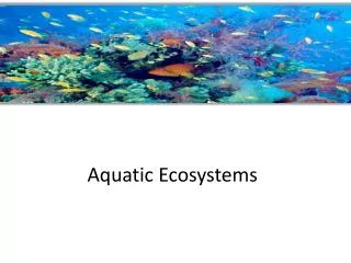
Aquatic Ecosystems
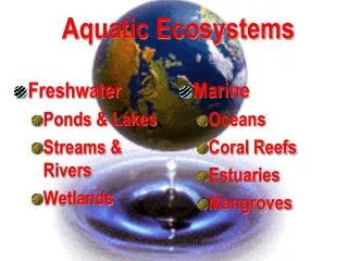
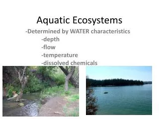
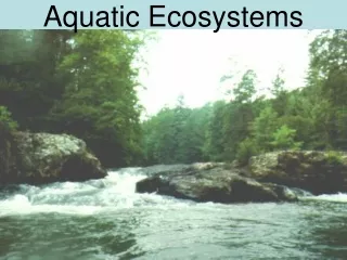
Freshwater Ponds & Lakes Streams & Rivers Wetlands. Marine Oceans Coral Reefs Estuaries. Aquatic Ecosystems. Ponds & Lakes Streams & Rivers Wetlands. Freshwater. Freshwater. Only 3% of the world’s water is fresh 99% of this is frozen or buried in aquifers


Aquatic Ecosystems
E N D
Presentation Transcript
Freshwater Ponds & Lakes Streams & Rivers Wetlands Marine Oceans Coral Reefs Estuaries Aquatic Ecosystems
Ponds & Lakes Streams & Rivers Wetlands Freshwater
Freshwater Only 3% of the world’s water is fresh 99% of this is frozen or buried in aquifers 1% is found in lakes,ponds, rivers or streams
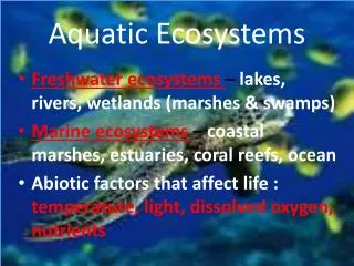
Freshwater is defined as having a low salt concentration—usually less than 1% Plants and animals in freshwater regions are adjusted to the low salt content and would not be able to survive in areas of high salt concentration (i.e, ocean) Freshwater - lentic
Ponds and Lakes • range in size from just a few square meters to thousands of square kilometers • ponds may be seasonal, lasting just a couple of months (such as sessile pools) • lakes may exist for hundreds of years or more • may have limited species diversity since they are often isolated from one another and from other water sources like rivers and oceans
Ponds and Lakes • divided into three different “zones” determined by depth and distance from the shoreline • littoral zone • limnetic zone • profundal zone
Littoral Zone • Zone close to shore • warmest since it is shallow and can absorb more of the Sun’s heat • sustains a fairly diverse community, which can include several species of algae (like diatoms), rooted and floating aquatic plants, grazing snails, clams, insects, crustaceans, fishes, and amphibians • the egg and larvae stages of some insects are found in this zone • vegetation and animals living in the littoral zone are food for other creatures such as turtles, snakes, and ducks
Limnetic Zone • near-surface open water surrounded by the littoral zone • well-lighted (like the littoral zone) and is dominated by plankton, both phytoplankton and zooplankton (rotifers) • plankton are small organisms that play a crucial role in the food chain – most life would not be possible without them • variety of freshwater fish (nekton) also occupy this zone
Profundal Zone • Plankton have short life spans—when they die, they fall into the deep-water part of the lake/pond • much colder and denser than the other two • little light penetrates all the way through the limnetic zone into the profundal zone • animals are decomposers (bentos)
The Three Layers of a Lake During Summer Stratification Atmosphere Lake Surface Epilimnion – warm, light water Thermocline – boundary layer Hypolimnion – cold, heavy water Lake bottom
Ponds and Lakes Temperature varies seasonally. Summer from 4° C near the bottom to 22° C at the top Winter from 4° C while the top is 0° C (ice) between the two layers is a narrow zone called the thermocline where the temperature of the water changes rapidly with depth
Ponds and Lakes Temperature varies seasonally. Summer from 4° C near the bottom to 22° C at the top Winter from 4° C while the top is 0° C (ice) between the two layers is a narrow zone called the thermocline where the temperature of the water changes rapidly with depth
Ponds and Lakes • during the spring and fall seasons is a mixing of the top and bottom layers resulting in a uniform water temperature of around 4° C • mixing also circulates oxygen throughout the lake • many lakes and ponds do not freeze during the winter resulting in the top layer being a little warmer
Ponds and Lakes • ice can develop on the top of lakes during winter • blocks out sunlight and can prevent photosynthesis • oxygen levels drop and some plants and animals may die • called "winterkill."
Ponds and Lakes Temperate Lakes Go Through an Annual Cycle Based on Changes in Climate Over the Four Seasons
Lake Succession • Oligotrophic lakes • young; low in nutrients & productivity • clear & sparkling blue • deep water is oxygen-rich • Eutrophic lakes • older; nutrient rich & high in productivity • green & murky • O2 often depleted in deep water during summer • Nutrients in sewage & agricultural runoff speed eutrophication.
Process of Eutrophication • Defined as the enrichment of a body of water and subsequent increase in productivity. • Occurs naturally but at a slow pace over geological time • Human activities greatly accelerate the process of eutrophication: • Increased nutrient input from fertilizer mismanagement • Nutrients associated with sewage
Streams & Rivers-lotic • bodies of flowing water moving in one direction • found everywhere—they get their start at headwaters, which may be springs, snowmelt or even lakes • travel all the way to their mouths, usually another water channel or the ocean
Watershed • describes an area of land that contains a common set of streams and rivers • drains into a single larger body of water, such as a larger river, a lake or an ocean
Streams & Rivers • characteristics change during the journey from the source to the mouth • temperature is cooler at the source than it is at the mouth • water is also clearer, has higher oxygen levels, and freshwater fish such as trout and heterotrophs can be found there
Streams & Rivers • Towards the middle part of the stream/river, the width increases, as does species diversity—numerous aquatic green plants and algae can be found
Streams & Rivers toward the mouth the water becomes murky from all the sediments that it has picked up upstream decreasing the amount of light that can penetrate through the water less light less diversity of flora lower oxygen levels fish that require less oxygen, such as catfish and carp, can be found
Streams & Rivers toward the mouth the water becomes murky from all the sediments that it has picked up upstream decreasing the amount of light that can penetrate through the water less light less diversity of flora lower oxygen levels fish that require less oxygen, such as catfish and carp, can be found
Flow Mississippi River (Main Stem) Atchafalaya River (Distributary) Distributary – A smaller channel that takes water away from the main stem river.
River Channel Deep Holes Sand Bars
Oxbow Formation • Water flows at different speeds-fastest at outside banks • Inside banks fill with sediments • This creates the river to bulge out until a loop is formed • River meanders through flat terrain • Eventually enough deposits are laid to join the beginnings and ends of the loop (neck) diverting the river • With time the seal is closed off thereby creating a horseshoe shape (oxbow)
Wetlands • Wetlands are areas of standing water that support aquatic plants • Marshes, swamps, and bogs are all considered wetlands
Wetlands Plants • adapted to the very moist and humid conditions are called hydrophytes Pond lilies Cattails Sedges Tamarack Black Spruce Gum Cypress
Wetlands • highest species diversity of all ecosystems • many species of amphibians, reptiles, birds (such as ducks and waders), and furbearers can be found in the wetlands • not considered freshwater ecosystems as there are some, such as salt marshes, that have high salt concentrations—these support different species of animals, such as shrimp, shellfish, and various grasses
Wetlands River Otter Damselfly Dragonfly Mayfly Crayfish Snails Leech Bluegill Bass Catfish Sculpin Minnow Snakes Frog Turtle Great Blue Heron Canadian Goose
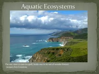
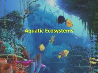
Marine Oceans Coral Reefs Estuaries Aquatic Ecosystems
Marine • cover about three-fourths of the Earth’s surface and include oceans, coral reefs, and estuaries • algae supply much of the world’s oxygen supply and take in a huge amount of atmospheric carbon dioxide • evaporation of the seawater provides rainwater for the land
Oceans • largest of all the ecosystems • dominate the Earth’s surface • separate zones • Intertidal • Pelagic • Abyssal • Benthic • great diversity of species • richest diversity of species even though it contains fewer species than there are on land
Intertidal Zone • where the ocean meets the land • sometimes submerged and at other times exposed • waves and tides come in and out • communities are constantly changing
Intertidal Zone • rocky coasts • stratified vertically • Where only highest tides reach • a few species of algae and mollusks • submerged during high tide • more diverse array of algae and small animals, such as herbivorous snails, crabs, sea stars, and small fishes • bottom of the intertidal zone • only exposed during the lowest tides, many invertebrates, fishes, and seaweed can be found
Intertidal Zone • sandier shores • not as stratified • waves keep mud and sand constantly moving • very few algae and plants can establish themselves—the fauna include worms, clams, predatory crustaceans, crabs, and shorebirds.
Wave Regions • much stronger than wind • decide what grows where • shores classified by amount of wave action • Exposed shores – receive full brunt of the ocean for most or at least some of the time • Semi-exposed shores – sheltered by barrier islands but still have to cope with waves • Sheltered shores – shelter of peninsulas and inshore islands • Enclosed shores • river mouths and estuaries • completely sheltered by either a protective rocks or a sand bar
Pelagic – Open Ocean • waters further from the land, basically the open ocean • generally cold though it is hard to give a general temperature range since, just like ponds and lakes, there is thermal stratification with a constant mixing of warm and cold ocean currents