Download
1 / 41
410 likes | 505 Vues
Explore the earthquake potential, historical events, and high seismicity of Izmir and its surroundings. Learn about risk reduction measures, seismic hazard assessment, and innovative strategies for disaster management.

E N D
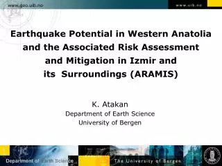
www.geo.uib.no Earthquake Potential in Western Anatolia and the Associated Risk Assessment and Mitigation in Izmir and its Surroundings (ARAMIS) K. Atakan Department of Earth Science University of Bergen Department ofEarthScience
www.geo.uib.no Background and our motivations Department ofEarthScience
www.geo.uib.no A long-term interest and a wake-up call Department ofEarthScience
www.geo.uib.no • Background and Motivations: • The earthquake potential of the active faults in Izmir and its surroundings • Historical destructive earthquakes along these faults • Present day high seismicity in the area • Susceptibility to local site effects • Densely populated metropolitan area with high vulnerability • High earthquake risk • Need for mitigation strategies • Implementation of risk reduction measures • Opportunities: • New EU Program - FP7 Department ofEarthScience
www.geo.uib.no The North Anatolian Fault (NAF) Department ofEarthScience
Present-day plate motions in Turkey based on GPS Sengör et al., 2004
Present-day motions in Izmir and its surroundings based on recent GPS data Aktug and Kilicoglu, 2006
Instrumental seismicity in Western Anatolia (data from KOERI)
Earthquake focal mechanisms in Western Anatolia (data from Harvard University)
Instrumental seismicity in Izmir and its surroundings show clearly which faults are being reactivated. The historical events in 1688, 1735 and 1788 which destroyed the city three times, are, on the other hand, more difficult to associate with faults. Erdik et al., 1997
The offshore faults in the south show strike-slip motion Altinok et al., 2005 Ocakoglu et al., 2004
Spectacular outcrops along the Manisa Fault are exceptional. Usually the fault surfaces are not visible.
www.geo.uib.no How do we address these problems? Department ofEarthScience
Continuous circle of efforts Before the earthquake (preparedness/mitigation) During the earthquake (rapid response) After the earthquake (restructuring)
www.geo.uib.no Seismic risk = hazard * vulnerability Social vulnerability vs vulnerability of the built environment Department ofEarthScience
www.geo.uib.no Potential earthquake sources Seismic hazard assessment Major tasks in assessing the seismic risk and its implementation in disaster management Local site effects Vulnerability Seismic risk assessment Mitigation strategies Department ofEarthScience
www.geo.uib.no Earthquake rupture and the resulting damage is a complex function of various parameters Department ofEarthScience
Appropriate Seismic Hazard Assessment methodologies are needed
www.geo.uib.no Seismic hazard assessment Deterministic methods Probabilistic methods Time-dependent Scenario based GM-modeling Poissonian Department ofEarthScience
www.geo.uib.no KOERI, Izmir Earthquake Master Plan Department ofEarthScience
www.geo.uib.no Hybrid (broad-band) Ground Motion Simulations Department ofEarthScience
Computed ground motions for a scenario earthquake along the Izmir Fault, Western Segment
Computed ground motions for a scenario earthquake along the Izmir Fault, Eastern Segment
www.geo.uib.no KOERI, Izmir Earthquake Master Plan Department ofEarthScience
www.geo.uib.no KOERI, Izmir Earthquake Master Plan Department ofEarthScience
www.geo.uib.no Predominant frequencies around Kordon, Izmir based on H/V spectral ratios of the microtremors Mikrotremor verilerine dayali Izmir, Kordon civarindaki anasalinim frekanslari Department ofEarthScience
www.geo.uib.no Department ofEarthScience
The complex built environment in Izmir poses challenges in defining the vulnerability with respect to earthquake loads. Innovative approaches are needed.
Building types and standards vary significantly throughout the Izmir area. Göksu, 2006
We need new technologies and innovative approaches Düzgün et al., 2005
Critical issues to be discussed: • Project scope • Project size (optimum size) • Project focus (single location vs several locations) • Scientific challenges (basic science vs applied) • Innovations and new technologies • Participating Institutions and their experience and expertise • European dimension (generic aspects) • European policies and priorities in FP7 (relevance)
www.geo.uib.no Thank you for your attention! Department ofEarthScience