Download

1 / 18
190 likes | 390 Vues
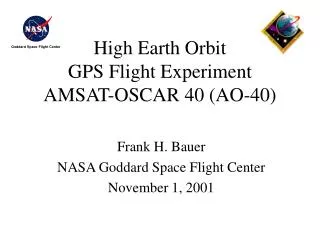
High Earth Orbit GPS Flight Experiment AMSAT-OSCAR 40 (AO-40). Frank H. Bauer NASA Goddard Space Flight Center November 1, 2001. AMSAT Phase 3D (AO-40). Experiment Objectives Long term, real time attitude and orbit determination experiment

E N D
High Earth OrbitGPS Flight ExperimentAMSAT-OSCAR 40 (AO-40) Frank H. Bauer NASA Goddard Space Flight Center November 1, 2001
AMSAT Phase 3D (AO-40) • Experiment Objectives • Long term, real time attitude and orbit determination experiment • Mapping the GPS constellation antenna patterns above the constellation • Understanding the robustness and limitations of using GPS above the constellation • Team • AMSAT, NASA GSFC • GPS Hardware • 2 Trimble Tans Vector Receivers • 4 patch antennas on perigee side of spacecraft • 4 high gain (10 dB) antennas on apogee side of spacecraft AMSAT Phase 3D in Kourou Launch: November 16, 2000 Vehicle: Ariane 5 Orbit: 1000 by 58,800 km, i=6
GPS Receiver (1 of 2) in Phase 3D’s Equipment Bay Perigee Antenna (1 of 4) Apogee Antenna (1 of 4)
AO-40 Orbit a 36286.409 km e 0.796838 i 6.04 deg W 151.818 deg w 335.84 deg M 2.00 deg Rate of right asc ~ -0.208 deg/day hp = 1000 km ha = 58800 km Period: 19.1 hours Epoch: doy 278.71185185, GPStime: [1134,493517.0] UTCtime: 2001-10-05, 17:05:04
AO-40 Attitude wrt GPS Orbit w= 5.4 rpm
Current Status • First data retrieved on Sept 25, 2001 • AO-40 represents first long-term HEO GPS experiment—daily results • Producing more data than expected—highly likely tracking more satellites than shown due to gaps in data files • Expect to continue to retrieve first phase of data through November • Experiment will revolutionize the use of spaceborne GPS---new facet to support autonomous navigation and formation flying in HEO/GEO
Lots of data is being collected High SNRs during peripapse passes High density of contacts near perigee passes enhance likelihood of fitting an accurate orbit to the data Numerous contacts between high SNR regions indicate high alititude contacts
AMSAT Data for 10/06/2001: Predicted (green) Tracked (blue) 32 31 30 29 28 27 26 25 24 23 22 21 20 19 18 17 16 predicted and actual GPS tracks 15 14 13 12 11 10 9 8 7 6 5 4 3 2 1 18 19 20 21 22 23 24 Time of Day [hrs] 60 55 km] 3 50 altitude [10 45 40 18 19 20 21 22 23 24 Time of Day [hrs] October 6, 2001 Data Near Apogee
Point solutions may be possible when 3-axis stabilized Four or more simultaneous GPS satellites
Close-up of multiple track overlap window Signals are fading as fourth PRN is acquired Approximately 5 minutes of four satellite tracking
Orbit Determination • Some cases near perigee, four satellites were tracked simultaneously. • Point solution computed using the data collected during perigee pass on Oct 5th. Difference between this point solution and the state computed from two line elements is 120 km primarily in the along track direction. This level of error could simply be the error in the TLE-based ephemeris itself. • Point solution being used as initial guess to process the complete data set in Microcosm (a batch filter) and GEODE (a sequential filter). The Microcosm and GEODE orbits will be differenced against each other and the TLE ephemeris.
signal obstructed by the Earth main lobe tracking side lobe tracking
Future Steps • Data returned from AO-40 will enable further characterization of GPS signal characteristics at high altitudes, and provides an opportunity to demonstrate orbit determination in a highly eccentric orbit using only observations from a low-cost GPS sensor • Lessons learned from AO-40 GPS experiment are guiding future HEO GPS efforts at GSFC: • PiVoT GPS receiver incorporates optimized algorithms and satellite selection logic for HEO • PiVoT will be capable of tracking all satellites in view and computing a real-time orbit solution in the AMSAT orbit • GSFC & AMSAT interested in follow-on experiment opportunity—could develop s/c & GPS receiver • Would like to partner on follow-on experiment---looking for small s/c launch opportunity