Download
1 / 29
290 likes | 434 Vues
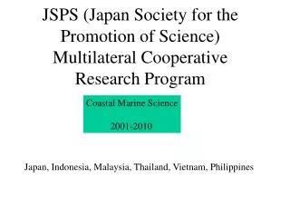
JSPS (Japan Society for the Promotion of Science) Multilateral Cooperative Research Program. Coastal Marine Science 2001-2010. Japan, Indonesia, Malaysia, Thailand, Vietnam, Philippines. 4 projects. Project 1: Water circulation and the process of material transport

E N D
JSPS (Japan Society for the Promotion of Science) Multilateral Cooperative Research Program Coastal Marine Science 2001-2010 Japan, Indonesia, Malaysia, Thailand, Vietnam, Philippines
4 projects Project 1: Water circulation and the process of material transport in the coastal area and marginal seas of the East and Southeast Asia (P.I., T.Yanagi, Kyushu Univ.) Project 2: Ecology and oceanography of harmful marine microalgae (P.I., Y.Fukuyo, Univ. of Tokyo) Project 3: Biodiversity studies in the coastal waters of the eastern and the southeastern Asia (P.I., K.Matsu-ura, National Museum) Project 4: Pollution of hazardous chemicals in the coastal marine environment and their ecological effect (P.I., N.Miyazaki, Univ. of Tokyo)
Regional Studies Gulf of Tongking Banpakong Est. Manila Bay Malacca Str. Java Sea
Fish cage dev. Product. (X 1000 fish) Cages Production Cages (unit) Why Gulf of Lampung ?
The Environmental Situation of Hurun Bay Precipitation Fish cage Depth (m) Gulf of Lampung Hurun bay SFC Warm Cold Scale 5 km Hatchery
Depth (m) Method Time Sampling : Sampling Station November 03 (Tr D-W), January 04, March 04 (WET=NW Monsoon), April 04,May 04 (Tr W-D), June 04, July 04, August 04, September 04 (Dry=SE Monsoon) Parameters : • - Temperature, Salinity, Transparency, • DO, DIN, DIP, TOM, • Fitoplankton • Precipitation, Solar Radiation and • Wind 8 Stations 3 Stations
Temporal and Spatial Variation of DIN Tran W-D Dry Tran D-W Wet DIN
Seasonal variations in average residence time and water temperature Suhendar and Yanagi (2006)
Recommendation Carrying capacity of fish culture in Hurun Bay varies seasonally. Cultured fish number and bait must be reduced during transition seasons.
Special field observations in the Upper Gulf of Thailand 9-11 Oct., 4-6 Dec. 2003 13-15 Jan. 2004 12-14 May, 7-9 Oct. 2004 26-29 Jul., 1-4 Nov. 2005 23-26 Jul. 2006 Transparency CTD, DO Water sampling Plankton net Light characteristics GPS buoys tracking
Objectives • To develop the air-correction algorithm of ocean color images • To develop the water-correction algorithm of ocean color images • To develop the hydrodynamical model • To develop the ecosystem model • To investigate the relation between surface convergence and • primary production • What is the generation mechanism of the patchiness structure • in the ocean?
Local algorithm for chl.a Chl.a(μg/l)=181.4exp(-4.74R) R=Rrs(520)/Rrs(565) Matsumura et al. (2006)
MERIS MODEL Oct 2003 28 Oct 2003 Anukul and Yanagi (2006)
Comparison between satellite image and model result Oct. 2003
MERIS MODEL Dec 2003 5 Dec 2003
MERIS MODEL Jan 2004 3 Jan 2004
MERIS MODEL Jul 2005 16 Jul 2005
Chlorophyll and Vertical Diffusivity CU – 6 (Jul 2005)
CU – 5 (Oct 2004) Sensitivity Analysis Strong Wind Normal Weak Wind
6 3 5 2 4 1 8 7 Observation data 1996.3~1998.12 8 stations (-1m, middle, bottom) T,S,Chl.a
6 3 5 2 4 1 7 Box model analysis Load from Pasig river Pasig川からの負荷 500 km2 35 km Horizontal Advection and diffusion 3 m 8 m 10 m Vertical Advection and diffusion 鉛直 移流・拡散 溶出 Release
DIN budget in Manila Bay Load 1= 8.05×10⁶μmol/s Deposition > photosynthesis deposition<photosynthesis Nov. (rainy) Apr. (dry) 1 4 2 19 D<P D<P (1.66) (2.67) (7.32) (2.21) 19(=3+16) 30(=20+10) 2 D≒P 0 D>P (4.47) (9.44) (4.44) (1.96) 26(=8+18) 22(=21+1) 3 5 D>P D>P (0.10) (7.04) 9 4 (DINμmol/l)
Aliasing62.10 days Aliasing58.75 days Aliasing173.22 days Aliasing45.71 days AVISO Morimoto(2008)
Tide error(M2+S2+K1+O1) Morimoto(2008)
Ecological roles of seagrass beds • Buffering effects of waves and currents • Protection against erosion • Absorption of nutrients and production of oxygen • Primary production comparable to tropical rain forests • Spawning, nursery and feeding grounds for fishes and molluscs • Habitat for epiphytic animals and plants • Contribution to bio-diversity
Decrease in seagrass beds in the world • Increase in population along the coasts induces eutrophication and reclamation. • Reclamation destroys habitat of seagrass. • Seagrass is sensitive to low transparency due to eutrophication and water pollution. Necessity to map seagrass bed distributions in an efficient way such as satellite imagery
Cooperative study on seagrass mapping using ALOS Avnir-2 imagery Prof. M. Ibrahim Seeni Mohd (Universiti Technologi Malaysia) Sea truthing: Langkawi (March) and TiomanIsles. (This year) Dr. Mahatma Lanuru (Hasanuddin University) Sea truthing: Barrang Isles. (next July) Counterpart: Dr. T. Komatsu (ORI, Univ. Tokyo)
Project 1:Water circulation and Material transportFuture from 2008 to 2010 Numerical ecosystem model is a very powerful tool for synthesize physical, chemical and biological data in the coastal sea. We will carry out interdisciplinary study using ecosystem model coupled with hydrodynamical model in Gulf of Thailand Manila Bay Jakarta Bay Gulf of Tonking Eastern coastal sea of Malaysia Satellite remote sensing on sea-grass beds and coral reefs using ALOS in the coastal sea of Malaysia.