Download
1 / 12
120 likes | 258 Vues
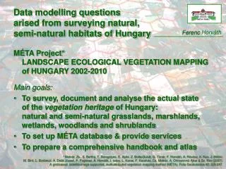
Data modelling questions arised from surveying natural, semi-natural habitats of Hungary. Ferenc Horváth. MÉTA Project* LANDSCAPE ECOLOGICAL VEGETATION MAPPING of HUNGARY 2002-2010 Main goals :

E N D
Data modelling questionsarised from surveying natural, semi-natural habitats of Hungary Ferenc Horváth MÉTA Project*LANDSCAPE ECOLOGICAL VEGETATION MAPPING ofHUNGARY 2002-2010 Main goals: • To survey, document and analyse the actual state of the vegetation heritage of Hungary:natural and semi-natural grasslands, marshlands, wetlands, woodlands and shrublands • To set up MÉTA database & provide services • To prepare a comprehensive handbook and atlas * Molnár, Zs., S. Bartha, T. Seregélyes, E. Illyés, Z. Botta-Dukát, G. Tímár, F. Horváth, A. Révész, A. Kun, J. Bölöni, M. Biró, L. Bodonczi, Á. Deák József, P. Fogarasi, A. Horváth, I. Isépy, L. Karas, F. Kecskés, Cs. Molnár, A. Ortmann-né Ajkai & Sz. Rév (2007): A grid-based, satellite-image supported, multi-attributed vegetation mapping method (MÉTA). Folia Geobotanica 42: 225-247.
Standard Habitat Classification* NatureSDIplus, kick off … Marshes: • Eu- and mesotrophic reed and Typha beds, • Oligotrophic reed and Typha beds of fens, floating fens • Glyceria, Sparganium and Schoenoplectus beds • Water-fringing helophyte beds with Butomus … Dry deciduous woodlands: • Closed termophilous oak woodlands • White oak scrub woodlands • Turkey oak - sessile oak woodlands • … * Bölöni, J., Zs. Molnár, E. Illyés & A. Kun (2007): A new habitat classification and manual for standardized habitat mapping. Annali di Botanica (nuova serie) 7: 55-76.
Why a new Habitat Classification? Phytosociology • plant species composition • sampling (relevé) based • strong tradition • 1 : 5.000 • too specialized • not include all Habitat Classification • all (semi-)naturalhabitat types • strong BioDiv relevance • equivalent & complement toN2000 habitats • Hungary & Pannonian Ecoregion CORINE LCover • include all LC types • EU standard • 1 : 100.000 • mainly man-influenced • no biodiversityrelevance > 600 types 86 categories 26 LC class >>> transformation rules, interlinkage!?
MÉTA Methodology • Raster (MÉTA hexagon) based • Image supported • Multi-attributed • Field work 1 km
Habitat Maps 5 km • MÉTA • hexagon based • multi-attributed • from regionalto countrywide
Habitat Maps 5 km • Traditional • vector based • 1 : 5.000 5 km >>> multiple habitat records by spatial units!
Qualifying habitats - NATURALNESS Landscape processes, land use • land transformation: habitat loss • disturbance: degradation - regeneration ! - invasion species/population loss, change, gain Naturalness – high relevance • to biodiversity & nature conservation • to ecosystem services & ecological stability • to sustainability >>> habitat quality ranking?!
Biodiversity & Landscape Indicators • Habitat Diversity • Natural Capital Index • Sustainable Land Use Classes >>> other, ie. synthetic attributes?!
Data modelling questionsarised from surveying natural, semi-natural habitats of Hungary MÉTA ProjectLANDSCAPE ECOLOGICAL VEGETATION MAPPING ofHUNGARY 2002-2010 • transformation rules, interlinkage between habitat classification systems? • multiple habitat records by spatial units, spatial aggregation? • habitat quality ranking? • applying other, ie. synthetic attributes:landscape & biodiversity indicators?