Download
1 / 9
90 likes | 199 Vues
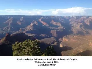
Hike from the North Rim to the South Rim of the Grand Canyon Wednesday , June 5, 2013 Mark & Max Miller. Starting the hike, dawn, North Rim, 42 degrees.

E N D
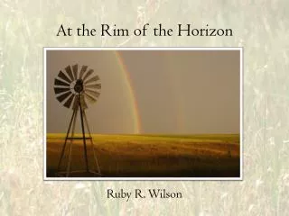
Hike from the North Rim to the South Rim of the Grand Canyon Wednesday, June 5, 2013 Mark & Max Miller
The North Kaibab Trail runs down this tributary canyon, from the upper right to the lower left of the picture. The North Rim is the horizon, along the top of the picture. The greenery toward the bottom of the canyon (bottom center of the picture) is the location of Phantom Ranch -- cabins where sane people spend the night before hiking back up to the top. (I think it can take years to get a reservation there, though.)
Son Max on the trail. 15 miles downhill to the Colorado River. Even downhill, it's a long hike, getting hotter all the way. The lower section turned into a twisting maze through steep cliffs that seemed like we had wandered into the Twilight Zone forever.
101 degrees here. This is the river that supplies most of the water for Las Vegas, Phoenix, and many other cities of the Southwest, along with irrigation for agriculture & golf courses, and much of the area's hydroelectric power. Hardly a drop makes it to the ocean anymore. The river levels have been steadily dropping, after many years of drought in the region.
Bright Angel Trail: the route up to the South Rim. You can see a bit of the Colorado River in this picture, and the trail starting to wind upward. This trail is about 9 miles long and about a mile uphill. They say you could stack 4 Empire State Buildings on top of one another from the bottom, and they would not reach the top. The bottom of the rim has a climate like the Mexico border, and the top of the North Rim has a climate like Canada.
The National Park Service posts many very graphic warning signs about the heat and other demands of the Canyon. Too many tourists skip down the trail without enough water, sunscreen, etc. - -then realize that it's a lot harder to hike back up. There are over 250 helicopter rescues per year -- at a cost to the victim, I'm told, of over $1500. My son started feeling the effects of the heat shortly after we crossed the river: he drank plenty of water, but probably lost too much salt. He had a looong, slow climb back to the top -- but he did it! (Not to brag, but I felt pretty good; I had been working out on stair steps in the Mississippi heat for months in advance.) Fortunately, we had brought flashlights, just in case. We made the South Rim by 10:00 p.m., & were showered and tucked in our beds at the lodge shortly thereafter. Too late for dinner that night, but it was a darn good breakfast the next morning :-)
My boots, that night, tied together with the chinstrap of my hat after the hot rocks of the Canyon floor melted the glue holding on the soles. To their credit, these (LL Bean) boots survived Katrina clean-up, a week's backpack through Yellowstone, multiple backpacking trips in the Smokies, and recent tornado clean-up in Hattiesburg.