Download
1 / 27
270 likes | 422 Vues
What is ?. 7.1. ما هو Google ( جو جل ) ؟. Geographical information by the combination of: المعلومات الجغرافية المكونة من Imagery الصورة 3D geography جغرافيا ثلاثى الأبعاد

E N D
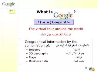
What is ? 7.1 ما هو Google ( جو جل ) ؟ Geographical information by the combination of:المعلومات الجغرافية المكونة من • Imagery الصورة • 3D geography جغرافيا ثلاثى الأبعاد • Maps خرائط • Business data بيانات العمل The virtual tour around the world الرحلة الأفتراضيه حول العالم
Google EarthDownload for free Website: http://earth.google.com
Possibilities of Google Earthامكانيات جو جل الأرض Navigating the earth Search for places and directions Marking places on the earth 1 – الإبحار او الملاحة فى الأرض 2 – بحث الأماكن والاتجاهات 3 – تحديد الأماكن على الأرض
Three ways to navigateثلاثة طرق للملاحة • Use navigation control • Use mouse • Use keyboard * التحكم باستخدام الملاحة * استعمال الماوس * استعمال لوحة المفاتيح
Navigation controlتحكم الملاحة Zoom in/out the view تكبير المنظر للداخل / خارج Move over the earth حركه على الأرض
Navigation controlتحكم الملاحة Rotate the view تدوير المنظر Zoom in/out the view تكبير المنظر للداخل / خارج Tilt the view ملء المنظر Move over the earth حركه على الأرض
For example:Tilt and rotate Mt Araratكمثال : ملء وتدوير Mt Ararat Tilt and rotate
Navigation controlتحكم الملاحة Rotate the view Zoom in/out the view Tilt the view Reset northwards Reset tilt Move over the earth
Layersالطبقات While exploring a location, specific features in the “Layers” menu can be turned on. The map will show these features. بينما استكشاف الموقع، قائمة المميزات المحددة فى الطبقات يمكن ان تفتح ، والخريطة ستوضح هذه المميزات
For example: Londonكمثال : لندن Click on Google Earth Community
3D Viewمنظر ثلاثى الابعاد Some parts of Google Earth display 3D builldings. بعض اجزاء من جو جل الأرض يعرض بناء ذو ثلاثى الأبعاد Click on 3D Buildings انقر على بناء ذو ثلاثى الابعاد
2. Search for places and directions2 – البحث للأماكن والاتجاهات Fly to الطيران الى Local Searchالبحث المحلى Directionsالاتجاهات
Fly Toالطيران الى Fill in a city name, address, zipcode, etc, click on search and you will fly towards the place. املاء فى اسم المدينة , العنوان ، رمز الضغط الخ , انقر على بحث واتت سوف تطير نحو المكان
Local Searchالبحث المحلى Google search makes it possible to find a local business. Fill in a certain business, click on search and Google Earth displays it and gives a list. بحث جو جل يجعله ممكنا للحصول العمل المحلى. املأ بعض العمل , انقر على بحث وجو جل الأرض يعرضه ويعطى قائمة
For example:Search for hotels in Londonكمثال : بحث للفنادق فى لندن
Directionsالاتجاهات Enter a place/address in the “To here” and “From here” link and the direction will be given. Click play and Google Earth will even fly along the route. ادخل المكان / العنوان فى ” الى هنا“ و ” من هنا“ والوصل سوف يعطى الاتجاه . انقر التشغيل وجو جل الأرض سوف يطير على طول الطريق
For example:From Russel Square to Ldn Bridgeكمثال : من مربع رو سل الى جسر لندن Zoom in … … or tilt and rotate
3. Marking places on the earthاشارة الأماكن على الأرض Features on the map, if turned on, are indicated by a variety of placemarks. By clicking on the placemark, information can be obtained. الملامح على الخاريطه , فى حالة التشغيل هناك مؤشر الى تنوع اشارات المكان . بواسطة النقر على اشارات المكان يمكن الحصول على المعلومات
For example:Earthquakes in Eastern Turkeyكمثال : زلزال فى شرق تركيا
Data inputمدخلات البيانات Data can be put in Google Earth and shared with other users. Find a location Give it a placemark and a description/weblink The data is saved in My Places • يمكن وضع البيانات فى جو جل الأرض والمشاركة مع مستخدمين آخرين • ايجاد الموقع • اعطاء اشارة الموقع التوصيف / ربط موقع الشبكة • حفظ البيانات فى الموقع
Final remarksالملاحظات النهائية Streaming indicator (bottom of image): All available data is reached. Fly To, Local Search and Directions limited outside US, Canada and the UK. High resolution for major cities (especially US) Every month new updates Other Google Earth Products * مؤشر الانسياب ( قاع الصورة ) وصل جميع البيانات * التحليق الى , بحث محلى واتجاهات محدودة خارج الولايات المتحدة الأمريكية , كندا , المملكة المتحدة * عالى الثبات للمدن الرئيسية ( خاصة امريكا ) * انتاج اخر من جو جل الأرض