Earth Observation for Climate Change
570 likes | 891 Vues
Earth Observation for Climate Change. International trends & developments How to promote earth observation applications? How to get funding? Capacity building. 0. Introduction. Mark Noort, consultant, project manager HCP international: consulting, marketing of earth observation

Earth Observation for Climate Change
E N D
Presentation Transcript
Earth Observation for Climate Change International trends & developments How to promote earth observation applications? How to get funding? Capacity building
0. Introduction Mark Noort, consultant, project manager HCP international: consulting, marketing of earth observation Coordinator GEONetCab: project for promotion & capacity building of earth observation applications
Earth observation applications • On the verge of reaching new user communities • These new user communities need to be involved • Weakest link / last mile aspects are important • Marketing needed: promotion & capacity building
Life cycle of products & services Initialization System analysis & design Rapid prototyping System development Implementation Post-implementation
Assessment of business & funding opportunities • Categories of environmental management products & services • Life cycle phase of product or service • Regional context, level of technological & economic development • Optimum marketing mix
Goals • Increased resilience of communities with respect to climate variability • Increased adaptive capacity of natural and managed systems under current and predicted climate variability Mainstreaming adaptation to climate change in agriculture and natural resources projects (World Bank)
Data needed for monitoring (from “Climate knowledge for action”) * Those to which satellites make an important monitoring contribution
Data Portals Climate change knowledge portalhttp://sdwebx.worldbank.org/climateportal/index.cfm Climate change explorer http://weadapt.org/knowledge-base/using-climate-information/the-climate-change-explorer-tool Climate wizard http://www.climatewizard.org/ UNDP adaptation learning net http://www.adaptationlearning.net/ IPCC data distribution center http://www.ipcc-data.org/ Earth System Grid http://www.earthsystemgrid.org/home.htm; jsessionid=92341D76DB0CDDB7EE13A2D59C9B80D5
Approach • Choose entry points such as food security or risk management • Identify champions = most appropriate counterpart • Show vulnerability patterns & socio-economic impact • Adaptation: different levels of possible regret (no, low, high) -> aim at no regret, high impact Mainstreaming adaptation to climate change in agriculture and natural resources projects (World Bank)
The Role of Science • Improved projections, predictions and monitoring of multidecadal global to regional climate changes • Stronger scientific foundation for adaptation and mitigation • Improved predictions of high-impact weather and climate • Science-based support to responses and planning • Developing national and international climate services • Education and capacity building An Earth-system prediction initiative for the twenty-first century (AMS)
Important aspects related to carbonaccounting programmes, such as REDD • MRV: measurement, reporting, verification • Control of emissions leakage (displaced emissions): reduction in one place leads to higher emission in another area • Closely related to tenure questions • Payment for ecosystem services (PES) • Communication with and involvement of villagers • Approved methodologies for verified carbon standard (VCS) • Land use / land cover baseline, using GIS and remote sensing • Phases, approaches, tiers and steps for measuring / assessing REDD Analysing REDD+, challenges and choices
Response strategies • Reactive adaptation • Anticipatory adaptation Climate change: impacts, vulnerabilities and adaptation in developing countries (UNFCCC) • Africa: temperature ↑, rainfall ↓, droughts ↑, floods ↑ • Asia: temperature ↑, rainfall ↓ (except Central Asia), droughts ↑, cyclones ↑, heat waves ↑ • Latin America: temperature ↑, rainfall ?, glaciers ↓, landslides ↑, floods ↑, hurricanes (Caribbean) ↑, heat waves ↑ • Small island developing states: temperature ↑, rainfall ↑ or ↓ (depending on region), cyclones ↑
Lessons from experience • Climate change needs to be treated as a major social and economic risk to national economies (not just environmental) • Addressing short-term vulnerabilities is the best strategy for preparing for long-term impacts • Important role for communities and private sector in climate risk management (involve in planning and implementation of adaptation • Full buy in from regulatory agencies is needed • No-regrets strategies and “soft” solutions embedded in more sustainable natural resources management should be pursued where they are available Managing climate risk (World Bank)
Adaptation at the farm level • Crop calender shifts and crop changes • Soil and water management changes • Fertilizer use / land use decisions • Water, labour, capital use (intensive or not, efficiency) Needed: Climate information, seasonal climate forecasts, early warning, infrastructure, insurance, technology development (crop varieties, irrigation technology) Mainstreaming adaptation to climate change in agriculture and natural resources projects (World Bank)
It can be simple Trees planted in Niger for soil conservation (left 1975, right 2003)
More references on monitoring: Climate knowledge for action, a global framework for action – empowering the most vulnerableAdvocating a Global Framework for Action, consisting of a User Interface Platform, Climate Services Information System and three components: observations and planning, research modelling and prediction, capacity building Climate and land degradation (WMO) Overview of trends, causes and measures (including remote sensing for agroclimatic mapping) Guidelines on analysis of extremes in a changing climate in support of informed decisions for adaptation (WMO) Guide on datasets, observations, analysis and toolkit(s) WCRP (GEWEX, CliC, CLIVAR, SPARC) documents Reports on clouds, implementation plan and achievements, fact sheets on sea level rise and monsoons State of the climate in 2011 Very detailed overview of the state-of-the-art in climate research, related to the year 2011 River basins and climate change report 2012 Overview of climate change in river basins + case studies
More references on adaptation: Mainstreaming climate change adaptation into development planning: a guide for practitioners (UNDP/UNEP) Guide for policy formulation, including adaptation indicators Forest service roadmap for responding to climate change (USA) Approach towards adaptation, mitigation and sustainable consumption) Planning for climate change: leading practice principles and models for sea change communities in coastal Australia Study on possible adaptation measures for coastal climate change Integrating agriculture, forestry and other land use in future climate regimes Overview of possible adaptation measures, including the use of remote sensing World Bank studies on coastal cities in Northern Africa Reports on risks and possible actions, see also GEONetCab disaster management toolkit
More references on carbon accounting: Forest carbon accounting, overview and principles General guidelines, stresses importance of remote sensing Analysing REDD+, challenges and choices Detailed overview of approach, methodology, guidelines and performance indicators
More general references: Kick the habit (UN) General introduction on climate change and what you can do as an individual Acting on climate change: the UN system delivering as one Overall description of UN strategy Climate change science compendium Comprehensive popular overview of climate science Managing the risks of extreme events and disasters to advance climate change adaptation – summary for policy makers (IPCC) Short description of risks and adaptation options for decision making
State-of-the-art Earth observation is new technology. Learn technical skills, but when back in professional practice, it has to be put to good use. That involves ‘selling’ it. How to do that? To whom? Could be your own boss, local authorities, communities, etc.
Categories of products and services • monitoring and modelling (global/regional -> greenhouse gases, arctic environment, oceans, agriculture, weather) • carbon accounting • prediction and mitigation of effects
Main advantages of using satellite data for climate change • Year-round data collection, also when field data collection is not possible(remote locations, bad weather conditions) • Reduced costs when compared to traditional field data collection methods in remote environments (land cover classification for example). • Remote sensing systems can capture a synoptic view of the landscape and oceans, to more adequately characterise dynamics. • Remote sensing provides additional information that can supplement more intensive sampling efforts and help extrapolate findings From: Space technologies and climate change, implications for water management, marine resources and maritime transport (OECD)
Visualization with Google Earth Using digital globes to visualize climate change impact -> testing Google Earth applications to visualize climate change in Australia + community forest monitoring (Google Earth + handheld GPS) Climate impact water cycle presentation (Australia) 4D water visualization potential in Google Earth
Monitoring references: Capacity development and integration of local knowledge for climate change impacts and vulnerability assessment (Philippines) SimCLIM and impact models for climate change preparedness at the local level Accelerated changes of environmental conditions on the Tibetan plateau caused by climate change Changes in temperature, NDVI, wind and heat flux over the last decades, derived from remote sensing Changes in land cover, rainfall and stream flow in Upper GilgelAbbay catchment, Blue Nile Basin (Ethiopia) Study on changes over the last decades based on several satellite images Global biophysical datasets (NASA) presentation Overview of results/trends of different satellite measurements related to climate change
More monitoring references: GEO Carbon showcase: http://www.youtube.com/watch?v=cmS3RergtP4 GMES climate change: http://www.youtube.com/watch?v=ujDU6hyn-vg General climate change: http://preview.grid.unep.org GEO Task US-09-01a: Critical Earth Observation priorities – climate societal benefit area Overview of observation needs for research, modelling, policy formulation and decision making EUGENE climate change status quo and workshop report Overview of data and information requirements , actors, models, outputs and gaps
Example: change in annual runoff by 2041-2060, relative to 1900-1970 in % From: Water resources climate change presentation (Japan)
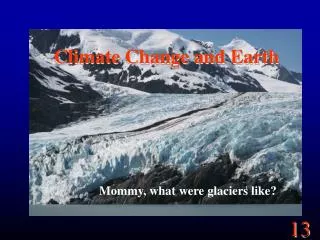
Support change detection Muir glacier, Alaska – August 1941 Muir glacier, Alaska – August 2004
Adaptation references: NASA regional integrated sciences and assessments annual report 2011 Examples of successful earth observation applications for climate change preparedness, mainly in the areas of drought and water management Tearfund CEDRA toolkit Step-by-step guide to define community climate adaptation activities in developing countries Important adaptation topics: disaster risk management & food security, see: • GEONetCab disaster management toolkit • GEONetCab crop modelling toolkit
Carbon accounting references: GMES brochures on forest carbon tracking & arctic monitoring Bolsafloresta progress report Use of remote sensing (INPE, Planet Action) for monitoring community REDD activities in Brazil SARvision presentation REDD+ examples from Guyana and Surinam and oil palm example from Malaysia Global and regional land cover and land change monitoring: progress and needs (Wageningen) Overview of land cover change and carbon stock monitoring Field examples of community forest carbon mapping Chapters from book on community forest management Community forestry as a prerequisite for REDD Overview of requirement, possibilities and difficulties of community forestry, including the use of remote sensing
More carbon accounting references: Carbon accounting example Madagascar (Planet Action) Land use analysis, above-ground biomass assessment with LIDAR, soil organic carbon mapping with satellite imagery, scenario development, scaling up from project level to national level http://www.planet-action.org/automne_modules_files/polyProjects/public/r8299_93_reddpilot_project_goodplanet_madagascar_17dec10.pdf Global Forest Observation Initiative (GFOI) implementation planOverview of requirements, possibilities and difficulties of community forestry, including the use of remote sensing GOFC-GOLD sourcebook Exhaustive overview of assessing carbon stocks and emissions, detailed description of methodology
Other references: Land administration options for projects involving payments for carbon sequestration Article on remote sensing and participatory land tenure identification for payment for ecosystem services, examples from Brazil, Mozambique and Indonesia GIS for climate change (ESRI) Climate change is a geographic problem (ESRI) Practical examples and approach
Marketing of earth observation Marketing of earth observation is difficult. New technology, few big companies, lots of small ones. Lots of reports describing the bottlenecks, like reliability, data access, data continuity, etc. Means that relatively a lot of effort is needed to promote EO.
Points to keep in mind: • Look for opportunities, where can you have most success in a short time: quick-wins. • Target the right audience to start with: who would be interested and listen to you? • Identify the problem that they are trying to solve: is it the same as yours? • Learn to speak the same language. Example ‘ECVs’: this is a term most managers do not understand and do not care about. Use terms related to mitigation and adaptation. • Look for examples from elsewhere (success stories): solutions that work and are affordable.
Be patient: introduction of new technology and / or applications takes time
Approach • Share information on your subject (a thing you are doing) and think that is interesting for your contact, then look for the link. Could this solve a problem for your partner? Are adjustments necessary? Need other parties be involved? Take it from there. • LEADS, LEADS, LEADS
How? • Establish your network. • Look for opportunities. • Write a good proposal. • Promise much, but not too much.
Proposal outline(more detailed version in separate document, see also www.geonetcab.eu ) 1. Introduction / relevance 2. Objective(s) 3. Activities 4. Output 5. Management & evaluation 6. Risk assessment 7. Time schedule 8. Budget Annexes
Other references • Civicus: writing a funding proposal • Michigan State University: guide for writing a funding proposal • ESRI: writing a competitive GRANT application • REC: project proposal writing
Again: • SHARED PROBLEM • SHARED LANGUAGE • SHARED SOLUTION If all else fails, try to link with a more popular (and easy to understand) topic.
General Marketing is promotion + capacity building. Especially for the introduction of new technologies capacitybuilding is important at all levels. Capacity building is the instrument to increase self-sufficiency and make solutions work.
Think of: • Different instruments for different levels: workshops for decision makers and awareness raising, detailed technical training for professionals. • Provide follow-up. Getting funding for good capacity building is difficult: everybody agrees that it is important, but nobody has time. • Training is usually part of funding of big projects that are managed by big companies or ministries, as a consequence capacity building is forgotten (in the end). • Aim at small budgets that are available without having to tender.
Examples & references global change SysTem for Analysis, Research & Training: START provides guidelines and training opportunities related to climate change issues TearfundCEDRA toolkit Step-by-step guide to define community climate adaptation activities in developing countries GEONetCab capacity building web www.geonetcab.eu compilation of tutorials, references, open-source software, etc. GEO Portal: www.earthobservations.org
START: biodiversity and climate change training www.start.org