Download
1 / 20
200 likes | 326 Vues
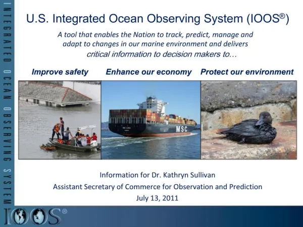
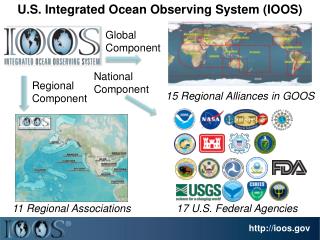
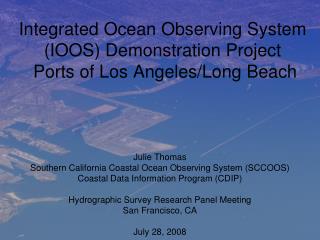
Integrated Ocean Observing System (IOOS) Demonstration Project Ports of Los Angeles/Long Beach. Julie Thomas Southern California Coastal Ocean Observing System (SCCOOS) Coastal Data Information Program (CDIP) Hydrographic Survey Research Panel Meeting San Francisco, CA July 28, 2008.

E N D
Integrated Ocean Observing System (IOOS) Demonstration Project Ports of Los Angeles/Long Beach Julie Thomas Southern California Coastal Ocean Observing System (SCCOOS) Coastal Data Information Program (CDIP) Hydrographic Survey Research Panel Meeting San Francisco, CA July 28, 2008
Presentation Outline • Overview of ports of Los Angeles/Long Beach Integrated Ocean Observing System (IOOS) Project • Proposed San Francisco Project • How can these two sites serve as a template for other major ports within the US?
CALIFORNIA OCEAN CURRENTS MONITORING Program COASTAL DATA INFORMATION PROGRAM • Based at Scripps since 1975 • 35 Wave Stations • 14 People • $2.5M+ / year budget • Funded by: USACE CDBW (SCCOOS BEACON ONR…) • Based at Scripps since 2004 • $21M initial funding • Funded by: • Coastal Conservancy • Statewide Program
Why was LA/LB choosen for the IOOS project site? • Combined the ports of Los Angeles/Long Beach are the 5th largest in the world. • Over the last decade, the Los Angeles Pilots have safely completed more than 52,000 vessel movements. • Last year, Long Beach Pilots made approximately 8,000 ship moves. • Since 2000, more than 6 millionpassengers have visited Catalina Island through thePort of LA. Busy Port and close to home!
Interactive Google Maps Display of Near Real-Time Surface Currents Leverage existing HF Radar infrastructure http://sccoos.ucsd.edu
San Pedro Channel Leverage existing infrastructure for Wave products Pilot Transfer Area San Pedro Wave Buoy South Swell West Swell SAN PEDRO CHANNEL
Model Validation “Buoy Network” Spectral Refraction Model Local Seas Offshore Wave Buoys Measure Arriving Swell from the Open Ocean Offshore Buoys measure
Waves and Currents in the San Pedro Channel SCCOOS providing currents CDIP providing wave observations, Nowcasts and forecasts. http://sccoos.ucsd.edu/themes/harbors
Ports of Los Angeles/Long Beach Click on your area of interest. Catalina
3 day wave forecast Capability to send automated notification when thresholds are exceeded!
Coastal Conservancy is facilitating discussions as to how we can develop an Integrated currents and waves website for San Francisco. Lack of data Inside the Golden Gate Need more wind and current data.
San Francisco Bar Buoy - Collaboration Buoy- driven Wave Model Predictions CDIP Point Reyes Buoy Long Period Swell CDIP Bar Buoy Short Period Seas Swell + Sea Prediction
Shallow Water Wave Breaking Predictions on the Bar SF BAR BUOY Occasional Wave Breaking Frequent Wave Breaking
Can this project serve as a template for additional Ports and Harbors? • Need to leverage existing infrastructure! • - Where do we have HF Radar and in-situ measurements for currents? • Where do we measure high resolution wave data? • For what regions are accurate, high resolution wave models developed?
CDIP Wave Buoys Near Ports and Harbors How important is consistency for The inter and intra-state maritime community? Each port has its own unique Set of challenges…no one Template fits all! Port/Harbor buoys Other CDIP wave buoys
Next Steps and Issues? • Discussions are in progress with NOAA Physical Oceanographic “Real-Time System (PORTS ) as to how best integrate with their system. • Discussions are in progress between NOAA and the Army Corps to develop • a National Waves Plan - assuring that there are quality wave measurements • at every port entrance. • Questions and Issues: • - Is this project worth expanding to additional ports? Are the operational folks really using the site? • - Is consistency of the same “look and feel” web presentation important? • - How do we talk the same language (waves, swell, seas, Hs, Tp, Dp….) ? • - What is the best data feed to make the products useful offshore? • - Would training/educational workshops be beneficial? • - What is the State and Federal commitment? • - What is the liability? (Answer: Our products do not contain warnings…that is the NWS office’s task. We provide the best data available so that the maritime community can make educated and informed decisions.)
This project is an example of IOOS commitment to NOAA’s mission for assuring safe and efficient maritime transportation. 75% of commerical vessel accidents are attributed to human error.