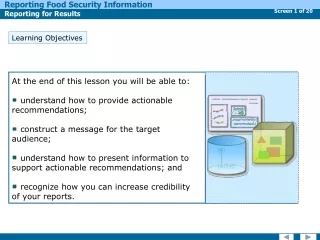

Learning Objectives
E N D
Presentation Transcript
An overview of the concepts and components that support the data sharing and integration mission of the US National Spatial Data Infrastructure (NSDI)
Learning Objectives • After completing this lesson the student can: • list the key components of a Spatial Data Infrastructure (SDI) • explain government’s role in infrastructure development • discuss key National Spatial Data Infrastructure (NSDI) elements and the manner in which the elements support development of the NSDI
What is a Spatial Data Infrastructure (SDI)? • “The SDI provides a basis for spatial data discovery, evaluation, and application for users and providers within all levels of government, the commercial sector, the non-profit sector, academia and by citizens in general.” • --The SDI Cookbook http://www.gsdi.org
What is a Spatial Data Infrastructure (SDI)? • Components of a Spatial Data Infrastructure • Policies & Institutional Arrangements governance, data privacy & security, data sharing, cost recovery • People training, professional development, cooperation, outreach • Data digital base map, thematic, statistical, place names • Technology hardware, software, networks, databases, technical implementation plans
Government Role in Infrastructure • The US Government: • developed the National Interstate Highway system that serves as the baseline infrastructure for commerce • advanced the Internet infrastructure design • developed Global Positioning System technology • promotes standards to enable compatible solutions • funds national, state, local and University research, design and implementation We cannot imagine the fullest extent of how an SDI will be populated or what applications will live upon it!
NSDI Elements • Here’s an overview of the elements and status of the NSDI...
NSDI Elements • The first task is to inventory who has what data of what type and quality • A standardized form of metadata was published in June 1994 by the Federal Geographic Data Committee. The US is in the process of adopting a an international metadata standard. Metadata
Geospatial Metadata • Metadata can apply to data, data delivery services and other information resources • Inventory provides documentation of existing internal geospatial resources within an organization • Catalog permits structured search and comparison of held geospatial resources by others • Documentation provides end-users with adequate information to take the resource and apply it in an appropriate context
Geospatial Metadata • Metadata Formats • The FGDC Content Standard for Digital Geospatial Metadata (CSDGM, 1998) is exchanged in XML or text format • The metadata community offers metadata formatted using other metadata standards, including Dublin Core, ANZLIC, and profiles of ISO 19115 • Any metadata record can be presented as more reader friendly using HTML format
Framework GEOdata Geospatial Data • Special-use thematic layers are built and described as available geospatial data • Common data layers are being defined in the NSDI Framework activity. See Framework Training Lessons under NSDI Data Themes in the NSDI Training Project. Metadata
Geospatial Data • Framework Data Standards • Eleven abstract data content standards are being promulgated through the ANSI process as American National Standards • Each thematic content standard has an informative annex describing its implementation as XML/GML Application Schemas using OGC Web Feature Services
Geospatial Data • Framework supports: • community standards for sets of spatial features, feature representation, and attributes to a least common denominator • exchange of data through collecting, converting, or associating information to common Framework data standardswith an encoding format • multiple representations of real-world features at different scales and times by feature identifier and generalization
Geospatial Data • NSDI Framework Themes • Elevation • Orthoimagery • Hydrographic Data • Governmental Unit Boundaries • Cadastral • Geodetic Control • Transportation • Roads ▪Air ▪Transit • Rail ▪Marine
Geospatial Data • Framework content models should be: • simple Place minimal additional technical and other demands on contributors • attractive Be able to incorporate data from many sources • adaptive Evolve with contributors’ changing requirements and capabilities • responsive Sensitive to different missions, goals, resources, and schedules
Geospatial Data • With and Without Without Framework With Framework Framework multiple translators per system 1 translator per system
Framework GEOdata Services • The NSDI includes the services needed to help discover and interact with data Services Metadata
Framework GEOdata Discovery Services • Discovery Service is the core function of the NSDI Clearinghouse for geospatial information and the Geospatial One-Stop (GOS) portal, geodata.gov Discovery Access Processing Services Metadata
Discovery Services • Geodata.gov’s portal provides: • uniform, distributed search through a single user interface to all domestic metadata collections to find data and maps • free advertising to provide world access to your holdings under the principle of “truth-in-labeling” • full-text metadata search and categorical browsing • links to full data access and web mapping and feature services, where available geodata.gov harvests XML forms of domestic metadata from Z39.50 and browsable Web directories into a searchable collection or ‘cache’
Discovery Services • Geodata.gov provides: • Map service can be registered and visualized in the geodata.gov viewer • Downloadable data websites and applications can be registered as resources • Thematic and geographic communities can post and manage selected content • NSDI Stakeholders can post data collection plans and requirements at the geodata.gov Marketplace • available online at http://geodata.gov
Discovery Services • Publish Your Metadata • Cooperate on Data Acquisitions • Browse Communities • Find Data or Services • Visit Featured Maps andApplications
Framework GEOdata Access Services • A second category of services provides standardized access to geospatial information via static files on ftp or via web services. These services deliver ‘raw’ geospatial data, not maps Discovery Access Processing Services Metadata
Access Services • Data Access Concepts: • Standardization of data access implies several things: • definition of model used for the data to be exchanged • adoption of an exchange or encoding format • agreement on data access protocol(s) • Communities should publicize the agreed means of operation to simplify data exchange, as with Framework
Framework GEOdata Access Services • A third class of services provides additional processing on geospatial information Discovery Access Processing Services Metadata
Processing Services These include capabilities that extend and enhance the delivery of data through processes applied to raw data • Web Mapping Services (OGC WMS) • Symbolization • Coordinate Transformation (OGC WCTS) • Analysis or topologic overlay services • Routing services
Services Metadata Framework GEOdata Standards Standards • Standards touch every NSDI activity
Standards Standards establish common specifications and practices for: • data content • data models of representation • data processing • data documentation • data exchange • thematic vocabularies and keywords • software interfaces • web mapping and feature services
World Wide WebConsortium(W3C) Open Geospatial Consortium(OGC) RegionalSDIs Federal Agencies State Government NSDI ThematicSDIs Universities Non-Gov’t Orgs (NGOs) OtherNSDIs Private Sector InternationalOrganizationfor Standards (ISO) AmericanNational Standards Institute (ANSI) Standards • NSDI standards are developed in cooperation with many communities
Partnerships Services Metadata Framework GEOdata Standards Partnerships • Partnerships extend our capabilities
Partnerships Partnerships are the glue of the NSDI • Federal Geographic Data Committee defined roles and responsibilities enable collective governance • NSDI Cooperative Agreements Program (CAP) seed funding furthers existing efforts toward common goals and extend local capabilities in technology, skills, logistics, and data • NSDI CAP: Fifty States Initiative FGDC provides seed funding through grants to states to promote the development of State-based NSDI plans
Partnerships Partnerships are the glue of the NSDI • USGS Geospatial Liaisons USGS has a national network of State Geospatial Liaisons who work with State, local, and non-governmental partners to leverage resources and jointly develop infrastructure and data to support the NSDI • Policy and Planning collaborative strategies address the needs of many and leverage the resources of all
Partnerships • Federal Geographic Data Committee (FGDC) • an interagency committee promoting the coordinated: • development • use • sharing • dissemination • of digital geospatial information resources via the NSDI
Partnerships • FGDC Organization • Steering Committee: federal agency decision-makers and non-federal collaborating partners that establish NSDI policy & direction • Executive Committee: In 2008, Executive Committee was added to the FGDC steering committee. EC is comprised of agency officials with major geospatial component in their mission to provide additional guidance, advice, and recommendations. • National Geospatial Advisory Committee- a federal committee provides advice and recommendations on the management of federal programs, provides a forum to convey views representative of non-federal stakeholders in the geospatial community.
Partnerships • Coordination Group: federal agency technical representatives & NSDI Stakeholders responsible for guiding NSDI implementation • Thematic Subcommittees: address issues specific to data themes • Working Groups:address issues specific to NSDI components • Secretariat Staff: responsible for the daily administration of NSDI activities
Partnerships NSDI Cooperative Agreements Program An annual funding program that assists the geospatial data community in implementingthe NSDI. • open to State,local and tribal governments, academia, commercial, and non-profit organizations • emphasizes partnerships, collaboration and leveraging of geospatial resources Visit: http://www.fgdc.gov/grants • CAP supports: • Standards implementation through guide development and training • Participation in the Clearinghouse and Geospatial One-Stop Portal • Implementing OpenGIS Web Mapping and Web Feature Services • Demonstrating to Federal business managers the value of incorporating geospatial approaches into business processes • Establishing participation in The National Map • Building organizational collaboration and cooperation among organizations
Partnerships • NSDI Cooperative Agreements Program • Fifty States Initiative • An FGDC & National States Geographic Information Council (NSGIC) partnership to: • encourage implementation of Statewide Spatial Data Infrastructures (SSDIs) • provide guidance on planning activities • encourage formation of partnerships and leverage of resources • provide a uniform framework for the SSDI strategic and business plans
Partnerships • USGS Geospatial Liaisons • A nationwide network of USGS geospatial specialists located in the field to: • cultivate and sustain long-term partnerships to support NSDI implementation • advise and consult on geospatial data and technology • foster and improve communications among all NSDI stakeholders
Partnerships Policy and Planning • Geospatial information policy and strategic planning ensure: • continued investment of resources in high value geospatial data programs, activities and technologies • information resource management as an integral part of overall mission planning • effective and economical development of the Nation’s spatial data infrastructure
Partnerships Policy and Planning • Requires that NSDI stakeholders at all levels of government, industry, academia, and community participate to ensure that geospatial data integrate both horizontally and vertically to support: • business operations • disaster management • natural resource management and other geospatial activities that cross geopolitical boundaries and require data at multiple scales.
Summary We are all Stakeholders in building the NSDI because we all: • have geospatial data resources of value to those beyond our own community • are in need of geospatial data resources and applications developed by others • have limited time and resources • The NSDI provides the metadata, framework data, standards, services, and partnerships fundamental to the effective sharing of geospatial data and resources
Summary • You have completed “Overview of the NSDI” • Through this lesson you should be able to: • list the key components of a Spatial Data Infrastructure (SDI) • explain government’s role in infrastructure development • discuss key National Spatial Data Infrastructure (NSDI) elements and the manner in which the elements support development of the NSDI