Download
1 / 60
950 likes | 2.35k Vues
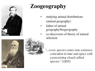
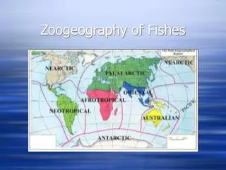
Zoogeography of Fishes. Zoogeography of Fishes. Patterns and processes in the distribution of fishes (i.e., what causes certain fish species to be where they are?) Global Regional Local Successively smaller sieves that determine fish distribution Predictability of fish assemblages.

E N D
Zoogeography of Fishes • Patterns and processes in the distribution of fishes (i.e., what causes certain fish species to be where they are?) • Global • Regional • Local • Successively smaller sieves that determine fish distribution • Predictability of fish assemblages
Global • Plate tectonics • Rearrangement of land masses • sunfishes restricted to N.A. (arose following split of land masses, temperate, freshwater)
Regional - Historic • Drainage Divides • Broad drainages isolate aquatic communities (Mississippi vs. Atlantic Slope)
Regional - Historic • Drainage Divides • Drainage rearrangement (stream capture) • Populations of Mississippi R. fishes on Atlantic slope • Etheostoma blennioides (Potomac captured Mississippi)
Regional—Historic • Glaciation • Mississippi Drainage oriented N – S • Fish disperse south • Atlantic Drainage oriented E – W • Teays R was the major N-W flowing river • Ice sheets dams caused it to flow S through the small Mississippi R. • Melt water cut through central highlands making Mississippi R the major river • Ancient Teays River Valley near present-day New and Kanawha Rivers
SE Fish Richness • Tennessee River most diverse • Atlantic slope least diverse • New / Kanawha River basin “relatively diverse” Warren et al. 1997
Regional - Local • Geology (regional characteristic that influences local conditions) • Habitat • Water Flow • Chemistry • Alkalinity - Hardness • Productivity
Regional - Local • Spatial Position • The position of a stream segment in a stream network influences species found there (distance from a species pool).
Local • Competition / Predation • Water Chemistry • Water Flow • Productivity • Habitat • Gradient • Stream Size Species Richness = -5.16 + 4.6 x (Basin Area) + 0.39 x (Link Order Diff) R2 = 0.79 df = 17 p < 0.0001
Barriers to Dispersal in Marine Systems Continents - e.g. Atlantic vs. Pacific faunas Temperature - e.g. tropical vs. temperate vs. polar Salinity - e.g. estuaries, freshwater (Panama Canal) Depth - deep-dwelling fishes can be isolated by submerged mountain ranges
Mechanisms for Dispersal in Marine Fishes Directed movements (e.g., with changes in temperature; migrations) Pelagic eggs/larvae - current-born dispersal Human action - transplants (e.g., striped bass, American shad in Pacific Ocean; 250 species introduced into San Francisco Bay)
Zoogeographic Groupings of Marine Fishes Continental Shelf (neritic) Pelagic Abyssal
Zoogeographic Groupings of Marine Fishes Continental Shelf (neritic) - 45% of all fishes Tropical Zone Temperate (North & South) Zones Arctic/Antarctic Zones Pelagic Abyssal
Zoogeographic Groupings of Marine Fishes Pelagic - Epipelagic (1.3% of all fish species) Meso- & Bathypelagic (5% of all fish species) Arctic Temperate Subtropical Tropical
Zoogeographic Groupings of Marine Fishes Continental Shelf (neritic) Pelagic Deep benthic (abyssal) 6.5% of all fish species little known about these
Example: Distribution of pelagic piscivores in north Pacific Ocean Arctic: Arctic char, pink salmon, some cods distributed north of 0° isotherm North Temperate: North Subtropical: Tropical:
Example: Distribution of pelagic piscivores in north Pacific Ocean Arctic: North Temperate: coho, chinook, steelhead, sockeye, chum salmon north of 14° isotherm, south of 0° isotherm North Subtropical: Tropical:
Example: Distribution of pelagic piscivores in north Pacific Ocean Arctic: North Temperate: North Subtropical: some tunas, marlins, basking sharks, mackerel sharks north of 20° isotherm, south of 14° isotherm Tropical:
Example: Distribution of pelagic piscivores in north Pacific Ocean Arctic: North Temperate: North Subtropical: Tropical: flying fish, tunas, whale sharks, marlins south of 20° isotherm in northern hemisphere and north of 20° isotherm in southern hemisphere
Definition & Overview Zoogeography - the study of the distributions of animal taxa over the surface of the earth Unique aspects of piscine zoogeography: longer period of record (since 350 mybp) constraints to dispersal in aquatic habitats (land masses) unique dispersal mechanisms - current movement of planktonic eggs & larvae
Interpretation of distribution patterns requires: Ecological information - e.g., can the fish taxa tolerate exposure to fresh water or salt water Freshwater dispersants - e.g., minnows - cannot tolerate any salinity Saltwater dispersants - freshwater fishes that can tolerate salinity - e.g., cichlids
Interpretation of distribution patterns requires: Geological information - what have been the past connections between water bodies past and present watershed configurations important - e.g., previous connections between Great Lakes basin and Mississippi River - 79% of fishes in GL Basin originated from Mississippi basin
Interpretation of distribution patterns requires: Geological information - continental drift
Interpretation of distribution patterns requires: Geological information - continental drift a single continent (Pangaea) existed as recently as Triassic (200 mybp) Pangaea split into two continents at end of Triassic (180 mybp): Northern continent - Laurasia (modern Eurasia & North America Southern continent - Gondwana (modern Africa, South America, Australia, Antarctica, India)
Interpretation of distribution patterns requires: Geological information - continental drift Gondwana split in Jurassic & Cretaceous Australia broke off first South America broke off later Several fish taxa are present only on southern continents: lungfishes - Australia, S. America, Africa cichlids - S. America, Africa, India characins - S. America, Africa
Interpretation of distribution patterns requires: Geological information - continental drift Laurasia split in Jurassic (120 mybp) North America separated from Eurasia Several fish taxa are present only on northern continents: Cyprinids (also have moved into Africa recently) Percids - Holarctic (in N. America & Eurasia) Catostomids - Nearctic (largely in N. America) Centrarchids - Nearctic (only in N. America) Cobitids - Palearctic (only in Eurasia)
Mississippi Basin Fauna illustrate these patterns well Contains ~ 330 species, 13 families Basin is ancient - present arrangement since Rocky Mtns. formed in Tertiary (~65 mybp) Ancient relics are extant today - have benefited from persistence of the basin: Chondrosteans - sturgeons, paddlefish gars, bowfins mooneyes, pirate perch, cavefishes - only found here
Mississippi Basin Fauna illustrate these patterns well New taxa originated and/or flourished here: Notropis/Cyprinella minnows (shiners) Etheostoma/Percina percids (darters) ictalurids (catfishes), especially Noturus - madtoms centrarchids, especially Lepomis (sunfishes) catostomids, especially Moxostoma (redhorses)
Why is the Mississippi fauna so diverse? Provided a refuge from glaciers, due to north-south axis Taxa could retreat south as glaciers moved south
Why is the Mississippi fauna so diverse? Provides a diversity of habitats: Different stream types: Coastal plain (Gulf of Mexico margin) Interior highlands Ozarks Tennessee/Kentucky plateau Interior lowlands Western (Missouri River basin) Central (Upper Mississippi River basin) Eastern (Ohio River basin)
Why is the Mississippi fauna so diverse? Provides a diversity of habitats: Speciation requires isolation - offered by these diverse AND separated habitat types e.g., Ozark fauna is unique from the Tennessee/Kentucky fauna, even though the habitats are similar - the Mississippi River valley separates them - no passage possible between for small taxa like darters, minnows, madtoms
Why is the Mississippi fauna so diverse? Provides a diversity of habitats: Species dependent on small, headwater streams are more easily isolated, and therefore are the most diverse groups shiners darters madtoms
Fish Fauna of the Great Lakes 1. Who are they? 2. Where did they come from? 3. What is the nature of the interactions among species?
1. Who are they? - How many are there? Low diversity: Native: 157 species Introduced: 22 species TOTAL: 179 species
Comparison with other fish faunas Laurentian Great Lakes: 179 species Coral Reefs: > 150 on 1 coral head Mississippi River Basin: > 330 species Amazon River Basin: > 2,000 species African Great Lakes: > 450 species ENDEMIC in ONE lake!
Why is diversity low? Temperature - cold
Why is diversity low? Temperature Productivity - low
Why is diversity low? Temperature Productivity Age - young
Why is diversity low? Temperature Productivity Age Connections to other lake and river basins - minimal
1. Who are they? - Two ecological groupings: Coldwater, deep lake group: Coolwater, shallow basin group:
1. Who are they? - Two ecological groupings: Coldwater, deep lake group: lake trout lake whitefish lake herring lake sturgeon deepwater sculpin deepwater ciscos Coolwater, shallow basin: