Download
1 / 41
410 likes | 528 Vues
This comprehensive overview explores the evolution and definition of Location-Based Services (LBS), detailing their intersection with essential technologies such as mobile devices, wireless communication, and Geographic Information Systems (GIS). Learn about key use cases, privacy considerations, interoperability challenges, and the potential of LBS in the burgeoning market valued at over $10 billion. With insights into how LBS can enhance user experience by providing tailored information based on geographic location, this session is vital for anyone interested in the future of mobile computing.

E N D
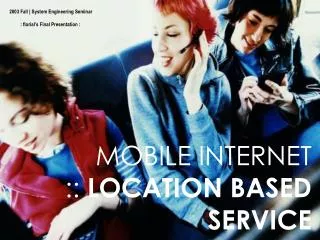
Information Technology I Special TopicsLocation Based Services 陳秋男 P93747001 蔡政賢 P93747003
Agenda • Emergence of LBS • What is LBS? • Basic Use Cases • Location Service Concepts • Research Issues • Privacy • Interoperability and Standard
Technical Business Innovations • 1876 Telephone • 1980 FAX • 1995 Internet • 1999 e-Everything • 2000 m – GIS and LBS
Convergence • The convergence of multiple technologies • Internet • Wireless communication • Geographic information system • Location technologies • Mobile devices
Emerging mobile computing application • Often need to know where things are physically located. • Location services, wireless location services, mobile location-based services • Relating location to other pertinent information gives meaning and value • We need directions from one place to another. • We want to interact naturally with I/O devices available in our environment. • Allow that mobile users (MUs) use services based in their position or geographic location
$10 Billion Internet and Mobile Location Services Market $5 Billion Market Size Inflection Point $1 Billion GIS Market 1980 2000 2005 1990 Time Emergence of Location Based Services
Nokia prognosis for 3G mobile communication Monthly income pr. user in euro (1 euro = 1 USD ca.) 100 Location based services 90 Div. telecomm. 80 Commercials Text messages Entertainment 70 Information services Photo messages Payment transactions 60 Music and video Internet surfing 50 Download from internet Chat on internet Multimedia messages 40 Vide conferencing 30 20 Normal speech 10 Fixed subscription fees 0 2000 2001 2002 2003 2004 2005 2006 2007 2008 2009 2010 2011
Agenda • Emergence of LBS • What is LBS? • Basic Use Cases • Location Service Concepts • Research Issues • Privacy • Interoperability and Standard
What is location-based service? • Definition 1 : • LBSs are information services accessible with mobile devices through the mobile network andutilizing the ability to make use of the location of the mobile device. (Virrantaus et al. 2001) • Definition 2 : • A wireless-IP service that uses geographic information to serve a mobile user. Any application service that exploits the position of a mobile terminal. (Open Geospatial Consortium (OGC, 2005))
What is location-based service? • A two way communication and interaction • User : tells the information he needs, preferences and position • Provider : deliver information tailored to the user needs • To answer : • Where am I ? • What is near by ? • How Can I go to ?
Agenda • Emergence of LBS • What is LBS? • Basic Use Cases • Location Service Concepts • Research Issues • Privacy • Interoperability and Standard
Agenda • Emergence of LBS • What is LBS? • Basic Use Cases • Location Service Concepts • Research Issues • Privacy • Interoperability and Standard
Location service concepts The Device • Cell phone • Palm top • Lap-top • Kiosk • Car-based computer • Cell antenna • Mobile device • Display Actors
Location service concepts The Location • Point and Reference • Segmented Line • Address • Route • Descriptive Directions • Gazetteer • Direction • Polygon Payload Items
Location service concepts • The Service • Routing • Avoiding Traffic • Tourism • Regional Attractions • Event Handling • Maps and Backdrops • Guidance • Preference • Service Providers
Position Distance Location Servers Route Selection Proximity Description Directory Area Distribution Relationship Suitability Presentation Inventory Frequency Pattern Trend Building Blocks of Location Services Basic Functions Demographics Directories Positions Routes Reports, GraphicViews, Messages Maps Sites Assets Events Service Points Transactions
OpenLS Interface Focus Areas Mobile Terminal GSM Location App Server Wireless - IP Platform (Core Network) Location App Servers Internet or Intranet Network Management Network Services Gateway Services Mobile Positioning Server Control Location Content Servers Database Engine Location Services System Concept GPS Location (Application) Service Client & Positioning SW/HW
Location Technologies • Network-based • Technologies that exploit the cellular infrastructure to obtain geo-location information. • Handset-based • Location intelligence is stored within terminal • Each of these groups may be divided into: • The MU uses signal transmitted by the base stations to calculate its own position • The base stations measure the signals transmitted by the MU and relay them to a central site for processing.
Location Technologiesnetwork-based • CGI+TA (Cell Global Identity + Timing Advance) X,Y Cell Size
Base Station 1 • Base Station 2 • =distance 2 • Base Station 3 • =distance 3 Location Technologiesnetwork-based • UL-TOA (Uplink Time of Arrival) • Mobile • =distance 1
Location Technologiesnetwork-based • AOA (Angle of Arrival) 2 1
Location Technologieshandset-based • GPS (Global Positioning System) • AGPS (Network Assisted GPS)
Difference 1-3 • Base Station 1 • Clock time 1 • Mobile • Clock time 2 • Base Station 3 • Clock time 3 • Base Station 2 • Difference 2-3 Location Technologieshandset-based • EOTD (Enhanced Observed Time Difference) • Difference 1-2
Agenda • Emergence of LBS • What is LBS? • Basic Use Cases • Location Service Concepts • Research Issues • The complete LBS system • Interoperability and Standard
Research issues • Real-Time Location Information, • where is the nearest incident investigation site? • Where is the nearest hospital, restaurant? • Tracking, • Traffic Monitoring and Routing, • Telematics, • Real Time Bus Location Information Systems.
Spatial Data • Essential component of LBS architecture • Storing and analyzing spatial data • Geographical Information System (GIS) • Refers to the computer-based capability to manipulate geographic data • Maps or images can be stored in vector or raster format. • A spatial object must have: • Location: a known point • Form: a geometric representation • Attribute: the nature of the object • Spatial relationship: the boundary of an area
Service Gateway WML WML/HTML SMS, GPRS, Wireless Internet AGPS BS AGPS API API LBS Application Server + Spatial Functions BS API Spatial Database API Billing Server The Complete LBS System Mobile Network
Traffic Information Services is NOT So Simple (You are about to join a ten kilometer traffic queue) • Create a planned route • Periodically get device location • Position device on appropriate transportation network (usually streets) • Route May be expressed as segmented line expression • Examine planned route for obstacles • Compute work-around if obstacle is discovered • Process and Present (portray) work-around • Obtain background road networks with street and place names with scale and map up date as device moves • Highlight planned route • Highlight work-around route • Explain the obstacle
Maneuver Examples • Turn onto street B • Bear to remain on street A • U-turn on street A • Turn to stay on highway A • Turn onto ramp B • Turn to enter a roundabout: pass n roads before exiting • Entering a boat ferry • Turn to stay on street A (fork) • Stay straight through complex intersection
Advisory Examples • Approaching a toll booth • Exiting a tunnel • Entering a bridge • Entering a new country • Road name changes • Roads Merge • Approaching Intermediate WayPoint • Approaching Destination • Walk To Destination
Peak-hour Link Time Table Non Peak-hour Link Time Table 5:00 PM 4:30 PM 4:00 PM 3:30 PM Origin Destination
Cost Functions for Routing and Navigation Find a route from my current position, stopping at a gas station for 10 gallons of gas, a pharmacy to pick up a bottle of Advil, and a flower shop for a dozen roses before arriving home. Three costs are involved: • the purchasing and stopping costs, • costs related to the time spent on the road, and • distance related costs such as gasoline used, and the wear and tear from the use of a car.
Interoperability and standard • Life without standards
Kinds of standards- Four Types • By Level of Coverage • International • Multinational, Regional • National • Local • By Level of Prescriptiveness • Recommended Practice: Advisory • Information Report: Informative • Standard: Normative • By Function • Design Standards • Interface Standards • Framework Standards • Performance Standards • Testing Methods • Terminology • By Development Process • De facto • Regulatory • Consensus
Transferring geospatial Data between different h/w & s/w Geospatial data Geospatial data S/W 2 Standard S/W 1
Summary • Several alternative location methods under development • Sensor driven • Each application has its necessary accuracy • Achieving accurate location in urban areas is challenging because of the effects of buildings • Standardization is focused on time-difference methods and the use of GPS