Download
1 / 33
330 likes | 566 Vues
Future Aviation Applications From GOES Frederick R. Mosher Aviation Weather Center. Aviation is Weather Sensitive. Thunderstorms Turbulence Aircraft Icing Volcanic Ash Head/Tail Winds Clouds/Restricted Visibility. New Technologies for Aviation Weather. Weather in the cockpit displays.

E N D
Future Aviation Applications From GOESFrederick R. MosherAviation Weather Center
Aviation is Weather Sensitive • Thunderstorms • Turbulence • Aircraft Icing • Volcanic Ash • Head/Tail Winds • Clouds/Restricted Visibility
New Technologies for Aviation Weather • Weather in the cockpit displays. • New remote sensing tools. • Improved weather forecast models and aviation forecast algorithms.
Weather in the Cockpit • 240x320 resolution video monitor in instrument panel of aircraft. • 30Kbs communications link to aircraft. • Commercial services for displays of aviation specific data. • Available for commercial and general aviation aircraft.
Avidyne Flightmax 850 Echo Flight Cheetah FL270 Garmin GNS 530 Control Vision Corp. Cockpit Displays
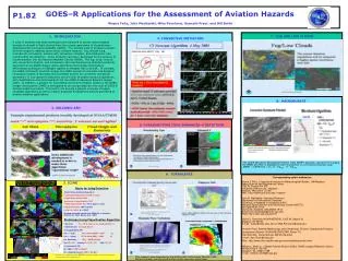
New Thunderstorm Detection Tools • Multi-channel algorithms such as the Global Convective Diagnostic( GDC) (infrared and water vapor). • Higher resolution GOES IR channels. • Lightning Mapper • Combined Satellite, Radar, and Lightning products such as National Convective Weather Forecast (NCWF).
Global Convective Diagnostic (GCD) http://aviationweather.noaa.gov/gcd/
Higher Resolution Goes Channels Simulated ABI (from MODIS) concentric anvil-layer waves Enhanced “V”: IR windows May 25, 2000 Enhanced “V” Actual GOES http://cimss.ssec.wisc.edu/goes/misc/000525.html
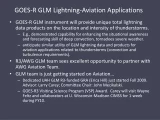
Continuous total lightning from GEO will identify intensifying storms and severe storm potential Ice flux drives lightning Process physics understood Storm-scale model for decision support system Physical basis for improved forecasts Updraft Intensifies Demonstrated in LEO with OTD & LIS Vortex Spins-up Lightning jump precedes severe weather Lightning improves storm predictability
National Convective Weather Forecast http://cdm.aviationweather.gov/ncwf/
New Turbulence Tools • Aircraft turbulence is caused by up and down eddies. • Higher resolution Water Vapor channels will be able to see these eddies. • New high resolution sounders (GIFTS) will be able to resolve some of these eddies in the vertical.
Mountain Waves in WV channel (6.7 um) 7 April 2000, 1815 UTC Simulated ABI Actual GOES-8 Mountain waves over Colorado and New Mexico were induced by strong northwesterly flow associated with a pair of upper-tropospheric jet streaks moving across the elevated terrain of the southern and central Rocky Mountains. The mountain waves appear more well-defined over Colorado; in fact, several aircraft reported moderate to severe turbulence over that region. Both images are shown in GOES projection. UW/CIMSS
Arctic (March 20-21, 2001) Sfc Temperature NAST-I Temperature Cross Section (K) NAST-I Relative Humidity Cross Section (%) Greenwich Mean Time
Clear Turbulence? NAST Near Fairbanks AK (3/21/01; 1-2 GMT) Temp Moisture 200 km Weak Turbulence Signatures at 150 mb Downdrafts:Warm&Dry Updrafts:Cold & Moist Temp Moisture Strong Turbulence Signatures at 300 mb Temp Moisture Moisture No Turbulence Signatures at 500 mb
Aircraft Icing • Aircraft flying through super cooled liquid water droplets which stick to wings causing loss of lift and increased drag. • Satellites will be able to detect super cooled liquid water at cloud tops.
Vis/1.6um/11um Vis/4um/8.5-11um ABI Simulations: Water/Ice Clouds and Snow/Lake Ice 3-color composites February 12, 2001 16:27 UTC UW/CIMSS UW/CIMSS Vis/4um/11um Ice cloud Lake Ice UW/CIMSS UW/CIMSS Vis/1.6um/8.5-11um Water cloud Ice cloud Super-Cooled cloud Lake Ice Snow
ABI Simulations (from MODIS data) Water/Ice Clouds and Snow/Lake Ice 3-color composite (Visible/1.6 μm/8.5-11 μm) February 12, 2001 16:27 UTC Vis/1.6um/8.5-11um Water cloud Ice Cloud Super-Cooled cloud Lake Ice Snow UW/CIMSS UW/CIMSS
Volcanic Ash • Multi Channel differences can differentiate between volcanic ash and weather clouds. • 12 micron channel detects silicates • 3.9 micron channel detects large particle size • 8.6 micron channel detects the SO2.
Winds • Head/tail winds have a major impact on aircraft fuel consumption. • Cloud winds measured where there are clouds. • Water vapor winds fill in around clouds. • Multiple water vapor channels will allow for different heights of wind measurements.
Restricted Visibility • Two classes of pilot’s license – Visible Flight Rules (VFR) and Instrument Flight Rules (IFR). Most general aviation pilots are VFR pilots. They must be able to see the ground to fly. • Fog detection with 3.9 micron channel at night. • Haze detection with blue and red channels.
Cloud Heights • ASOS cloud heights above 12,000 feet are currently determined from GOES data. • New GOES-R will significantly improve cloud height determination.
Future GOES -- simulating the Advanced Baseline Sounder (ABS) performance. Better cloud-top pressure retrievals. (UW/CIMSS) ABS/HES Cloud Top Pressure Retrieval Performance
Numerical Models • Higher resolution. Better physics. • Big advances in data assimilation. • Models are starting to effectively use satellite information. • Assimilation techniques can utilize radiances (temperature and moisture), cloud tops, initial convection, winds, fog, etc.
AVN Convective Precipitation overlaid on Observed Convection
Summary • Satellite information is becoming more important for safe, efficient aviation operations. • Weather forecasts are improving. • Technologies for delivery of weather information directly to the pilots are becoming available.