Download
1 / 56
620 likes | 1.42k Vues
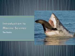
Introduction to Marine Science. 123rf.com. mare.hawaii.edu. Unit 2 Mrs. Jeffcoat. scrippsnews.ucsd.edu. Unit 2 Objectives:. Define Marine Science What are the four branches of oceanography? What are careers in the field of oceanography?

E N D
Introduction to Marine Science 123rf.com mare.hawaii.edu Unit 2 Mrs. Jeffcoat scrippsnews.ucsd.edu
Unit 2 Objectives: • Define Marine Science • What are the four branches of oceanography? • What are careers in the field of oceanography? • Explain the history of oceanography including contributions from various cultures and time periods • List, identify, and describe common tools used in oceanography
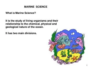
What is Marine Science • Marine: Related to the sea or ocean • Science: Body of knowledge and an organized method used to gain knowledge about the observable universe • Marine Science: Process of discovering facts, processes and unifying principles that explains the nature of oceans and their associated life form • Oceanography = Marine Science aaronetto.blogspot.com
4 Branches of Oceanography • Biological Oceanography: (AKA Marine Biology) Studies the diversity of life in the ocean and the ocean's role as their habitat • Chemical Oceanography: Studies the chemistry of seawater and the affect of chemical reactions on oceans • Geological Oceanography: Examines the composition of marine sediments and rocks including undersea volcanoes, seabed movement, undersea earthquakes, etc. • Physical Oceanography: Studies water movement (waves, currents, tides, etc.) Complete careers in oceanography poster project...
History of Oceanography • In class project... • History of Seafaring People Keynote Options: • Phoenicians • Polynesians • Greeks • Egyptians • Portuguese and Spanish • Vikings • Chinese
History of Oceanography Rise of Seafaring: 5,000 BC to 800 AD • 5,000 BC Early civilizations interact with oceans to obtain food • early evidence from primitive fish hooks and spears • 4,000 BC Earliest reference to voyage on a ship is the story of Noah and the Ark...widely debated rootsvt.com
History of Oceanography EGYPTIANS • -3,200 BC Egyptian Pharaoh Snefru brought 40 ships from Phoenicia to Egypt • -2,750 BC First recorded sea voyage for explorations • (recorded in Egyptian hieroglyphics) • -2,585-2,560 BC Egyptians built reed boat with oars and entombed the entire ship in the pyramid of Khufu http://www.touregypt.net/featurestories/greatpyramid5.htm
History of Oceanography POLYNESIANS • -2,000-500 BC Polynesians routinely crossed ocean over 1,000's of kilometers (1 mile=1609 m)in canoes made from tree trunks or planks that were sewn together with fiber rope and cracks sealed with tree sap • this is the earliest known regular long distance open ocean travel • in over 1,000 years they settled Fiji, Tonga, Samoa, Hawaii • used the north star and constellations to navigate southpacifichotels.travel
History of Oceanography • Polynesians were able to use: • wind and cloud formation • Color and clearness of the sea • Used cold and warm currents • Cold currents are sources of food _green, red or brown color • Warm currents are clear and blue.. • Sediments from rivers turn water brown and change the odor
History of Oceanography • Polynesians discovered Hawaii 1400 years ago. • http://app.discoveryeducation.com/search?Ntt=polynesian+ http://app.discoveryeducation.com/search?Ntt=polynesian+
History of Oceanography GREEKS • Were the first to use mathematics to make sophisticated maps for seafaring • Knew the earth was a sphere NOT flat • Pytheas (about 400 BC)- Determined the Atlantic tides are based on the phases of the moon and used degrees north and south of the north star to navigate • Eratosthenes (264- 194 BC)- Calculated the Earth's circumference and invented the 1st longitude/latitude system • Ptoleny (150 AD) - Mapped a portion of the Earth as a sphere on flat paper and continued to improve longitude and latitude grids into degrees, min, sec of the arc... we are still using this today!
Longitude and Latitude System • Imaginary grid lines used to identify specific locations on Earth • Both longitude and latitude lines are numbered in degrees and are further subdivided into minutes and seconds • Knowing longitude and latitude can pinpoint a location on Earth • Latitude is written first and then followed by longitude mrmeiners.wordpress.com
Latitude • Latitude lines run east-west • They never intersect and are called parallels • 0o parallel is the equator (the equator runs around the Earth at its widest point) • Parallels above the equator are called north latitudes • Parallels below the equator are called south latitudes
Longitude • Longitude lines run north-south • Begin at one pole and end at the other • Sometimes called meridians • The 0o or Prime meridian runs through Greenwich, England
http://app.discoveryeducation.com/search?Ntt=latitude+and+longitudehttp://app.discoveryeducation.com/search?Ntt=latitude+and+longitude
Practice Using Longitude and Latitude • Pretend that you want to find the wreck of the Titanic... • It's coordinates are 49o 56' 49'' W, 41o 43' 57'' • Those coordinates mean that 49 degrees, 56 minutes, and 49 seconds west longitude and 41 degrees, 43 minutes, and 57 seconds north latitude. • Those coordinates will put you directly on the Titanic... worldatlas.com
Practice Using Longitude and Latitude • Complete Longitude and Latitude Activity....
History of OceanographyThe Middle Ages (800 A.D. – 1400 A.D.) • Europe is in the “Dark Ages” • Fall of the Roman Empire • People thought the Earth was flat • Except for Vikings there is little ocean exploration • Vikings travelled the oceans from 790 A.D. to 1100 A.D. when global warming freed the North Atlantic of ice. • Explored, raided, and established trade routes to Southern Europe, North Africa, Central Asia, Iceland, Greenland, and the Americas • Leif Eriksson landed in Newfoundland, Canada
Age of Discovery-United Streaming http://app.discoveryeducation.com/search?Ntt=age+of+discovery
History of OceanographyThe Middle Ages (800 A.D. – 1400 A.D.) • China • 1000 A.D. Invention of the magnetic compass • Ships with central rudders and watertight compartments computersmiths.com
History of OceanographyEuropean Voyages of Discovery (1400 -1700) • European Renaissance (rediscovery) sparks new interest in ocean exploration • 1400’s Prince Henry of Portugal searched for a route to the East… didn’t make it but mapped out Western Africa in the process • 1487 Bartholomeu Dias completes first voyage around the Cape of Good Hope (tip of southern Africa) • 1497 Vasco de Gama led the first voyage around the Cape of Good Hope to India
History of OceanographyEuropean Voyages of Discovery (1400 -1700) • 1492 Portuguese explorer Christopher Columbus set out to find a route to Asia and accidentally discovers the Americas • 1454-1512 Italian explorer Amerigo Vespucci voyaged to South America and is the first person to recognize the “New World” as a separate continent • 1500’s Vasco Nunez de Balboa crossed the Isthmus of the Panama and discovered the Pacific Ocean on the other side and was the first European to sail into the Pacific • 1519 Ferdinand Magellan led exploration to sail around the world (he died but the 18 men from his crew that survived finished the voyage)
History of OceanographyBirth of Marine Science (1700-1900) • Captain James Cook (England) receives credit for first sea expedition devoted to scientific oceanography • 1735 – Harrison Invented chronometer • Made it possible to determine longitude in open sea (latitude was already calculated with star sightings) • Chronometer: Clock or watch that is not affected by the waves or motion of the sea bridgemanart.com 1oclockgun.com
History of OceanographyBirth of Marine Science (1700-1900) • Wilkes Expedition (United States) is authorized by congress to explore the southern Atlantic and the Pacific Ocean • Travelled to Madeira, both coasts of South America, Tierra del Fuego, many South Pacific Islands, Australia, New Zealand, Hawaii, California, Oregon, the Philipines, Singapore, and St. Helena • Visited and proved the existence of Antaratica • At their conclusion they had 19 volumes of maps, texts, and illustrations documenting their discoveries as well as many specimens of flora and fauna
Route of Wilke’s Expedition clade.ansp.org
History of OceanographyBirth of Marine Science (1700-1900) • Father of Physical Oceanography- Mathew Maury • US Naval officer that discovered a world wide pattern of surface winds and currents • 1855 Published the first textbook on modern oceanography – The Physical Geography of the Sea artworkoriginals.com oceanmotion.org
History of OceanographyBirth of Marine Science (1700-1900) • 1831 Charles Darwin’s voyage on the H.M.S. Beagle • Published two important scientific documents: • Structure and Distribution of Coral Reefs • The Origin of a Species – Outlines his theory of natural selection and evolution kobobooks.com
History of OceanographyBirth of Marine Science (1700-1900) • The Challenger Expedition 1872 • Devoted entirely to marine science exploration • Gathered physical, geological, chemical, and biological data as they documented temperature, currents, water chemistry, marine organisms, and bottom sediments • Some of the many accomplishments of this mission include: • First soundings deeper than 4,000 meters • Discovered marine organisms in the deepest part of the ocean • Identified 715 new genera and 4, 717 new species *NASA named the second space shuttle in honor of this expedition
Challenger Expedition geology.uprm.edu
History of Oceanography • Tools of Oceanography—Woods Hole Interactive • http://www.divediscover.whoi.edu/tools/atlantis.html
History of OceanographyTwentieth-Century Marine Science • Many changes including the industrial revolution occurred during this time some of the major advancements include: • Steam engines and iron ships (allow sailors to travel without being at the mercy of the wind and currents) • Submarines (made possible by the inventions of the diesel engine, electric motor, and lead batteries) • Science and technology feed each other as funding from countries and private industry increases • Technology needs for wars also increase technology and science
History of OceanographyTwentieth-Century Marine Science • Three “super” important expeditions: • German Meteor -1925 • Mapped the Atlantic sea floor using echo-sound technology • Atlantis – 1931 • First ship specifically built and designed for ocean study • Confirmed existence of Mid-Atlantic Ridge • Challenger II – 1951 • Found the deepest known part of the ocean located in the Marianas Trench (10,838 m or 35,558 ft)
History of OceanographyTwentieth-Century Marine Science • As a result of advances in science and technology the 20th century brought about many important tools for studying oceanography (this list includes just a few): -Submarines -Submersibles -Self-Contained Diving/Scuba - GPS -ROV’s -AUV’s -Satellites
History of OceanographyTwentieth-Century Marine Science Tools • Until the 20th Century scientists studied the oceans from above until the invention of the submersible • There are 3 Types of Submersibles: • Bathysphere • Bathyscaphe • Deep-diving submersibles 123rf.com
History of OceanographyTwentieth-Century Marine Science Tools • Bathysphere: (1930’s) Steel Ball with a window connected to the boat by an umbilical that provided communications and power • Limited because only operated vertically and was lowered and raised by a cable on ship en.wikipedia.org
History of OceanographyTwentieth-Century Marine Science Tools • Bathyscaphe: Sphere attached to a large float instead of a cable and ship with a small electric motor (operates like a blimp) • The float contains fluid that’s buoyant in water and a heavy ballast – by releasing fluid or some of the ballast the sphere could rise or descend • Limitations – difficult to operate and horizontal motion is limited en.wikipedia.org
History of OceanographyTwentieth-Century Marine Science Tools • Deep-diving Submersibles: 2-3 person submersibles that that dive in moderate to deep depths with excellent horizontal maneuverability • Less fragile that previous submersibles and easier to launch in rough seas • Limitations – cannot travel as deep as bathyscaphe • Some are equipped with robotic arms to grasp samples or perform experiments outside of the sub
History of OceanographyTwentieth-Century Marine Science Tools en.wikipedia.org Self-Contained Diving: • First equipment had hard hat that was supplied air from the surface through a hose – this equipment was heavy and hard to maneuver Men of Honor Clip • Scuba: Lightweight self contained system for underwater exploration • 1943 Jacques Cousteau developed scuba system that used compressed air and was relatively lightweight and simple • Within 20 years, scuba was in use by the military, scientists, and for recreation • Hardsuits: Wearable submersibles • Protect the diver from temperature and pressure and are far smaller and more mobile than conventional submersibles webspace.webring.com
Comparing the use of Scuba and Submersibles in Oceanography *Today many scientists use both submersibles and scuba